
MyTopo
Miccosukee Florida US Topo Map
Couldn't load pickup availability
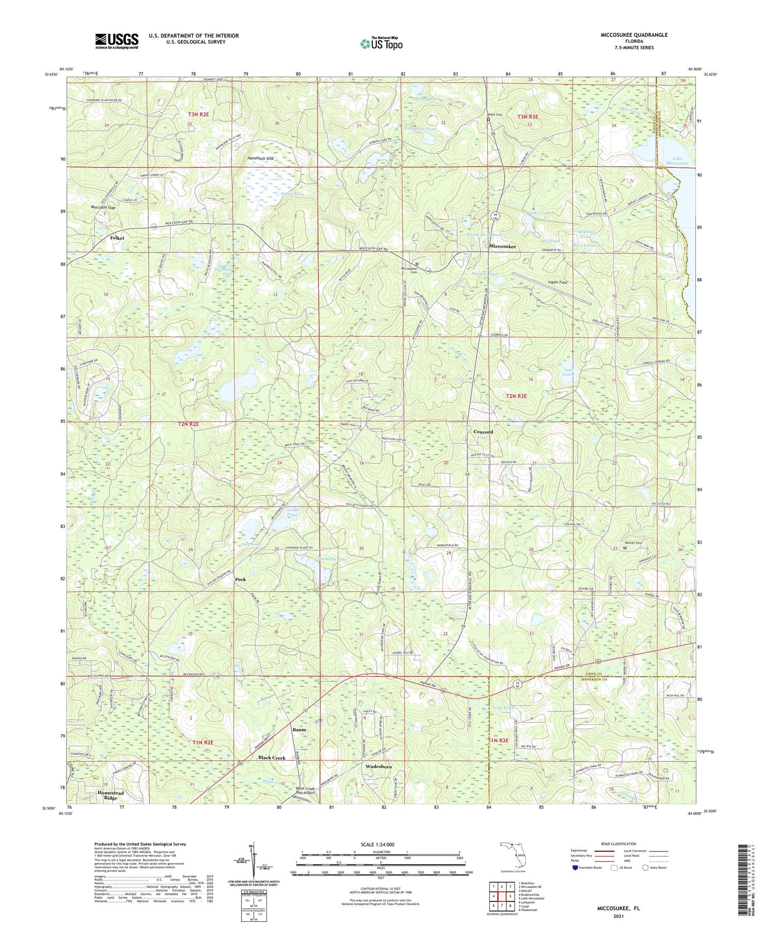
2024 topographic map quadrangle Miccosukee in the state of Florida. Scale: 1:24000. Based on the newly updated USGS 7.5' US Topo map series, this map is in the following counties: Leon, Jefferson. The map contains contour data, water features, and other items you are used to seeing on USGS maps, but also has updated roads and other features. This is the next generation of topographic maps. Printed on high-quality waterproof paper with UV fade-resistant inks.
Quads adjacent to this one:
West: Bradfordville
Northwest: Beachton
North: Miccosukee NE
Northeast: Metcalf
East: Lake Miccosukee
Southeast: Waukeenah
South: Lloyd
Southwest: Lafayette
This map covers the same area as the classic USGS quad with code o30084e1.
Contains the following named places: Alberta Lake, Alligator Pond, Baum, Beer Can Pond, Black Creek, Black Creek Pass Airport, Centenary Church, Cody Pond, Concord, Concord School, Drag Line Pond, Dry Creek, East Leon Division, Emma Lee Pond, Felkel, Gristmill Creek, Gum Pond, Halls Cemetery, Hammock Sink, Harolds Pond, Homestead Ridge, Indian Springs Church, Ingalls Field, Lake Lonnie, Lake Louise, Long Pond, Miccosukee, Miccosukee Cemetery, Miccosukee Census Designated Place, Micosukee Lookout Tower, Moccasin Gap, Mount Sinai Church, New Jerusalem Church, Old Pond, Peck, Runner Cemetery, Saint Pauls Church, Sanders Hammock Pond, Shady Grove Church, Shemonie Lake, Spring Head Pond, Straw Pond, Sunset Pond, Wadesboro, Windy Hill Farm, ZIP Code: 32309


