
MyTopo
Waukeenah Florida US Topo Map
Couldn't load pickup availability
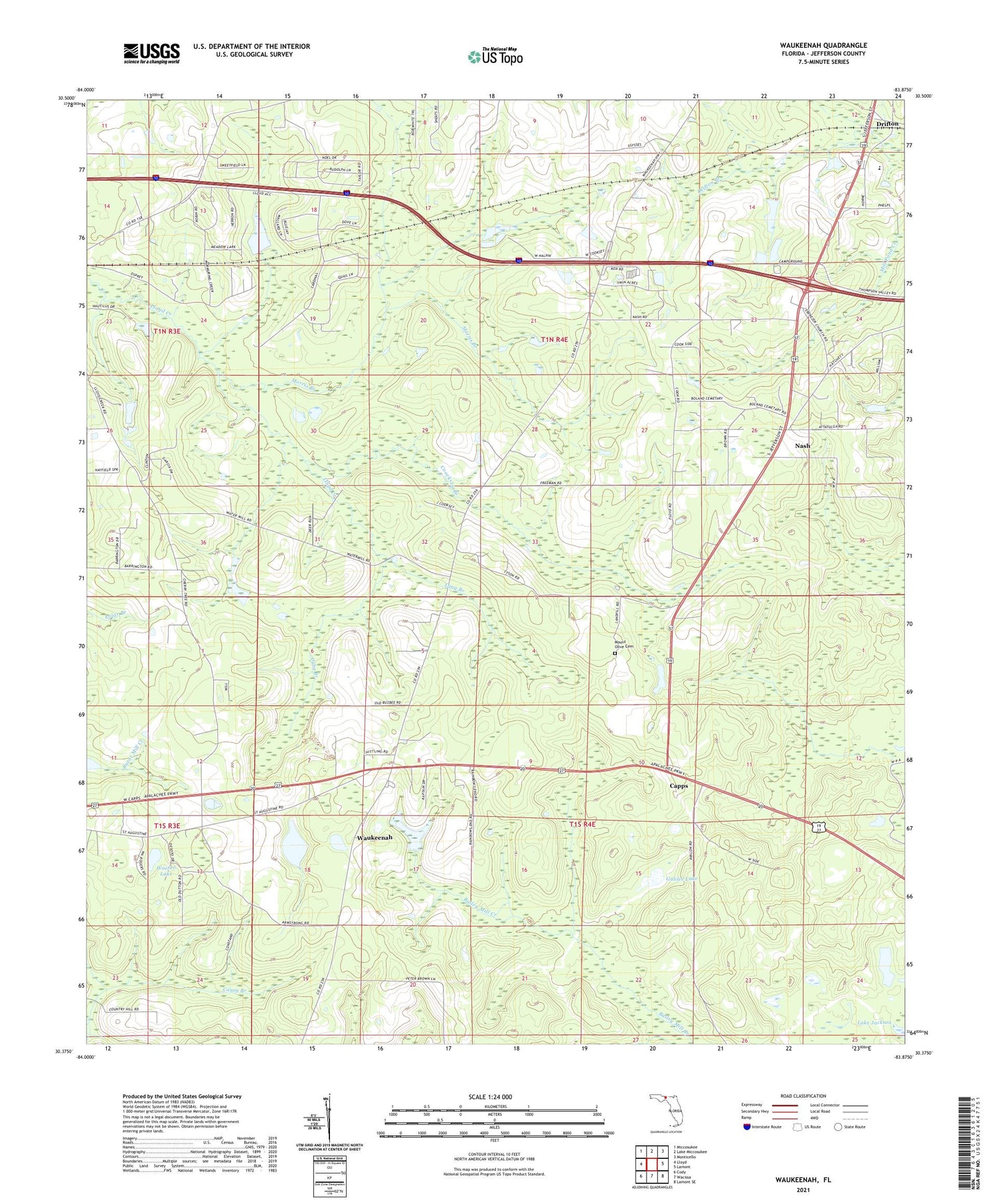
2024 topographic map quadrangle Waukeenah in the state of Florida. Scale: 1:24000. Based on the newly updated USGS 7.5' US Topo map series, this map is in the following counties: Jefferson. The map contains contour data, water features, and other items you are used to seeing on USGS maps, but also has updated roads and other features. This is the next generation of topographic maps. Printed on high-quality waterproof paper with UV fade-resistant inks.
Quads adjacent to this one:
West: Lloyd
Northwest: Miccosukee
North: Lake Miccosukee
Northeast: Monticello
East: Lamont
Southeast: Lamont SE
South: Wacissa
Southwest: Cody
This map covers the same area as the classic USGS quad with code o30083d8.
Contains the following named places: Bethel Church, Capps, Coocksey Branch, Cuba Branch, Drifton, Ebenezer Church, Galilee Lake, Hatchcakamocha, Jefferson County, Jefferson County Middle - High School, Lake Catherine, Lake Jackson, Lang Branch, Morris Branch, Mount Olive Cemetery, Mount Olive Church, Mount Zion Church, Nash, Pine Grove Church, Saint Rilla School, Sardis Church, Shadow Lake, Waukeenah, Waukeenah Census Designated Place, Waukeenah United Methodist Church, Wooten Lake


