MyTopo
Lee Florida US Topo Map
Couldn't load pickup availability
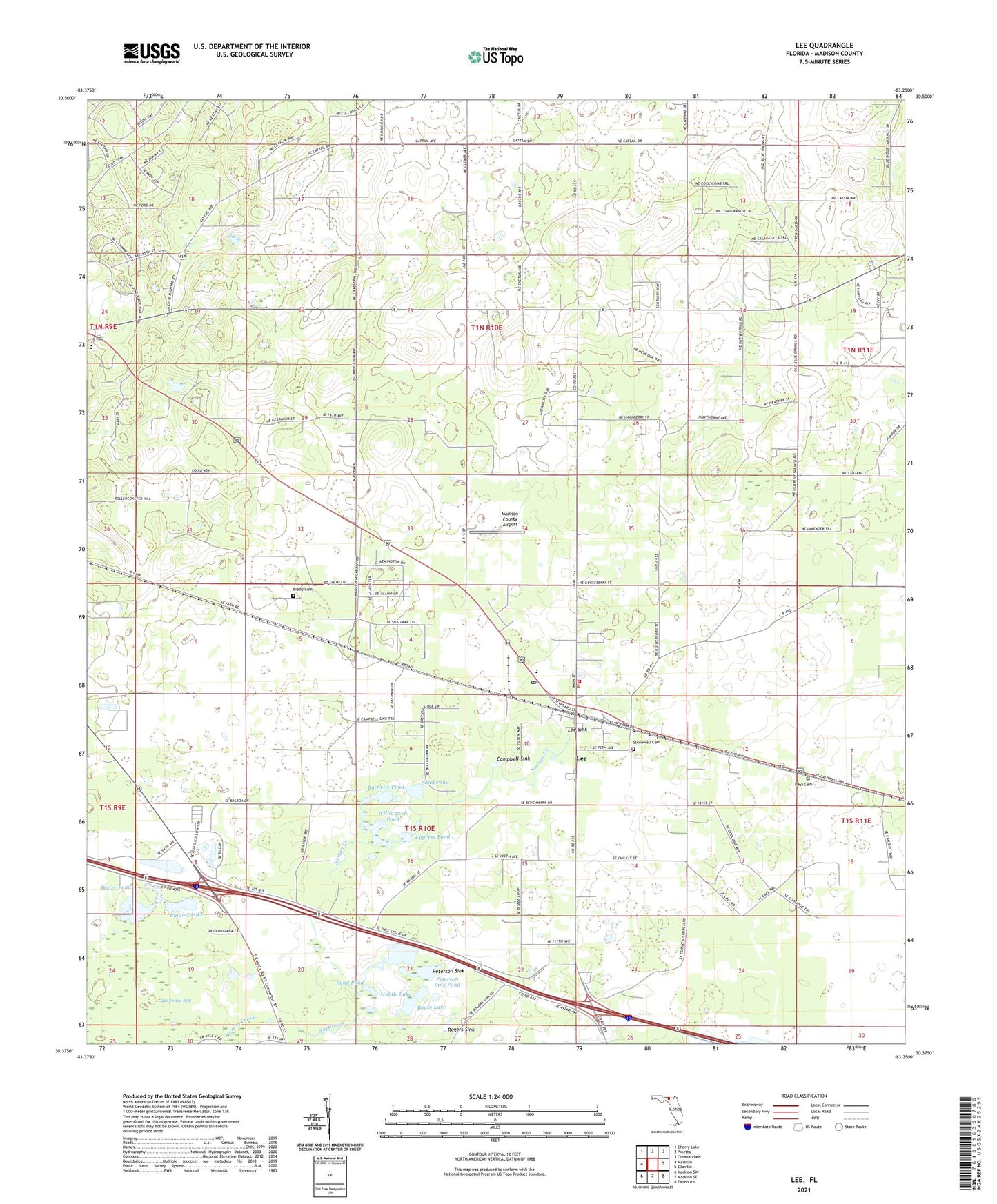
2024 topographic map quadrangle Lee in the state of Florida. Scale: 1:24000. Based on the newly updated USGS 7.5' US Topo map series, this map is in the following counties: Madison. The map contains contour data, water features, and other items you are used to seeing on USGS maps, but also has updated roads and other features. This is the next generation of topographic maps. Printed on high-quality waterproof paper with UV fade-resistant inks.
Quads adjacent to this one:
West: Madison
Northwest: Cherry Lake
North: Pinetta
Northeast: Octahatchee
East: Ellaville
Southeast: Falmouth
South: Madison SE
Southwest: Madison SW
This map covers the same area as the classic USGS quad with code o30083d3.
Contains the following named places: Booze Lake, Brady Cemetery, Burnette Pond, Campbell Sink, Corinth Church, Cypress Pond, Flying G Ranch Stolport, Hays Cemetery, Lee, Lee Community Volunteer Fire Department, Lee Junior High School, Lee Post Office, Lee Sink, Macedonia Church, Madison County Airport, Madison Division, Middle Lake, Mount Olive Church, Norton Creek, Peterson Sink, Peterson Sink Pond, Riggins Lake, Rogers Sink, Sand Pond, Stonewall Cemetery, Town of Lee, Water Pond, West Farm, Williamson Pond, ZIP Code: 32059