MyTopo
Ellaville Florida US Topo Map
Couldn't load pickup availability
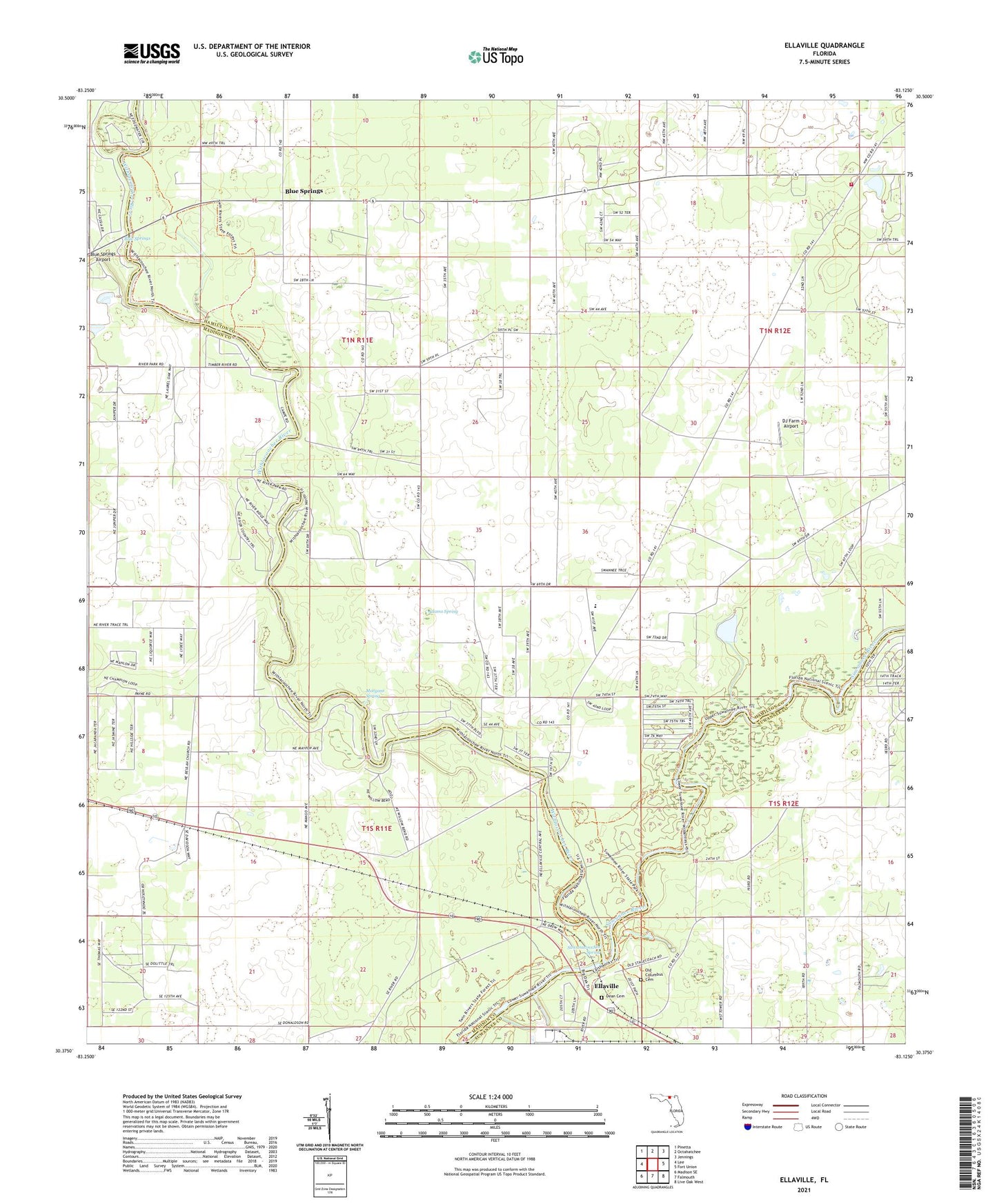
2024 topographic map quadrangle Ellaville in the state of Florida. Scale: 1:24000. Based on the newly updated USGS 7.5' US Topo map series, this map is in the following counties: Hamilton, Madison, Suwannee. The map contains contour data, water features, and other items you are used to seeing on USGS maps, but also has updated roads and other features. This is the next generation of topographic maps. Printed on high-quality waterproof paper with UV fade-resistant inks.
Quads adjacent to this one:
West: Lee
Northwest: Pinetta
North: Octahatchee
Northeast: Jennings
East: Fort Union
Southeast: Live Oak West
South: Falmouth
Southwest: Madison SE
This map covers the same area as the classic USGS quad with code o30083d2.
Contains the following named places: Adams Spring, Beulah Church, Blue Springs, Blue Springs Airport, Blue Springs Church, Corinth Church, Crossroads, Dean Cemetery, DJ Farm Airport, Drew Mansion, Dry Run, Ellaville, Hamilton County Fire and Rescue Department Crossroads Station, Morgans Spring, Old Columbus Cemetery, Peter Grove Church, Saint Pauls Church, Suwanacoochee Spring, Suwannee River Power Plant, Suwannee River State Park, Withlacoochee River