
MyTopo
Beachton Georgia US Topo Map
Couldn't load pickup availability
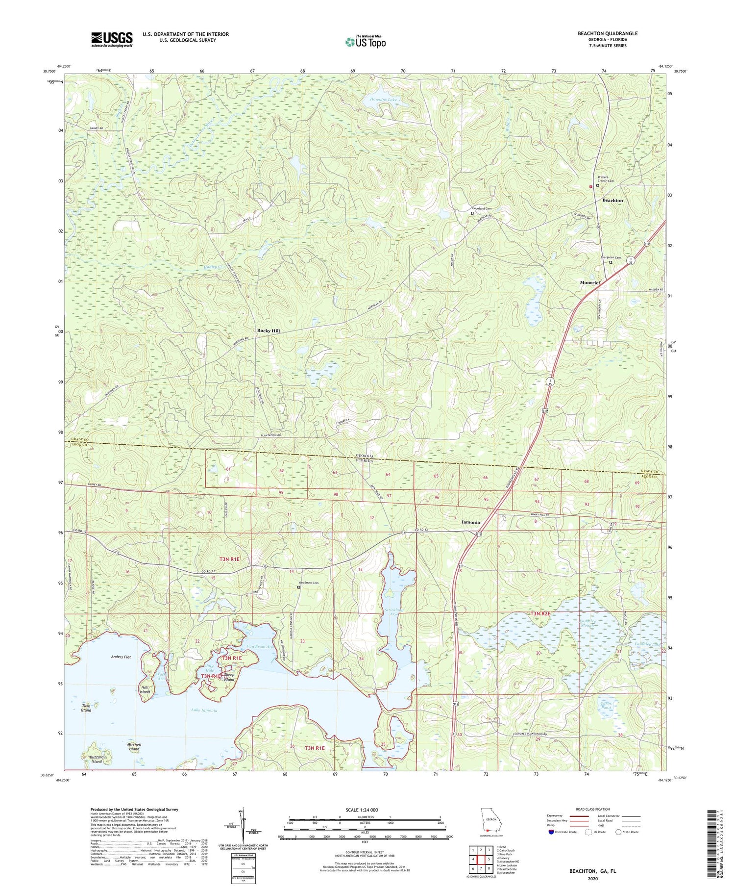
2024 topographic map quadrangle Beachton in the states of Georgia, Florida. Scale: 1:24000. Based on the newly updated USGS 7.5' US Topo map series, this map is in the following counties: Grady, Leon. The map contains contour data, water features, and other items you are used to seeing on USGS maps, but also has updated roads and other features. This is the next generation of topographic maps. Printed on high-quality waterproof paper with UV fade-resistant inks.
Quads adjacent to this one:
West: Calvary
Northwest: Reno
North: Cairo South
Northeast: Pine Park
East: Miccosukee NE
Southeast: Miccosukee
South: Bradfordville
Southwest: Lake Jackson
This map covers the same area as the classic USGS quad with code o30084f2.
Contains the following named places: Anders Flat, Beachton, Beth Page Church, Buck Creek, Buzzard Island, Carns Pond, Copeland Cemetery, Evergreen Cemetery, Floyd Chapel, Foshalee Slough, Good Shepherd Catholic Church, Grady County Volunteer Fire Department Beachton Station, Hadley Creek, Hall Island, Hawkins Lake, Hawkins Lake Dam, Hickory Hill Church, Iamonia, Jake Hole, Jerusalem Church, Lake Iamonia, Lester Island, Mitchell Island, Mitchell Point, Mitchell Pond, Moncrief, Moncriefs Store, New Ochlocknee Baptist Church, Page Church, Pleasant Hill, Pleasant Hill Church, Primera Church Cemetery, Rocky Hill, Rocky Hill School, Sheep Island, Southeast Grady Division, Strickland Arm, Strickland School, Tired Creek, Twin Island, Van Brunt Arm, Van Brunt Cemetery, Wyche Arm


