MyTopo
Withlacoochee Bay Florida US Topo Map
Couldn't load pickup availability
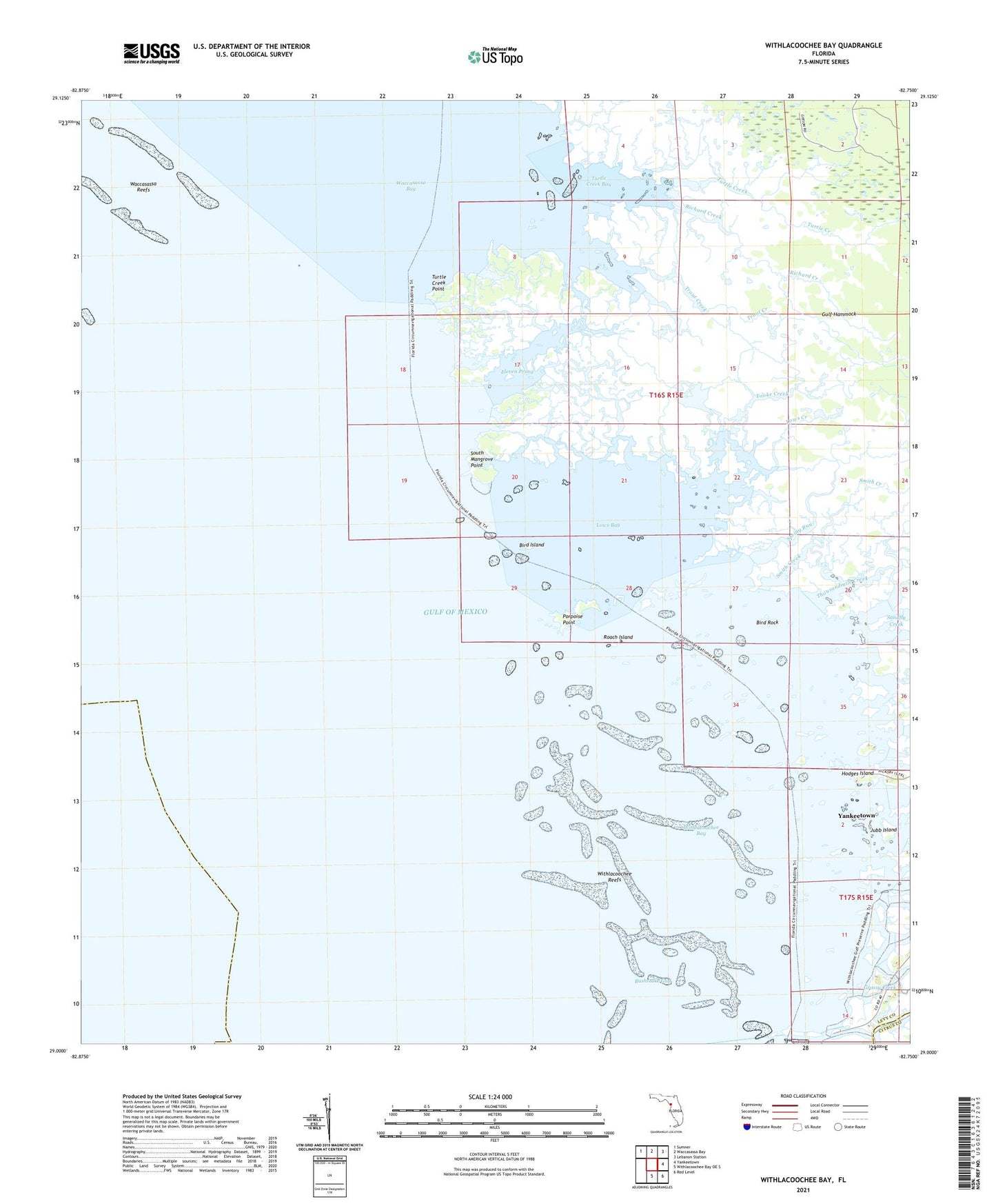
2025 topographic map quadrangle Withlacoochee Bay in the state of Florida. Scale: 1:24000. Based on the newly updated USGS 7.5' US Topo map series, this map is in the following counties: Levy, Citrus. The map contains contour data, water features, and other items you are used to seeing on USGS maps, but also has updated roads and other features. This is the next generation of topographic maps. Printed on high-quality waterproof paper with UV fade-resistant inks.
Quads adjacent to this one:
Northwest: Sumner
North: Waccasassa Bay
Northeast: Lebanon Station
East: Yankeetown
Southeast: Red Level
South: Withlacoochee Bay OE S
This map covers the same area as the classic USGS quad with code o29082a7.
Contains the following named places: Bird Creek, Bird Island, Bird Rock, Bushstake Gap, Covas Creek, Demory Creek, Eleven Prong, Fuller Creek, Grassy Creek, Helverson Creek, Hodges Island, Jones Creek, Jubb Island, Kelly Creek, Lows Bay, Lows Creek, MacDonald Creek, Pitts Camp, Porpoise Point, Pumpkin Island, Richard Creek, Roach Island, Smith Creek, South Mangrove Point, Spring Run, TFD Camp, Thousandmile Creek, Tooke Creek, Town of Yankeetown, Trout Creek, Turtle Creek, Turtle Creek Bay, Turtle Creek Point, Vassey Creek, Waccasassa Reefs, Withlacoochee Bay, Withlacoochee Reefs