MyTopo
Rock Hill Florida US Topo Map
Couldn't load pickup availability
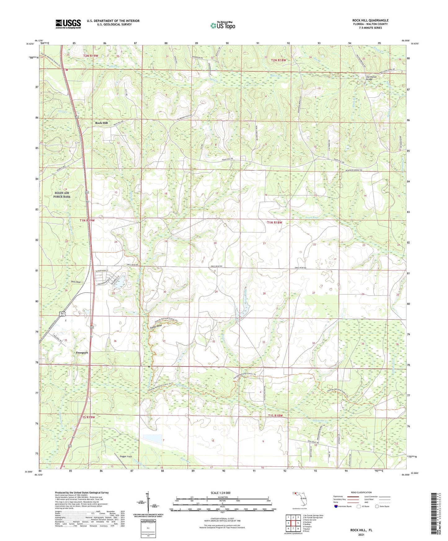
2024 topographic map quadrangle Rock Hill in the state of Florida. Scale: 1:24000. Based on the newly updated USGS 7.5' US Topo map series, this map is in the following counties: Walton. The map contains contour data, water features, and other items you are used to seeing on USGS maps, but also has updated roads and other features. This is the next generation of topographic maps. Printed on high-quality waterproof paper with UV fade-resistant inks.
Quads adjacent to this one:
West: Portland
Northwest: De Funiak Springs West
North: De Funiak Springs East
Northeast: Ponce de Leon
East: Redbay
Southeast: Bruce
South: Bunker
Southwest: Freeport
This map covers the same area as the classic USGS quad with code o30086e1.
Contains the following named places: Big Branch, Black Branch, Freeport High School, Magnolia Creek, Mill Creek, Old Walton Bridge, Owls Head, Owls Head Farm Airport, Rock Hill, Steep Head, Ward Branch, White Branch, Wolf Creek