MyTopo
Waccasassa Bay Florida US Topo Map
Couldn't load pickup availability
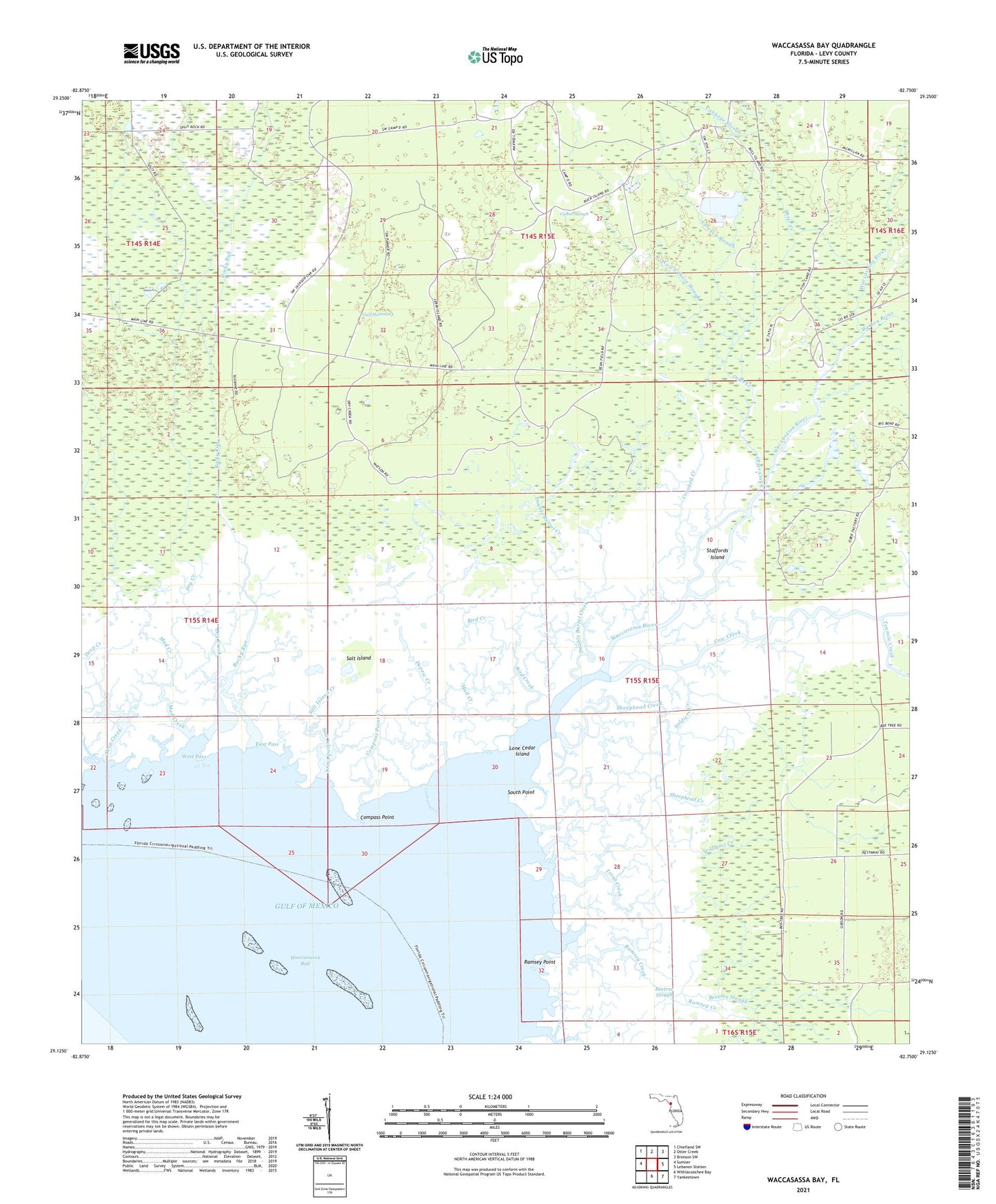
2025 topographic map quadrangle Waccasassa Bay in the state of Florida. Scale: 1:24000. Based on the newly updated USGS 7.5' US Topo map series, this map is in the following counties: Levy. The map contains contour data, water features, and other items you are used to seeing on USGS maps, but also has updated roads and other features. This is the next generation of topographic maps. Printed on high-quality waterproof paper with UV fade-resistant inks.
Quads adjacent to this one:
West: Sumner
Northwest: Chiefland SW
North: Otter Creek
Northeast: Bronson SW
East: Lebanon Station
Southeast: Yankeetown
South: Withlacoochee Bay
This map covers the same area as the classic USGS quad with code o29082b7.
Contains the following named places: Beetree Slough, Bird Creek, Cabbage Slough, Calbet Slough, Camp D, Camp E, Chicken Slough, Compass Point, Compass Point Creek, Cow Creek, Crooked Creek, Deep Creek, Depew Creek, Divedapper Creek, Double Barrel Creek, Dry Creek, East Pass, Gulf Hammock, Lone Cedar Island, Mud Creek, Otter Creek, Ramsey Creek, Ramsey Point, Rocky Run, Salt Island, Salt Island Creek, Sheephead Creek, Soldiers Creek, South Point, Staffords Island, Tenmile Creek, Trout Creek, Waccasassa Bay, Waccasassa River, Watch Chain Slough, Wekiva River, West Pass, Williams Camp, Williams Creek