
MyTopo
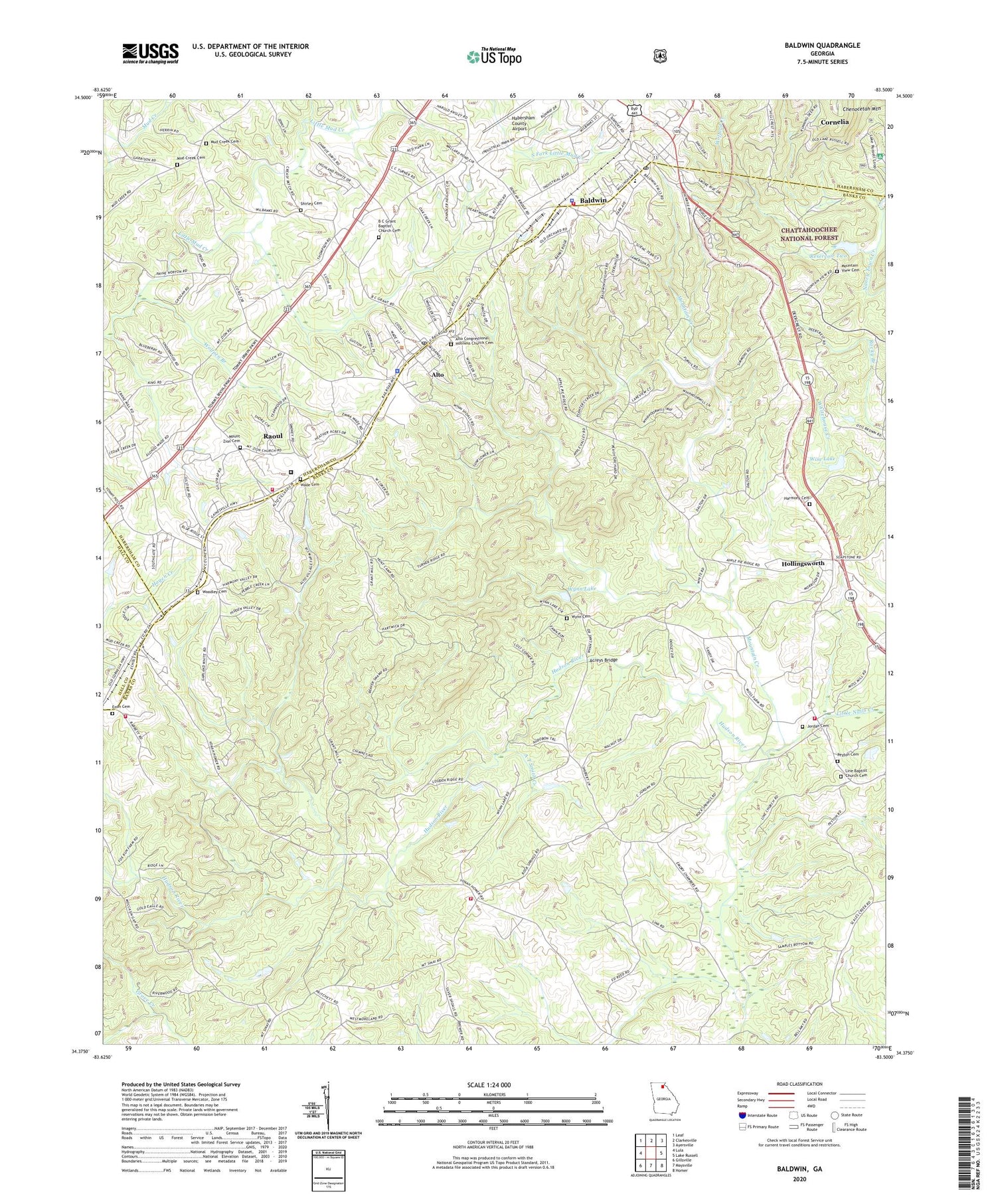
Baldwin Georgia US Topo Map
Couldn't load pickup availability
Also explore the Baldwin Forest Service Topo of this same quad for updated USFS data
2024 topographic map quadrangle Baldwin in the state of Georgia. Scale: 1:24000. Based on the newly updated USGS 7.5' US Topo map series, this map is in the following counties: Banks, Habersham, Hall. The map contains contour data, water features, and other items you are used to seeing on USGS maps, but also has updated roads and other features. This is the next generation of topographic maps. Printed on high-quality waterproof paper with UV fade-resistant inks.
Quads adjacent to this one:
West: Lula
Northwest: Leaf
North: Clarkesville
Northeast: Ayersville
East: Lake Russell
Southeast: Homer
South: Maysville
Southwest: Gillsville
This map covers the same area as the classic USGS quad with code o34083d5.
Contains the following named places: A T Smith Creek, Acreys Bridge, Allendale School, Alto, Alto Baptist Church, Alto Congressional Holiness Church Cemetery, Alto Police Department, Alto Post Office, Alto School, Arrendale State Prison, B C Grant Baptist Church Cemetery, Baldwin, Baldwin Baptist Church, Baldwin Division, Baldwin Elementary School, Baldwin Fire Department Station 4, Baldwin Police Department, Baldwin Post Office, Banks County Fire and Emergency Services Fire Station 21, Banks County Fire Department Station 230, Bethlehem Church, Bethlehem School, City of Baldwin, Crossroads Baptist Church, Enon Cemetery, Georgia Department of Corrections Fire Department Station 1, Georgia State Industrial Institute, Grant Church, Harmony Cemetery, Harmony Church, Hollingsworth, Hughesboro, Jordan Cemetery, Leno School, Liberty Hill Church, Liberty Hill School, Line Baptist Church Cemetery, Little Nails Creek, Longview, Middle Fork Broad River Structure Two Dam, Mount Sinai Church, Mount Zion Cemetery, Mount Zion Church, Mountain Creek, Mountain View Cemetery, Mountain View Church, Mud Creek Camp Ground, Mud Creek Cemetery, Mud Creek Church, Mud Creek School, Peyton Cemetery, Raoul, Raoul Census Designated Place, Reservoir Two, Rock Springs Church, Rock Springs Fire Department, Rock Springs School, Shirley Cemetery, State Industrial Institute, The Line Church, Town of Alto, Wade Cemetery, Wilbanks Corner, Wilson Shoals, Wise Lake, Wise Lake Dam, Wofford Creek, Woffords Settlement, Wolfpen Branch, Woodley Cemetery, Wooten Branch, Wynn Cemetery, Wynn Lake, Wynn Lake Dam, Yonah Church, ZIP Code: 30510


