MyTopo
Lula Georgia US Topo Map
Couldn't load pickup availability
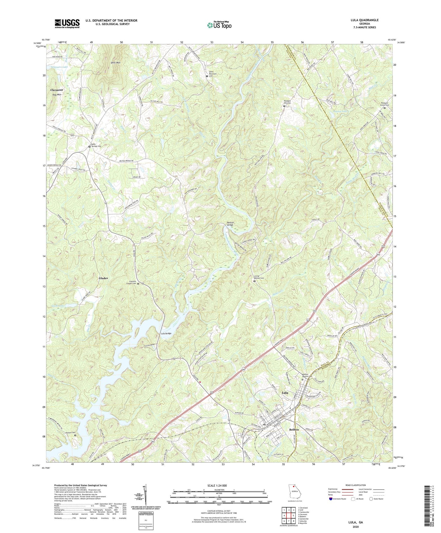
2024 topographic map quadrangle Lula in the state of Georgia. Scale: 1:24000. Based on the newly updated USGS 7.5' US Topo map series, this map is in the following counties: Hall, Banks, Habersham. The map contains contour data, water features, and other items you are used to seeing on USGS maps, but also has updated roads and other features. This is the next generation of topographic maps. Printed on high-quality waterproof paper with UV fade-resistant inks.
Quads adjacent to this one:
West: Clermont
Northwest: Cleveland
North: Leaf
Northeast: Clarkesville
East: Baldwin
Southeast: Maysville
South: Gillsville
Southwest: Gainesville
This map covers the same area as the classic USGS quad with code o34083d6.
Contains the following named places: Bellton, Bellton Baptist Cemetery, Bellton Bridge, Bellton Church, Bellton Creek, Belton, Bethlehem Church, Calvary Cross Church, City of Lula, Clemons Chapel, Clemons Chapel Cemetery, Crowder Ford, Dog Creek, Don Carter State Park, Enon Church, Enon School, First Baptist Church, Flat Creek, Garner Creek, Glade Lake, Glade Lake Dam, Glades, Hagen Creek, Hall County Fire Station 6, Haynie Lake, Haynie Lake Dam, Hog Mountain, Holly Springs Cemetery, Holly Springs Church, Hulsey Cemetery, Kings Church, Little John Creek, Little Mud Creek, Living Mission Cemetery, Living Mission Church, Living Word Tabernacle, Lula, Lula Bridge, Lula Elementary School, Lula Park, Lula Post Office, Lula Residential Historic District, Mossy Creek, Mud Creek, Pitts Creek, Pleasant Grove Cemetery, Pleasant Grove Church, Pleasant Hill Cemetery, Pleasant Hill Church, Seven Island Ford, Skitt Mountain School, Skitts Mountain Cemetery, Skitts Mountain Church, Whitmire Lake Dam, ZIP Code: 30554