MyTopo
Liberty Georgia US Topo Map
Couldn't load pickup availability
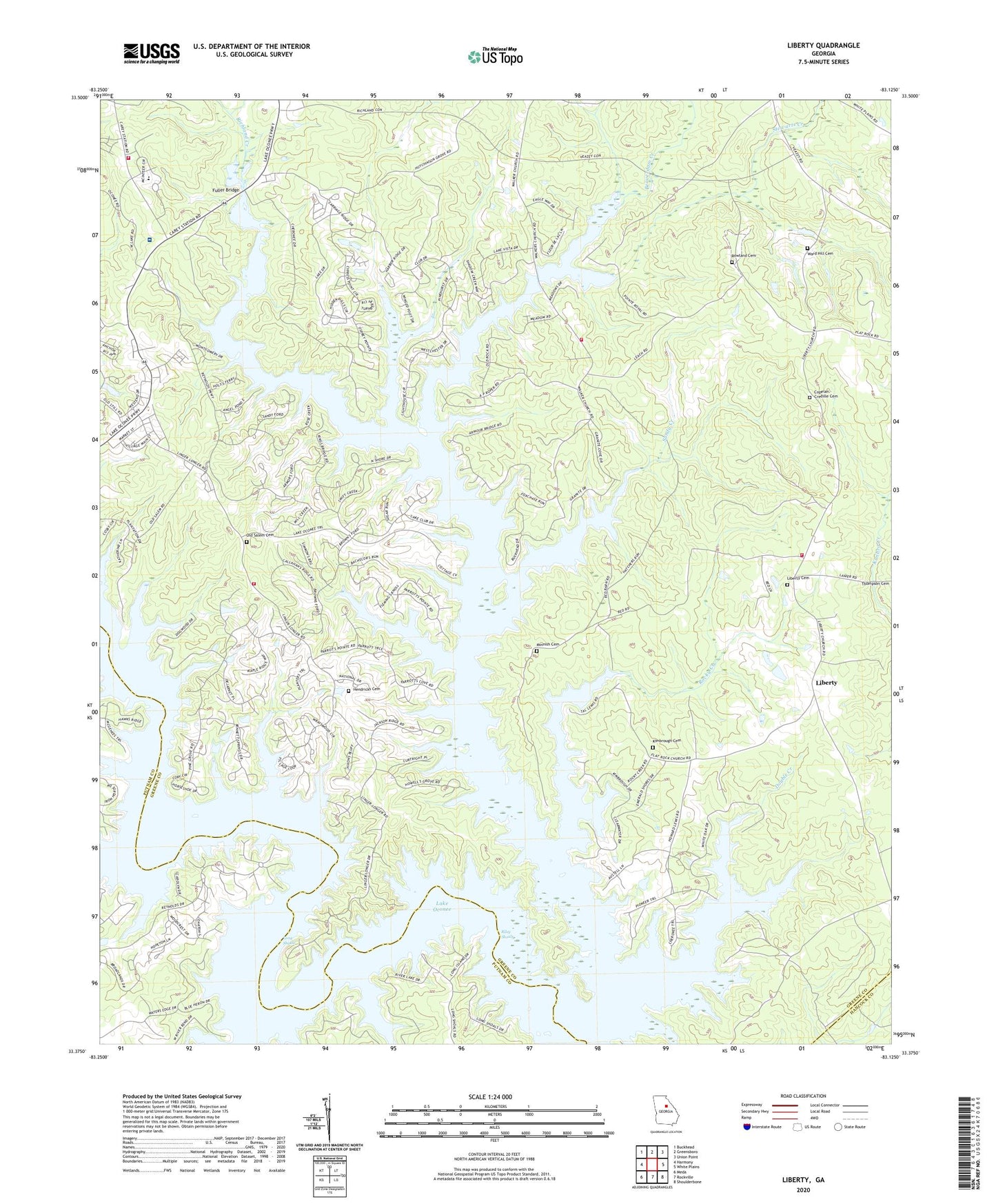
2024 topographic map quadrangle Liberty in the state of Georgia. Scale: 1:24000. Based on the newly updated USGS 7.5' US Topo map series, this map is in the following counties: Greene, Putnam, Hancock. The map contains contour data, water features, and other items you are used to seeing on USGS maps, but also has updated roads and other features. This is the next generation of topographic maps. Printed on high-quality waterproof paper with UV fade-resistant inks.
Quads adjacent to this one:
West: Harmony
Northwest: Buckhead
North: Greensboro
Northeast: Union Point
East: White Plains
Southeast: Shoulderbone
South: Rockville
Southwest: Meda
This map covers the same area as the classic USGS quad with code o33083d2.
Contains the following named places: Beaverdam Creek, Beulah School, Cawthon School, Comfort, Copelan - Credille Cemetery, Double Creek, Flat Rock, Flat Rock Church, Fuller Bridge, Hendricks Cemetery, Kimbrough Cemetery, Lake Oconee Charter School, Lawrence Center Church, Liberty, Liberty Cemetery, Liberty Chapel, Liberty Volunteer Fire Department, Lick Creek, Linger Longer Bridge, Little Creek, Long Shoals, Minnish Cemetery, Mount Calvary Church, Mount Olive Church, Old Salem Cemetery, Old Salem Volunteer Fire Department, Old Salem Volunteer Fire Department Station 2, Pine Grove Church, Red Oak School, Reeves Church, Richland Creek, Riley Shoals, Rocky Creek, Rowland Cemetery, Ruth, Salem Church, Salem School, Sandy Creek, Stewarts Creek, Walker - Church Volunteer Fire Department, Ward Hill Cemetery, WDDK-FM (Greensboro), Weaver Branch