MyTopo
Carnegie Georgia US Topo Map
Couldn't load pickup availability
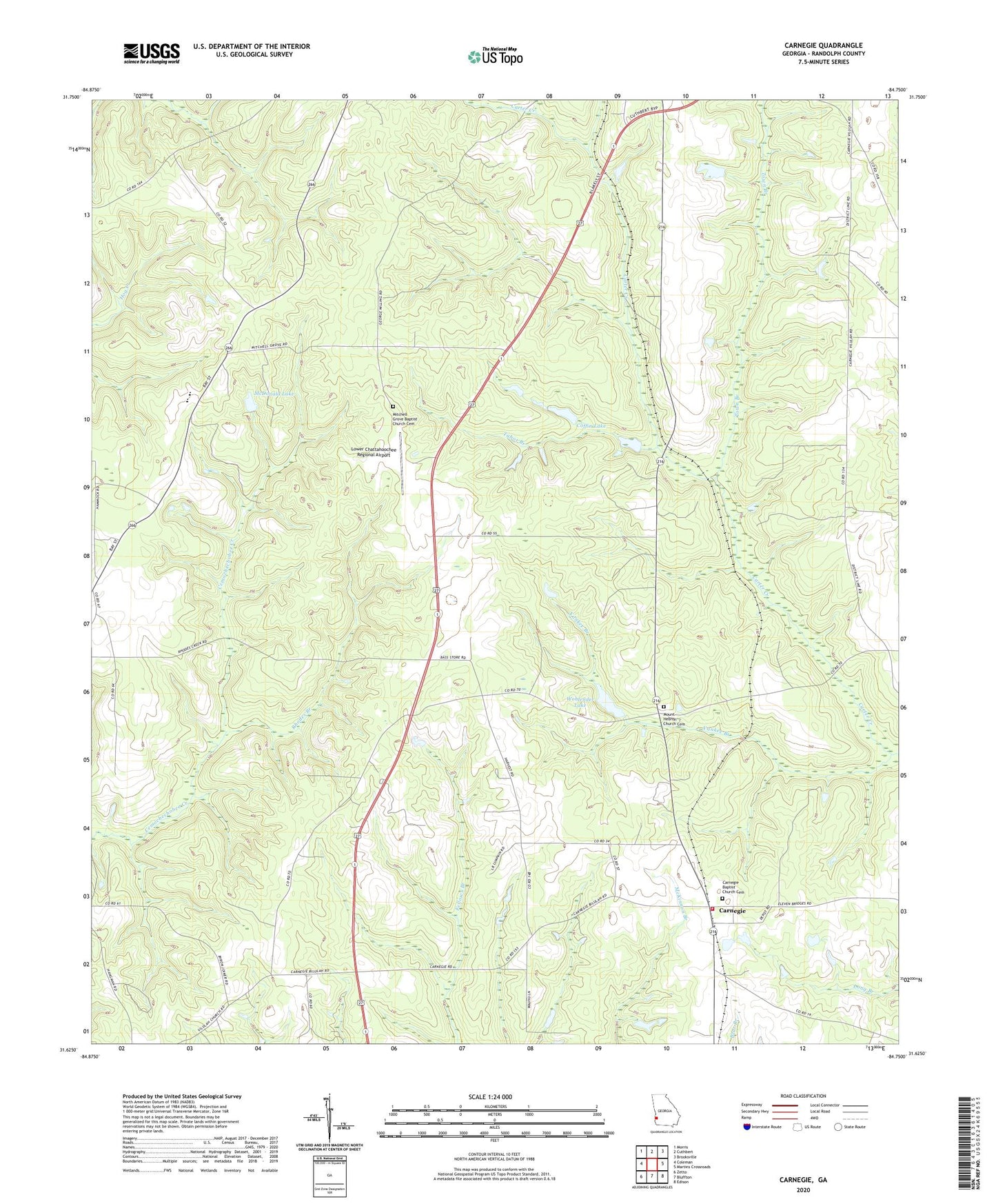
2024 topographic map quadrangle Carnegie in the state of Georgia. Scale: 1:24000. Based on the newly updated USGS 7.5' US Topo map series, this map is in the following counties: Randolph. The map contains contour data, water features, and other items you are used to seeing on USGS maps, but also has updated roads and other features. This is the next generation of topographic maps. Printed on high-quality waterproof paper with UV fade-resistant inks.
Quads adjacent to this one:
West: Coleman
Northwest: Morris
North: Cuthbert
Northeast: Brooksville
East: Martins Crossroads
Southeast: Edison
South: Bluffton
Southwest: Zetto
This map covers the same area as the classic USGS quad with code o31084f7.
Contains the following named places: Andrews Airport, Bass Store, Carnegie, Carnegie Baptist Church, Carnegie Baptist Church Cemetery, Coffin Lake, Coffin Lake Dam, Cuthbert Division, Grubb, Lower Chattahoochee Regional Airport, McDonald Lake, McDonald Lake Dam, Mitchell Grove Baptist Church Cemetery, Mitchell Grove Church, Mobley School, Mount Hebron Church, Mount Hebron Church Cemetery, Mount Zion Church, Pleasant Grove Church, Randolph County Fire Department Carnegie Station, Rhodes Branch, Saint Lukes Church, Saint Lukes School, Saint Marys Church, Tabor Branch, Tigner School, Town Branch, Weatherbys Mill, Wohlender Lake, Wohlender Lake Dam, Yankee Branch, ZIP Code: 39836