
MyTopo
Bluffton Georgia US Topo Map
Couldn't load pickup availability
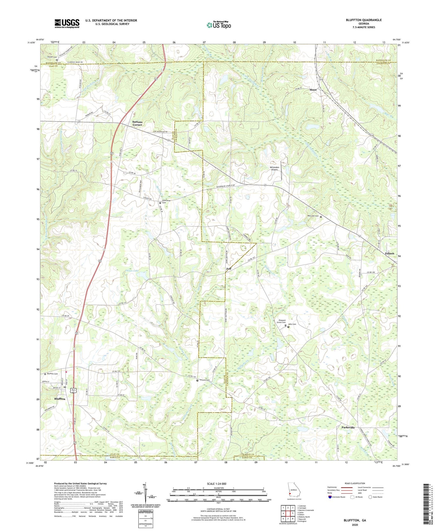
2024 topographic map quadrangle Bluffton in the state of Georgia. Scale: 1:24000. Based on the newly updated USGS 7.5' US Topo map series, this map is in the following counties: Calhoun, Clay, Randolph, Early. The map contains contour data, water features, and other items you are used to seeing on USGS maps, but also has updated roads and other features. This is the next generation of topographic maps. Printed on high-quality waterproof paper with UV fade-resistant inks.
Quads adjacent to this one:
West: Zetto
Northwest: Coleman
North: Carnegie
Northeast: Martins Crossroads
East: Edison
Southeast: Arlington
South: Bancroft
Southwest: Blakely North
This map covers the same area as the classic USGS quad with code o31084e7.
Contains the following named places: Blackburns Store, Bluffton, Bluffton Baptist Church, Bluffton Cemetery, Bluffton High School, Bluffton Methodist Church, Bluffton Post Office, Clay County Volunteer Fire Department Station 3, County School Number 2, Darveys Chapel, Enon Church, Enterprise Cemetery, Enterprise Church, Faines Lake, Faines Lake Dam, Fellows Branch, Friendship Church, Hattaway Lake, Hattaway Lake Dam, Jeff, Jonesville School, Mars Hill Cemetery, Mars Hill Church, McKinnon Branch, McLendon Airport, Mills Cemetery, Mount Ebel Church, Moye, Oakland, Oakland School, Parksville, Parksville Church, Pleasant Grove Cemetery, Pleasant Grove Church, Suttons Corner, Town of Bluffton, Union Church, Vilulah Cemetery, Vilulah Church, Vincent Cemetery, Vincent Church, Williams Creek


