MyTopo
Zetto Georgia US Topo Map
Couldn't load pickup availability
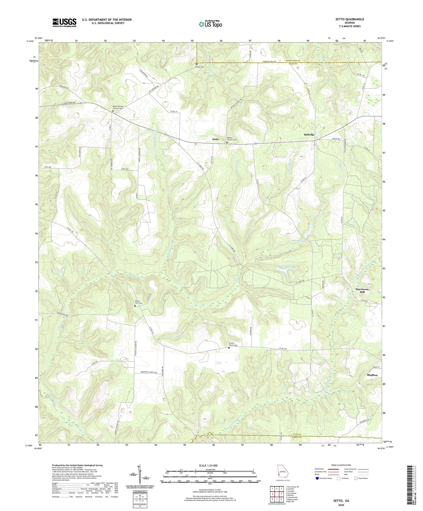
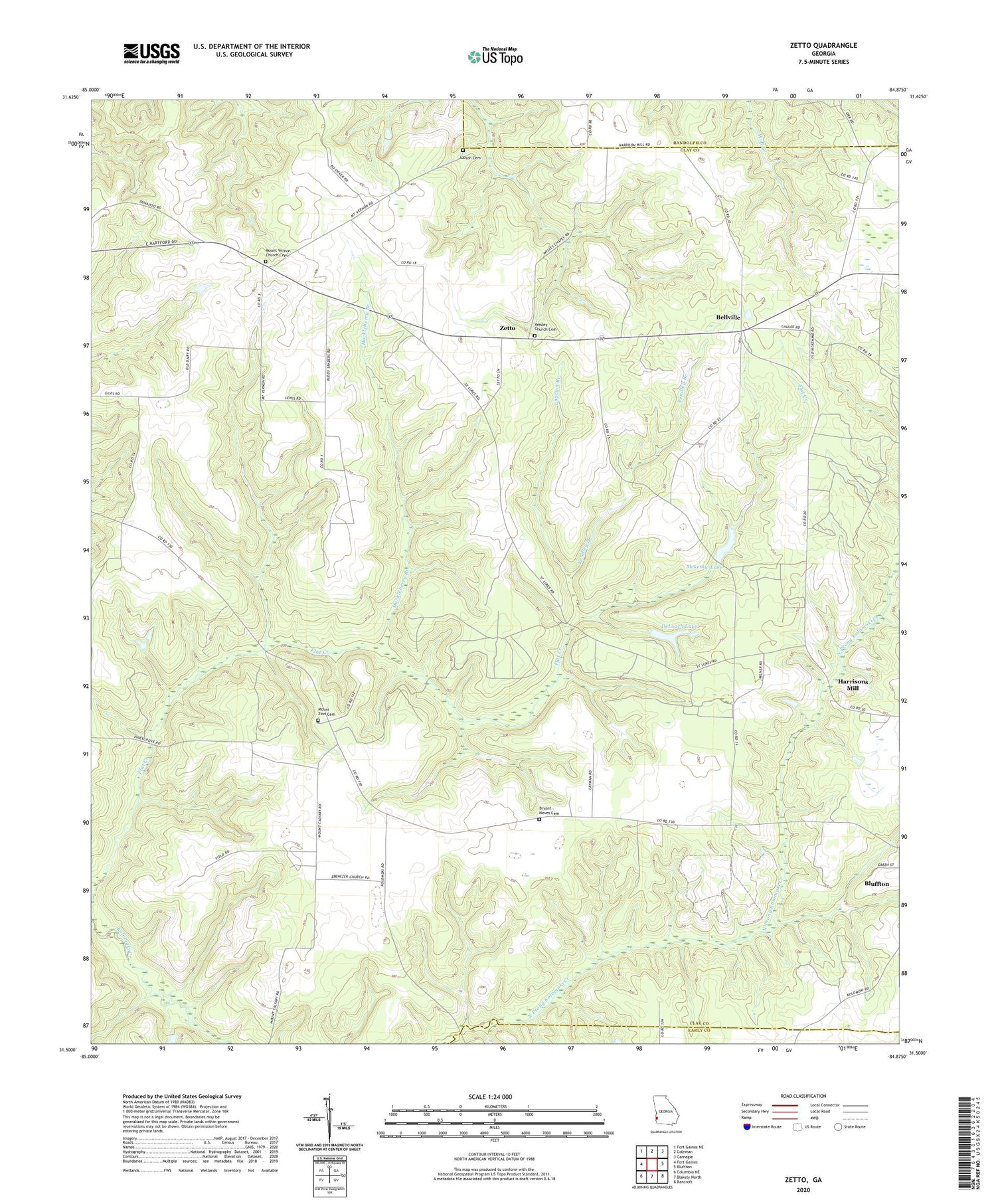
2024 topographic map quadrangle Zetto in the state of Georgia. Scale: 1:24000. Based on the newly updated USGS 7.5' US Topo map series, this map is in the following counties: Clay, Randolph, Early. The map contains contour data, water features, and other items you are used to seeing on USGS maps, but also has updated roads and other features. This is the next generation of topographic maps. Printed on high-quality waterproof paper with UV fade-resistant inks.
Quads adjacent to this one:
West: Fort Gaines
Northwest: Fort Gaines NE
North: Coleman
Northeast: Carnegie
East: Bluffton
Southeast: Bancroft
South: Blakely North
Southwest: Columbia NE
This map covers the same area as the classic USGS quad with code o31084e8.
Contains the following named places: Antioch Church, Bellville, Bluffton Division, Bryant - Neves Cemetery, Clay Lookout Tower, DeLoach Lake, Deloach Lake Dam, Ebenezer Church, Engram Branch, Fendley Branch, Fendley Lake, Fendley Lake Dam, Green Chapel, Harrisons Mill, Huckleberry Branch, Judson Cemetery, Mckemie Lake, Mckemie Lake Dam, Mckemie Lake North Dam, Mckenie Lake North, Mitchel Grove Church, Mount Calvary Church, Mount Vernon Church, Mount Vernon Church Cemetery, Mount Zion Cemetery, Mount Zion Church, New Judson Church, New Judson Church Cemetery, Saint Lukes Church, Wesley Chapel, Wesley Church Cemetery, Zetto, ZIP Code: 39851