MyTopo
Coleman Georgia US Topo Map
Couldn't load pickup availability
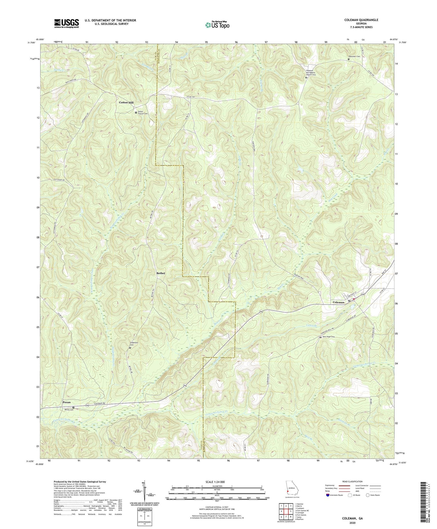
2024 topographic map quadrangle Coleman in the state of Georgia. Scale: 1:24000. Based on the newly updated USGS 7.5' US Topo map series, this map is in the following counties: Randolph, Clay. The map contains contour data, water features, and other items you are used to seeing on USGS maps, but also has updated roads and other features. This is the next generation of topographic maps. Printed on high-quality waterproof paper with UV fade-resistant inks.
Quads adjacent to this one:
West: Fort Gaines NE
Northwest: Hatcher
North: Morris
Northeast: Cuthbert
East: Carnegie
Southeast: Bluffton
South: Zetto
Southwest: Fort Gaines
This map covers the same area as the classic USGS quad with code o31084f8.
Contains the following named places: Bethel, Bethel Church, Caney Branch, Clay County, Coleman, Coleman Census Designated Place, Coleman Post Office, Cotton Hill, Ebenezer Cemetery, Ebenezer Church, Hog Creek, Jones Crossing, Knowles Branch, Little Creek, New Hope Baptist Church, New Hope Cemetery, Pecan, Pecan Cemetery, Pleasant Hill Baptist Church Cemetery, Pleasant Hill Church, Randolph County Fire Department Coleman Station, Shiloh Church, Shiloh Church Cemetery, Shorter Chapel, Singletary Cemetery, Waukeefriskee Creek, Wolf Branch