MyTopo
Coal Mountain Georgia US Topo Map
Couldn't load pickup availability
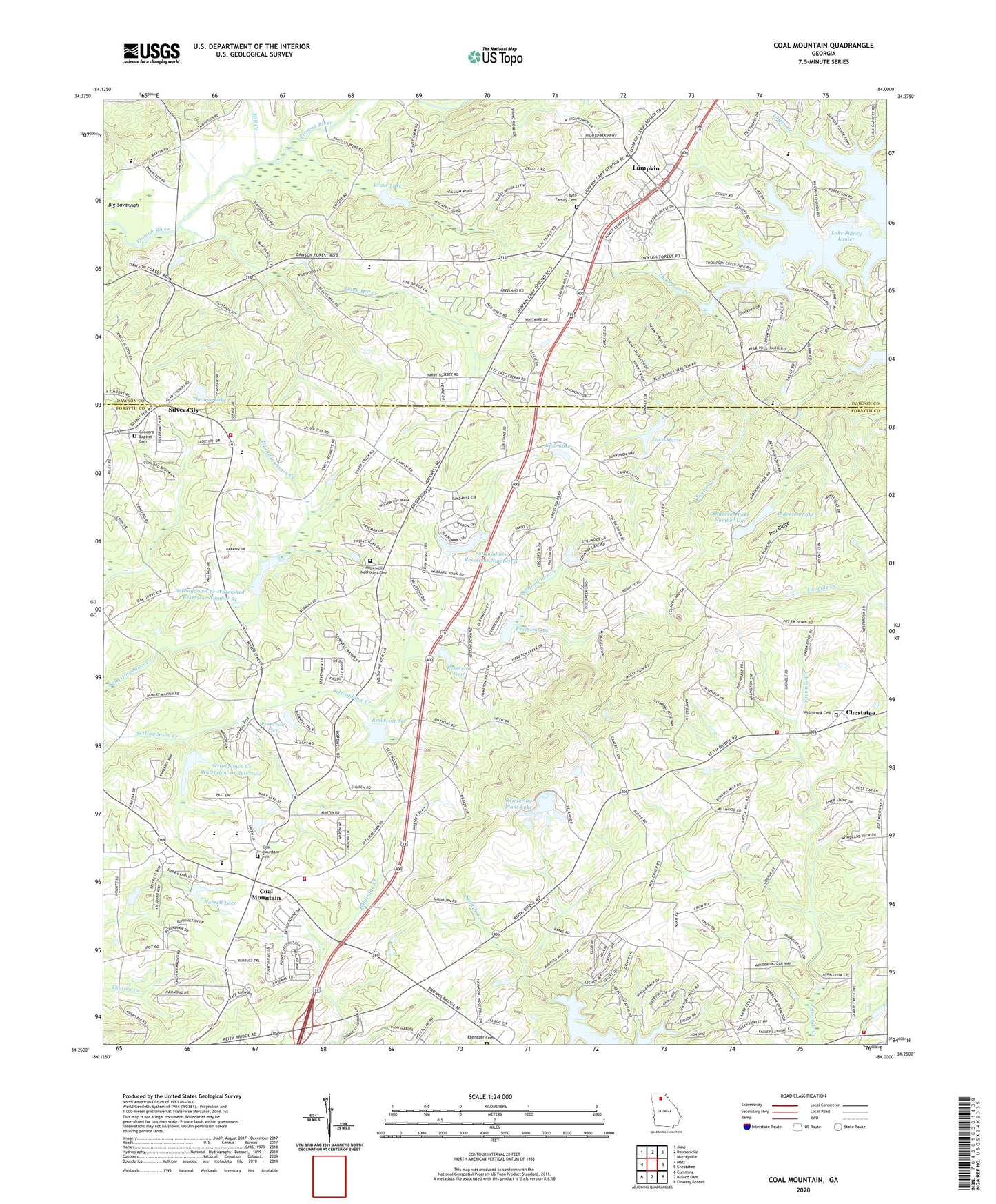
2024 topographic map quadrangle Coal Mountain in the state of Georgia. Scale: 1:24000. Based on the newly updated USGS 7.5' US Topo map series, this map is in the following counties: Forsyth, Dawson. The map contains contour data, water features, and other items you are used to seeing on USGS maps, but also has updated roads and other features. This is the next generation of topographic maps. Printed on high-quality waterproof paper with UV fade-resistant inks.
Quads adjacent to this one:
West: Matt
Northwest: Juno
North: Dawsonville
Northeast: Murrayville
East: Chestatee
Southeast: Flowery Branch
South: Buford Dam
Southwest: Cumming
This map covers the same area as the classic USGS quad with code o34084c1.
Contains the following named places: Adams Heliport, Anderson Dam Number One, Anderson Dam Number Two, Anderson Lake, Anderson Lake Number One, Anderson Lake Number Two, Beaverdam Creek Structure Number Four Dam, Beaverdam Creek Watershed Structure Number Five Dam, Bethel Church, Black Mill Creek, Blacks Mill, Black's Mill Elementary School, Bruce Lake, Byrd Family Cemetery, Chestatee Division, Coal Mountain, Coal Mountain Cemetery, Coal Mountain Church, Coal Mountain Elementary School, Concord Baptist Cemetery, Concord Church, Crossroads Church, Dawson County Fire Department Station 2, Ebenezer Cemetery, Etowah River Watershed Dam Number Nine, Forsyth County Fire Department Station 12, Forsyth County Fire Department Station 7, Forsyth County Fire Department Station 8, Forsyth County Fire Department Station 9, Georgia State Patrol Troop B Post 37 Cumming, Harmony Grove Church, Hopewell Church, Hopewell Methodist Cemetery, Kalb Dam, Kalb Lake, Kilough Church, Kilough Elementary School, Lake Marie, Lake Marie Dam, Liberty Church, Logan Creek, Lumpkin, Lumpkin Campground, Mill Creek, Norrell Lake, Norrell Lake Dam, North Forsyth High School, North Forsyth Middle School, Oak Grove Baptist Church, Pea Ridge, Rendering Plant Lake, Rendering Plant Lake Dam, Reservoir 59, Reservoir Five, Reservoir Four, Reservoir Six, Riverview Middle School, Salem Baptist Church, Settingdown Church, Settingdown Creek Structure 10 Dam, Settingdown Creek Structure 59 Dam, Settingdown Creek Structure Four Dam, Settingdown Creek Structure Six Dam, Settingdown Creek Watershed 10 Reservoir, Settingdown Creek Watershed Number 54 Dam, Settingdown Creek Watershed Reservoir Number 54, Settingdown Reservoir Number 56, Silver City, Silver City Elementary School, Thomas Lake, Thomas Lake Dam, Thompson Creek Access Point, War Hill Christian Academy, Westbrook Cemetery