MyTopo
Juno Georgia US Topo Map
Couldn't load pickup availability
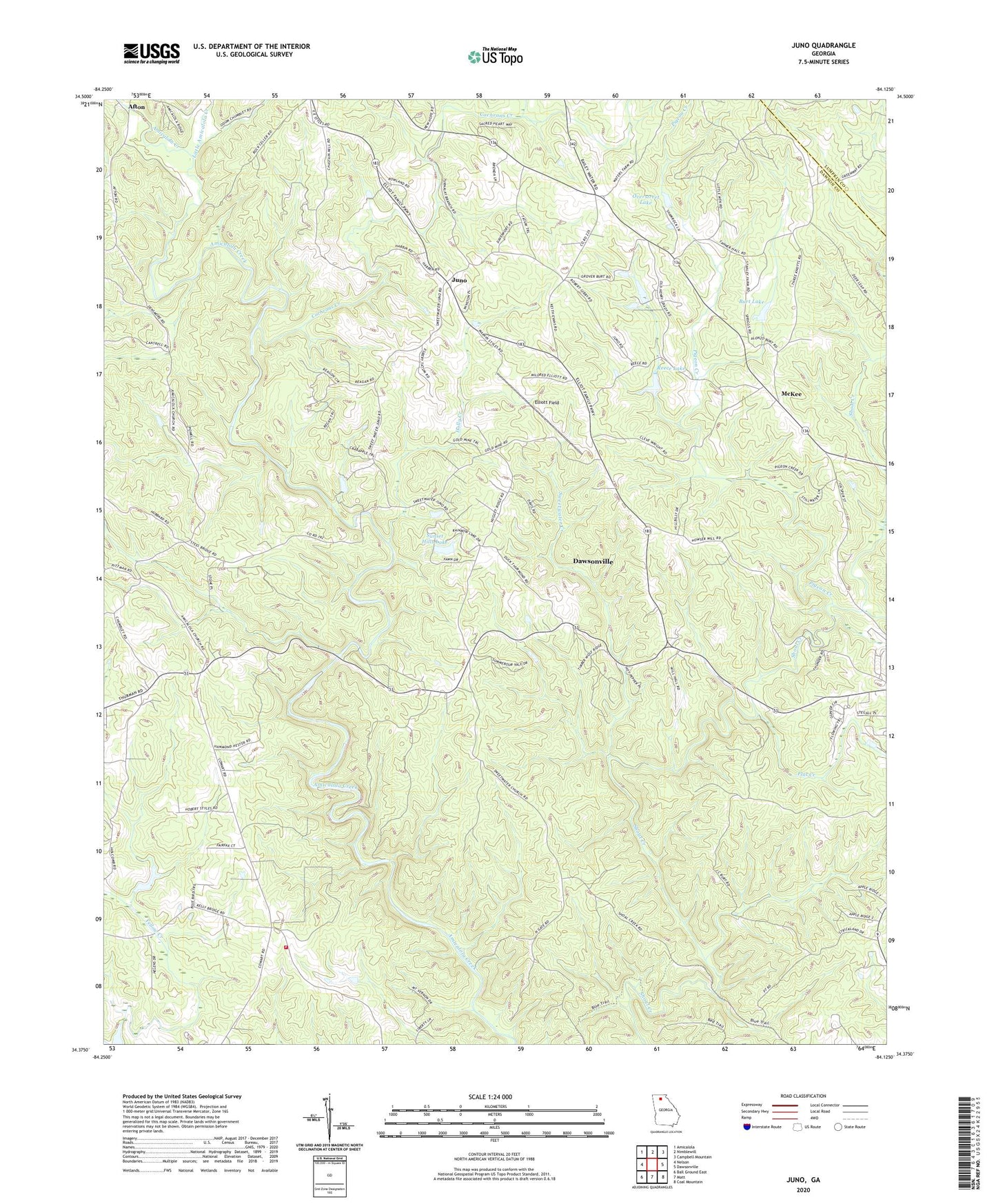
2024 topographic map quadrangle Juno in the state of Georgia. Scale: 1:24000. Based on the newly updated USGS 7.5' US Topo map series, this map is in the following counties: Dawson, Lumpkin. The map contains contour data, water features, and other items you are used to seeing on USGS maps, but also has updated roads and other features. This is the next generation of topographic maps. Printed on high-quality waterproof paper with UV fade-resistant inks.
Quads adjacent to this one:
West: Nelson
Northwest: Amicalola
North: Nimblewill
Northeast: Campbell Mountain
East: Dawsonville
Southeast: Coal Mountain
South: Matt
Southwest: Ball Ground East
This map covers the same area as the classic USGS quad with code o34084d2.
Contains the following named places: Amicalola Church, Bethel Church, Burt Creek, Burt Lake, Cochrans Creek, Dawson County, Dawson County Fire Department Station 5, Dawson Forest Wildlife Management Area, Dawsonville Division, Elliott Field, Etowah River Watershed Dam Number 22, Etowah River Watershed Dam Number 23, Etowah River Watershed Dam Number 24, Flat Creek, Holly Creek, Juno, Little Amicalola Creek, McKee, McKees Chapel, Mount Vernon Church, Overstreet Lake, Pigeon Creek, Pleasant Grove Church, Reece Lake, Sunset Hills Lake, Sunset Hills Lake Dam, Sweetwater Church, Sweetwater Creek, West Side School, West Side Tabernacle, ZIP Code: 30534