MyTopo
Cotton Georgia US Topo Map
Couldn't load pickup availability
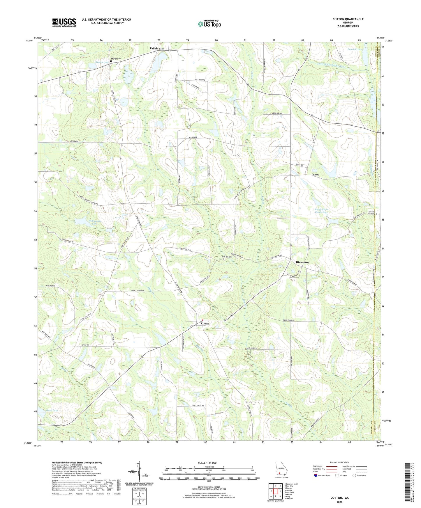
2024 topographic map quadrangle Cotton in the state of Georgia. Scale: 1:24000. Based on the newly updated USGS 7.5' US Topo map series, this map is in the following counties: Mitchell, Colquitt. The map contains contour data, water features, and other items you are used to seeing on USGS maps, but also has updated roads and other features. This is the next generation of topographic maps. Printed on high-quality waterproof paper with UV fade-resistant inks.
Quads adjacent to this one:
West: Camilla
Northwest: Baconton South
North: Sale City
Northeast: Doerun
East: Hartsfield
Southeast: Chastain
South: Meigs
Southwest: Pelham
This map covers the same area as the classic USGS quad with code o31084b1.
Contains the following named places: Akridge, Akridge Cemetery, Antioch Church, Arno Church, Blooming Light Church, Connell Lake, Connell Lake Dam, Cotton, Cotton Volunteer Fire Department, Hand Lake, Hand Lake Dam, Hinsonton, Lake Pleasant Church, Laney, Liberty Hill Cemetery, Liberty Hill Church, Mims Millpond, New Hope Church, Pebble City, Pebble City Church, Rigsby Lake, Rigsby Lake Dam, Rogerville, Saco, Sallys Branch, Sonny Glenn Estate Lake, Sonny Glenn Estate Lake Dam, Turner School, WABW-TV (Pelham), White Rock Church, Willingham Lake, Willingham Lake Dam, Zion Hill Cemetery, Zion Hill Church, ZIP Code: 31784