
MyTopo
Dexter Georgia US Topo Map
Couldn't load pickup availability
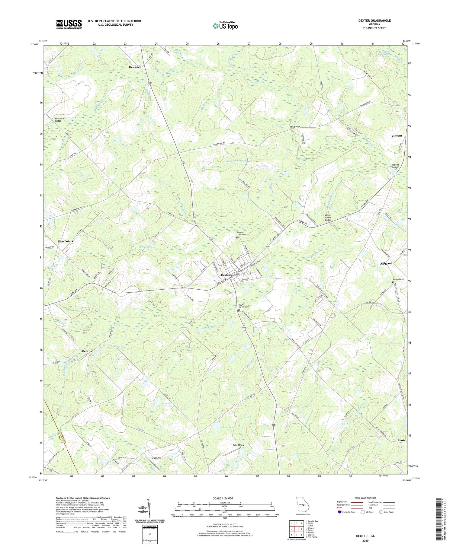
2024 topographic map quadrangle Dexter in the state of Georgia. Scale: 1:24000. Based on the newly updated USGS 7.5' US Topo map series, this map is in the following counties: Laurens, Dodge. The map contains contour data, water features, and other items you are used to seeing on USGS maps, but also has updated roads and other features. This is the next generation of topographic maps. Printed on high-quality waterproof paper with UV fade-resistant inks.
Quads adjacent to this one:
West: Chester
Northwest: Danville East
North: Dudley
Northeast: Dublin
East: Rentz
Southeast: Five Points
South: Cadwell
Southwest: Yonkers
This map covers the same area as the classic USGS quad with code o32083d1.
Contains the following named places: Alcorns, Alligood, Alligood Cemetery, Antioch Baptist Church, Bell Branch, Beulah Hill Church, Big Branch, Big Stitchihatchie Branch, Boggy Branch, Bryant School, Buckhorn Bridge, Buckhorn Church, Buckhorn Creek, Christian Science Tabernacle, Collins Branch, Dexter, Dexter Branch, Dexter Division, Dexter Post Office, Dexter School, Duke Strip 2, Five Points, Gin House Branch, Hill Bridge, Hogans Branch, Kemp School, Kewanee, Kewanee Church, Laurens County Fire Department Station 11, Little Boggy Branch, Little Rocky Creek, Little Stitchihatchie Branch, Lord Lake, Lord Lake Dam, Lt Landing, Malone Lake, Malone Lake Dam, Mount Carmel Cemetery, Mount Carmel Church, Mount Carmel School, Musgrove, Nameless, Nameless School, Nesmith Lake, Nesmith Lake Dam, New Salem School, Roberts Bridge, Rocky Creek Church, Rocky Creek School, Saint Lukes Cemetery, Scooter Route Branch, Shewmake Mill, Shewmake Springs, Spring Haven Bridge, Springhaven, Stitchihatchie Creek, Town of Dexter, Vincent, Whitley Branch, Wide Branch, Wilkin School, ZIP Code: 31019


