MyTopo
Cadwell Georgia US Topo Map
Couldn't load pickup availability
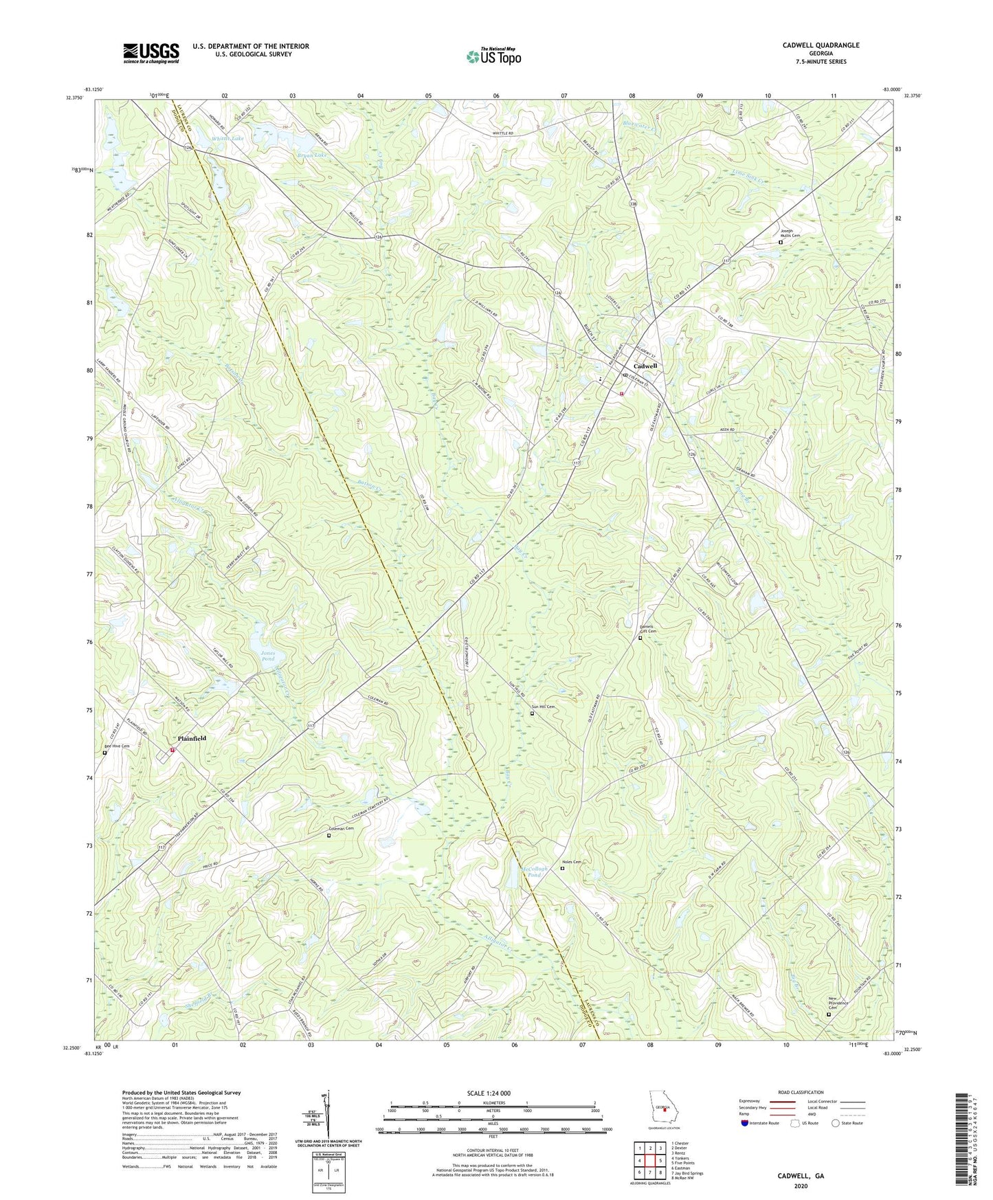
2024 topographic map quadrangle Cadwell in the state of Georgia. Scale: 1:24000. Based on the newly updated USGS 7.5' US Topo map series, this map is in the following counties: Laurens, Dodge. The map contains contour data, water features, and other items you are used to seeing on USGS maps, but also has updated roads and other features. This is the next generation of topographic maps. Printed on high-quality waterproof paper with UV fade-resistant inks.
Quads adjacent to this one:
West: Yonkers
Northwest: Chester
North: Dexter
Northeast: Rentz
East: Five Points
Southeast: McRae NW
South: Jay Bird Springs
Southwest: Eastman
This map covers the same area as the classic USGS quad with code o32083c1.
Contains the following named places: Batson, Batson Baptist Church, Batson Creek, Batson School, Bay Creek, Bay Springs Church, Bee Hive Cemetery, Beehive, Bryan Lake, Bryan Lake Dam, Cadwell, Cadwell Division, Cadwell Post Office, Cadwell School, Central Probation Detention Center, Coleman Cemetery, Daniels Gift Cemetery, Drench Grove Church, Ellistor School, Horne, Jones Pond, Jones Pond Dam, Joseph Mullis Cemetery, Laurens County Fire Department Station 12, McCollogh Pond, McCollogh Pond Dam, Middle Grounds Church, Mukerson, New Evergreen Church, New Providence Cemetery, Noles Cemetery, Plainfield, Plainfield Baptist Church, Plainfield Volunteer Fire Department, Pleasant Hill Church, Reedy Springs Church, Snow Hill Church, Sun Hill Baptist Church, Sun Hill Cemetery, Town of Cadwell, Whittle Lake, Whittle Lake Dam, ZIP Code: 31009