MyTopo
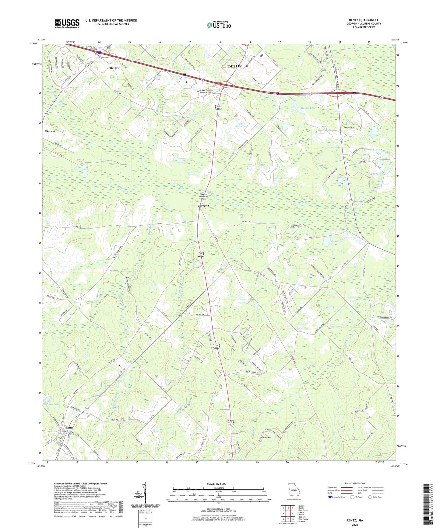
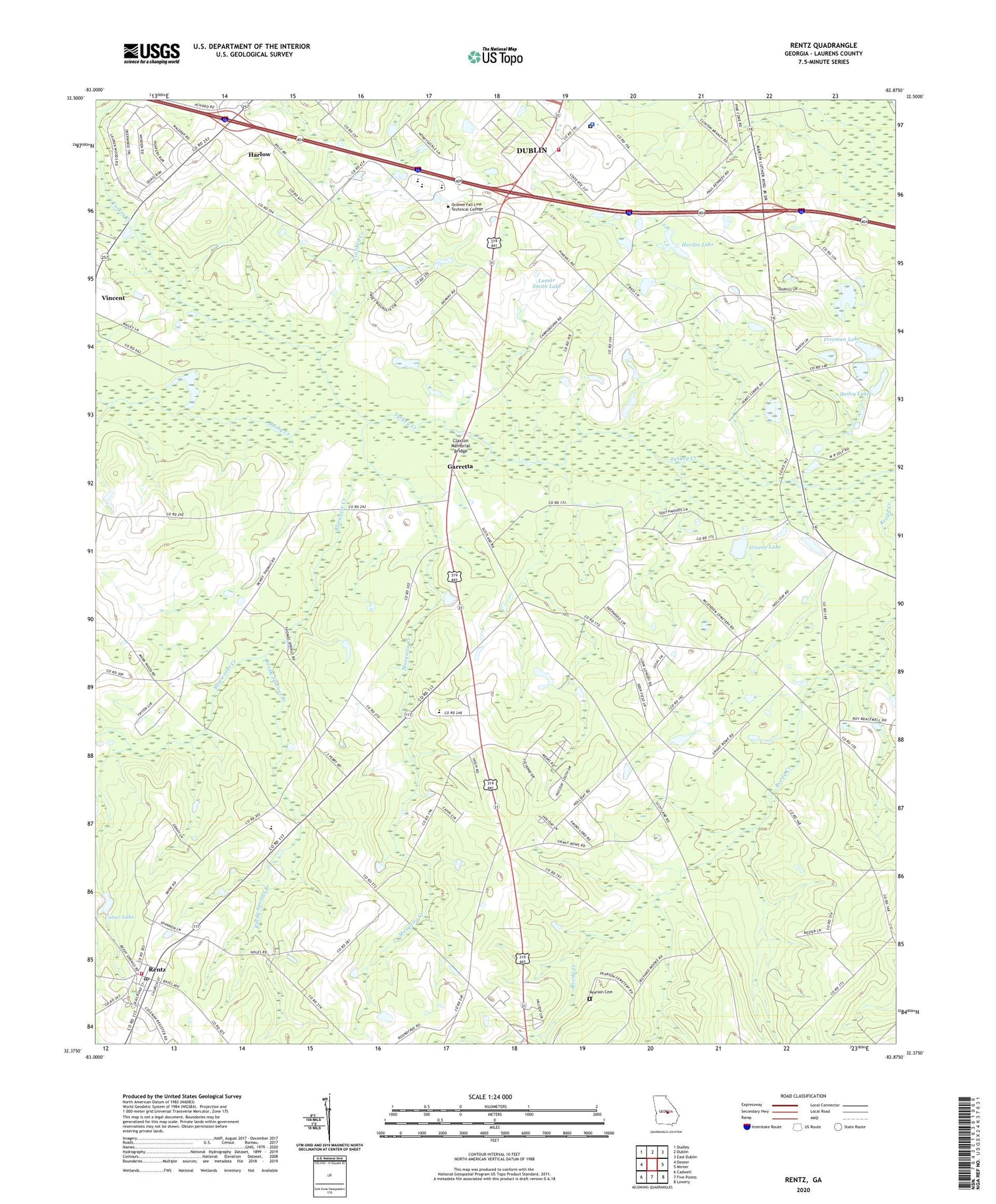
Rentz Georgia US Topo Map
Couldn't load pickup availability
2024 topographic map quadrangle Rentz in the state of Georgia. Scale: 1:24000. Based on the newly updated USGS 7.5' US Topo map series, this map is in the following counties: Laurens. The map contains contour data, water features, and other items you are used to seeing on USGS maps, but also has updated roads and other features. This is the next generation of topographic maps. Printed on high-quality waterproof paper with UV fade-resistant inks.
Quads adjacent to this one:
West: Dexter
Northwest: Dudley
North: Dublin
Northeast: East Dublin
East: Minter
Southeast: Lowery
South: Five Points
Southwest: Cadwell
This map covers the same area as the classic USGS quad with code o32082d8.
Contains the following named places: Bailey Lake, Bailey Lake Dam, Bluewater Church, Bluewater Creek, Cheeks Still, City of Rentz, Claxton Memorial Bridge, Colter Lake, Colter Lake Dam, Crooked Creek, Fleming Chapel, Freeman Lake, Freeman Lake Dam, Garretta, Georgia State Patrol Troop F Post 20, Gilders Landing, Greene Lake, Greene Lake Dam, Hardin Lake, Hardin Lake Dam, Harlow, Lamar Smith Lake, Lamar Smith Lake Dam, Laurens County, Laurens County Fire Department Station 13, Laurens County Jail, Laurens County Sheriff's Office, Laurens High School, Mayberry, McLendon School, Mosquito Creek, Mount Zion Church, New Bethel Church, Olivet Church, Pearson Cemetery, Pine Hill Church, Pinetucky Campground, Reedy Spring Church, Reedy Springs Branch, Rentz, Rentz Division, Rentz Post Office, Robertson Chapel, Rocky Creek, Spring Hill Church, Turkey Creek Church, West Laurens High School, West Laurens Junior High School, Woodard Grove Church, ZIP Code: 31021