MyTopo
Downs Georgia US Topo Map
Couldn't load pickup availability
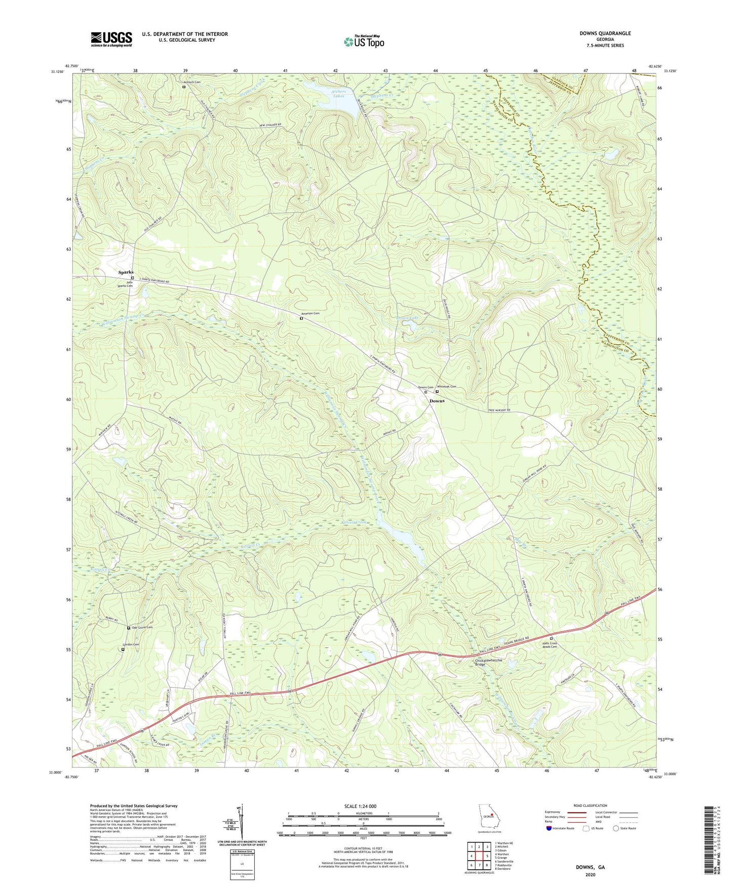
2024 topographic map quadrangle Downs in the state of Georgia. Scale: 1:24000. Based on the newly updated USGS 7.5' US Topo map series, this map is in the following counties: Washington, Jefferson, Glascock. The map contains contour data, water features, and other items you are used to seeing on USGS maps, but also has updated roads and other features. This is the next generation of topographic maps. Printed on high-quality waterproof paper with UV fade-resistant inks.
Quads adjacent to this one:
West: Warthen
Northwest: Warthen NE
North: Mitchell
Northeast: Gibson
East: Grange
Southeast: Davisboro
South: Riddleville
Southwest: Sandersville
This map covers the same area as the classic USGS quad with code o33082a6.
Contains the following named places: Amerson Cemetery, Antioch Baptist Church, Antioch Cemetery, Archers Lake Dam, Archers Lakes, Brown Lake, Brown Lake Dam, Chickasawhatchie Bridge, Downs, Downs Baptist Church, Downs Cemetery, Gordon Cemetery, Hall School, Halls Chapel, Halls Cross Roads Cemetery, Halls Crossing, Heidrich Airport, Holly Spring Church, Inman Branch, John Sparks Cemetery, Jordan Church, Jordan Mill Pond Dam, Jordan Millpond, Jordans Mill, Kittrell Creek, May Branch Church, May Branch School, Minton Springs Church, Oak Grove Cemetery, Sparks, Spring Hill Church, Union Church, White Oak Church, Whiteoak Cemetery