MyTopo
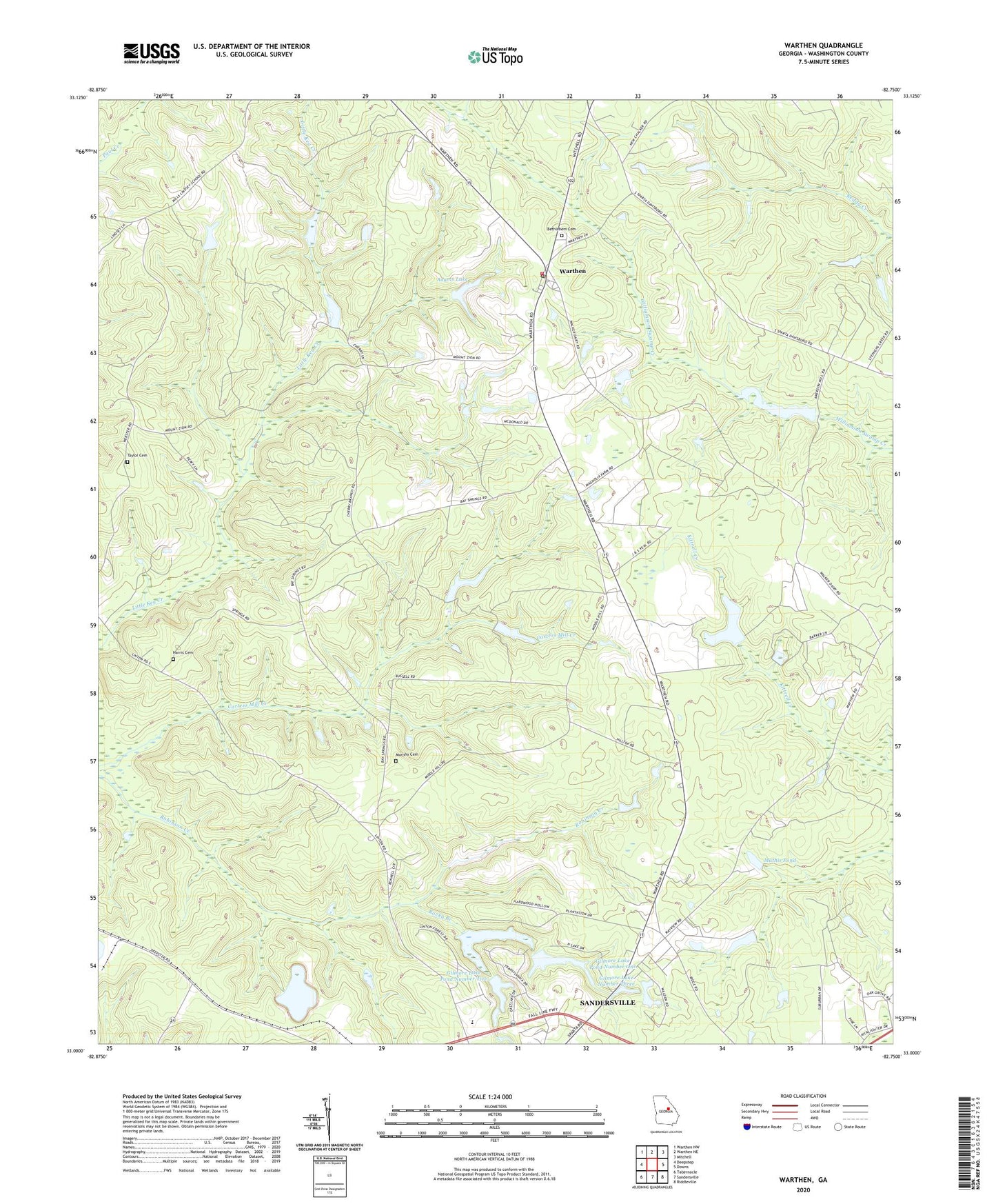
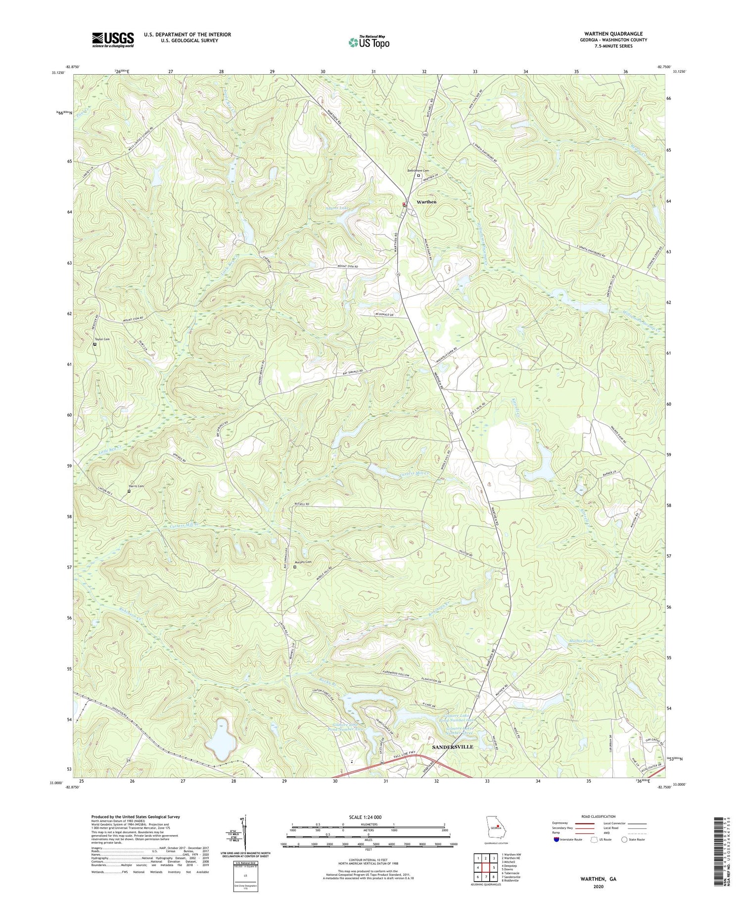
Warthen Georgia US Topo Map
Couldn't load pickup availability
2024 topographic map quadrangle Warthen in the state of Georgia. Scale: 1:24000. Based on the newly updated USGS 7.5' US Topo map series, this map is in the following counties: Washington. The map contains contour data, water features, and other items you are used to seeing on USGS maps, but also has updated roads and other features. This is the next generation of topographic maps. Printed on high-quality waterproof paper with UV fade-resistant inks.
Quads adjacent to this one:
West: Deepstep
Northwest: Warthen NW
North: Warthen NE
Northeast: Mitchell
East: Downs
Southeast: Riddleville
South: Sandersville
Southwest: Tabernacle
This map covers the same area as the classic USGS quad with code o33082a7.
Contains the following named places: Adams Lake, Adams Lake Dam, Alligator Branch, Base Spring Chapel, Bethlehem Cemetery, Bethlehem Church, Chapel Church, Gilmore Lake Dam Number One, Gilmore Lake Dam Pond Number Two, Gilmore Lake Number Three, Gilmore Lake Number Three Dam, Gilmore Lake Pond Number One, Gilmore Lake Pond Number Two, Harris Cemetery, Harris Methodist Church, Mathis Pond, Mays Mill, Mays Millpond, Mays Millpond Dam, Middle Hill Church, Mount Olive Church, Murphy Cemetery, Murphy School, Oak Grove Church, Reddy Creek, Robin Spring Church, Rocky Branch, Sandersville Division, Sandy Grove Church, Silas, Taylor Cemetery, Walker Pond, Walker Pond Dam, Warthen, Warthen Census Designated Place, Warthen Post Office, Warthen United Methodist Church, Warthen Volunteer Fire Department, ZIP Code: 31094