MyTopo
Warthen NE Georgia US Topo Map
Couldn't load pickup availability
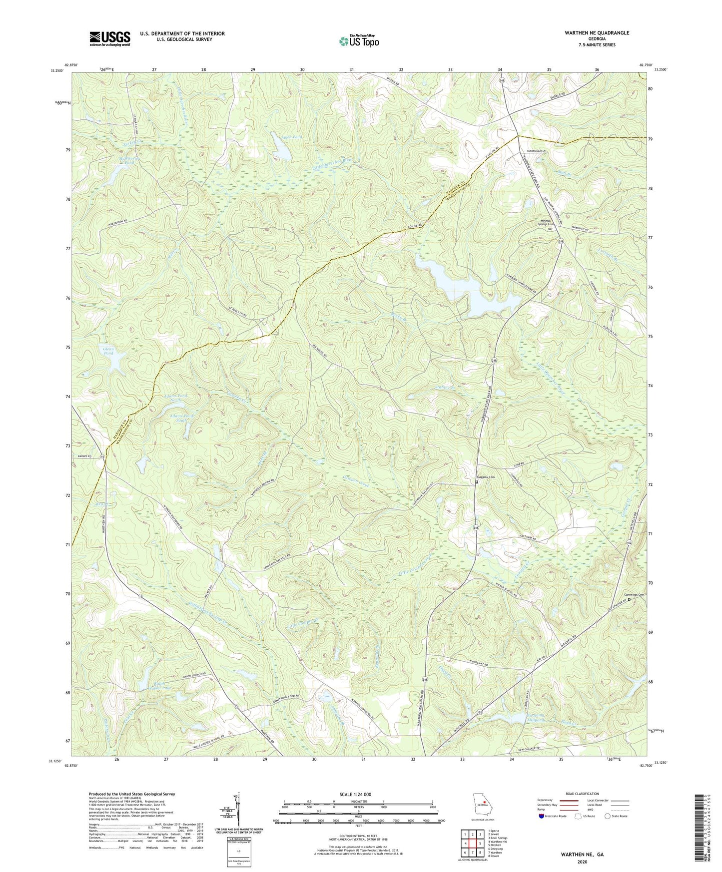
2024 topographic map quadrangle Warthen NE in the state of Georgia. Scale: 1:24000. Based on the newly updated USGS 7.5' US Topo map series, this map is in the following counties: Washington, Hancock, Glascock. The map contains contour data, water features, and other items you are used to seeing on USGS maps, but also has updated roads and other features. This is the next generation of topographic maps. Printed on high-quality waterproof paper with UV fade-resistant inks.
Quads adjacent to this one:
West: Warthen NW
Northwest: Sparta
North: Jewell
Northeast: Beall Springs
East: Mitchell
Southeast: Downs
South: Warthen
Southwest: Deepstep
This map covers the same area as the classic USGS quad with code o33082b7.
Contains the following named places: Adams Pond North, Adams Pond North Dam, Adams Pond South, Adams Pond South Dam, Aiken Pond, Aiken Pond Dam, Burgamy Cemetery, Burgamy Millpond, Burgamy Millpond Dam, Centralia School, Cummings Cemetery, Eureka, Glenn Pond, Glenn Pond Dam, Hamburg Mill Pond Dam, Hamburg State Park, Hamburgh Millpond, Lindsey, Little Cowpen Creek, McWhorter Pond, Meek Branch, Mill Creek, Mineral Springs Cemetery, Mineral Springs Church, Mount Hope Church, New Hope Church, Patterson Creek, Pine Hill Church, Ralph Walker Lake, Ralph Walker Lake Dam, Reynolds Branch, Rocky Branch, Saint James Church, Saint Pauls Church, Stabley Branch, Turkey Creek, Victor School, Victorwick School, Warthen Division