
MyTopo
Friendship Georgia US Topo Map
Couldn't load pickup availability
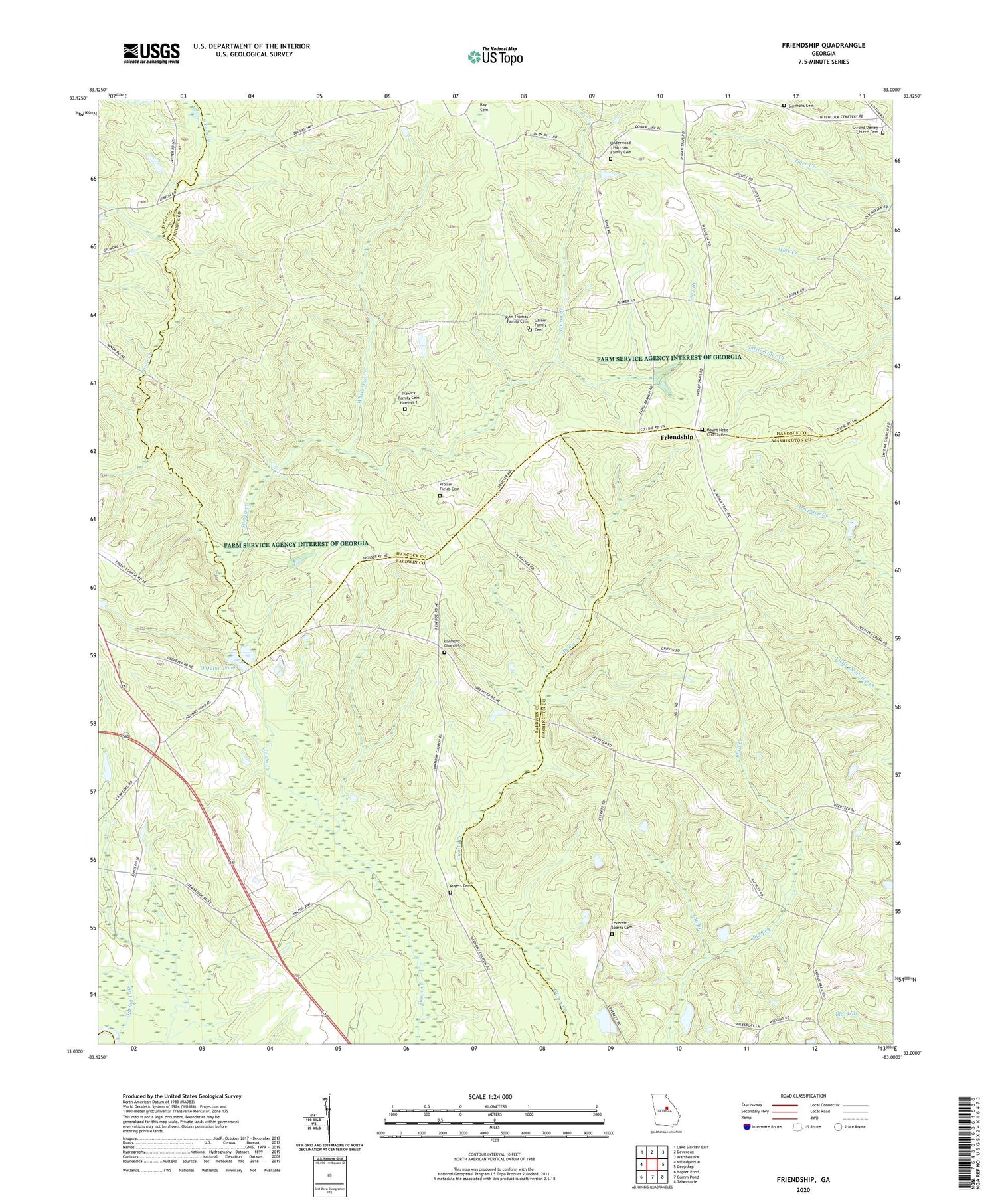
2024 topographic map quadrangle Friendship in the state of Georgia. Scale: 1:24000. Based on the newly updated USGS 7.5' US Topo map series, this map is in the following counties: Baldwin, Hancock, Washington, Wilkinson. The map contains contour data, water features, and other items you are used to seeing on USGS maps, but also has updated roads and other features. This is the next generation of topographic maps. Printed on high-quality waterproof paper with UV fade-resistant inks.
Quads adjacent to this one:
West: Milledgeville
Northwest: Lake Sinclair East
North: Devereux
Northeast: Warthen NW
East: Deepstep
Southeast: Tabernacle
South: Gumm Pond
Southwest: Napier Pond
This map covers the same area as the classic USGS quad with code o33083a1.
Contains the following named places: Allen Mill, Body of Christ Church, County Line Church, Friendship, Friendship Baptist Church, Friendship Church, Garner Family Cemetery, Gin Branch, Griffin Academy, Harmony Church, Harmony Church Cemetery, John Thomas Family Cemetery, Leverett - Sparks Cemetery, Long Branch, Minor School, Mount Nebo Church Cemetery, Nebo Church, O'Quinn Pond, O'Quinn Pond Dam, Peavy Lake, Peavy Lake Dam, Pleasant Grove School, Prosser Fields Cemetery, Roberson Chapel Church, Rogers Cemetery, Second Darien Church Cemetery, Simmons Cemetery, Spring Creek, Spring Lake, Trawick Family Cemetery Number 1, Underwood - Harrison Family Cemetery, White Oak Creek


