MyTopo
Deepstep Georgia US Topo Map
Couldn't load pickup availability
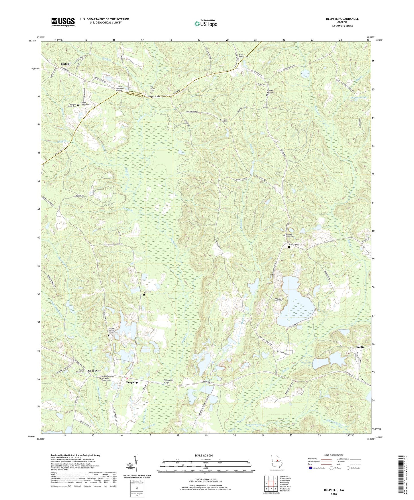
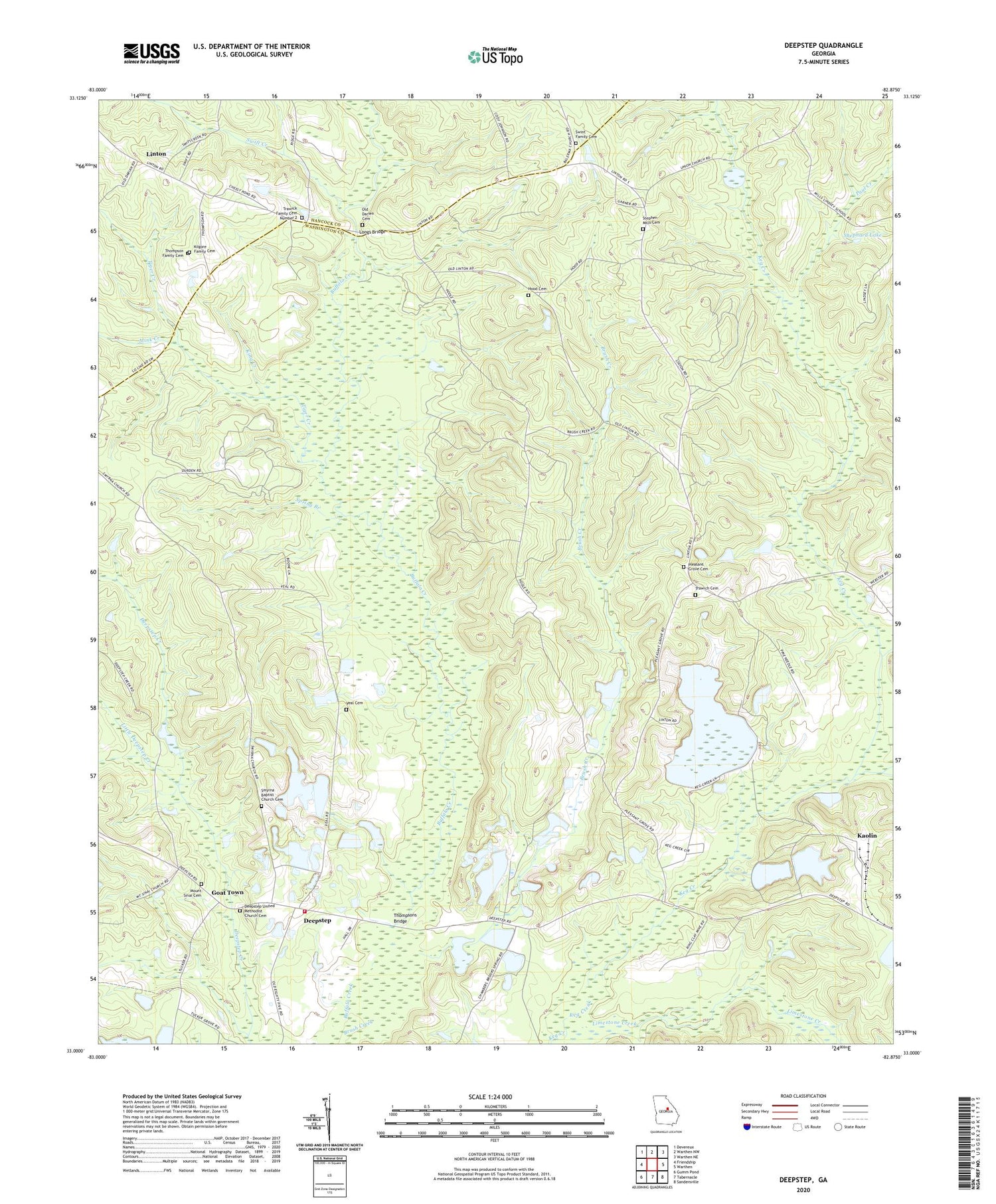
2024 topographic map quadrangle Deepstep in the state of Georgia. Scale: 1:24000. Based on the newly updated USGS 7.5' US Topo map series, this map is in the following counties: Washington, Hancock. The map contains contour data, water features, and other items you are used to seeing on USGS maps, but also has updated roads and other features. This is the next generation of topographic maps. Printed on high-quality waterproof paper with UV fade-resistant inks.
Quads adjacent to this one:
West: Friendship
Northwest: Devereux
North: Warthen NW
Northeast: Warthen NE
East: Warthen
Southeast: Sandersville
South: Tabernacle
Southwest: Gumm Pond
This map covers the same area as the classic USGS quad with code o33082a8.
Contains the following named places: American Ind Clay Company Lake, American Ind Clay Company Lake Dam, Bold Spring Church, Brush Creek, Carters Mill Creek, Darien Church, Deepstep, Deepstep School, Deepstep United Methodist Church, Deepstep United Methodist Church Cemetery, Deepstep Volunteer Fire Department, Goat Town, Hood Cemetery, Kaolin, Kilgore Family Cemetery, King Creek, Linton, Linton Historic District, Little Deepstep Creek, Little Keg Creek, Little Tiger Creek, Longs Bridge, Mink Creek, Mount Sinai Baptist Church, Mount Sinai Cemetery, Mount Sinai School, Old Darien Cemetery, Old Darien Church, O'Quinn Family Graveyard, Paul Creek, Pine Hill Church, Pleasant Grove Cemetery, Pleasant Grove Church, Robinson Creek, Second Darien Church, Shephard Lake, Shephard Lake Dam, Shiloh School, Smyrna Baptist Church Cemetery, Smyrna Church, Spring Branch, Stephen Mills Cemetery, Swift Creek, Swint Family Cemetery, Thompson Family Cemetery, Thompsons Bridge, Tiger Creek, Town of Deepstep, Trawich Cemetery, Trawick Family Cemetery Number 2, Veal Cemetery