
MyTopo
Warthen NW Georgia US Topo Map
Couldn't load pickup availability
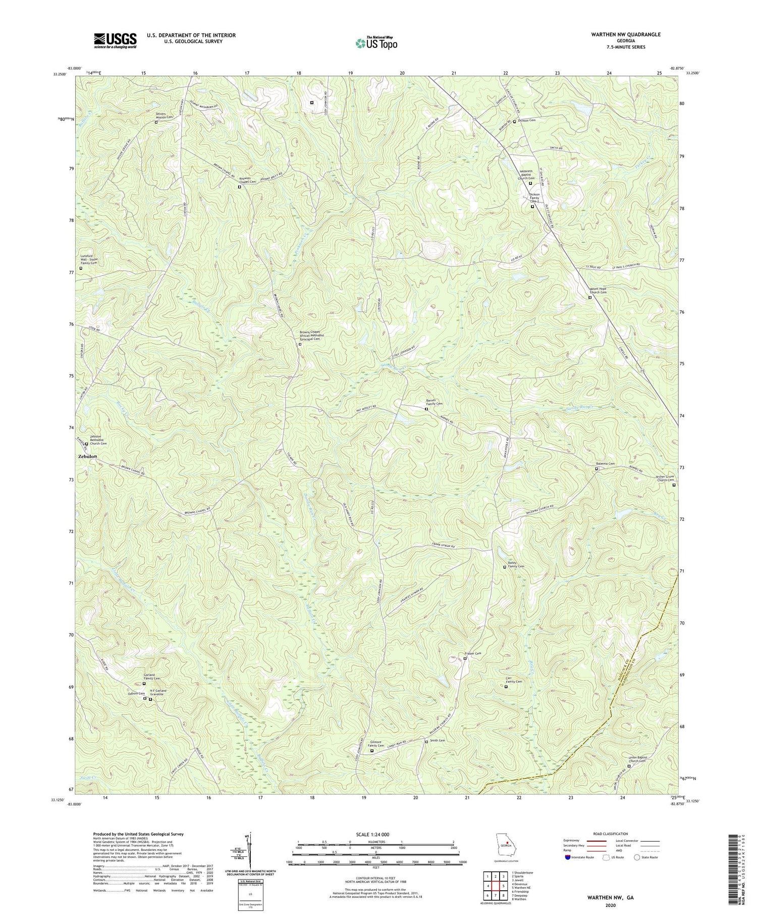
2024 topographic map quadrangle Warthen NW in the state of Georgia. Scale: 1:24000. Based on the newly updated USGS 7.5' US Topo map series, this map is in the following counties: Hancock, Washington. The map contains contour data, water features, and other items you are used to seeing on USGS maps, but also has updated roads and other features. This is the next generation of topographic maps. Printed on high-quality waterproof paper with UV fade-resistant inks.
Quads adjacent to this one:
West: Devereux
Northwest: Shoulderbone
North: Sparta
Northeast: Jewell
East: Warthen NE
Southeast: Warthen
South: Deepstep
Southwest: Friendship
This map covers the same area as the classic USGS quad with code o33082b8.
Contains the following named places: Archer Grove Church, Archer Grove Church Cemetery, Bailey Family Cemetery, Balerma Cemetery, Balerma Church, Barnes Family Cemetery, Browns Chapel African Methodist Episcopal Cemetery, Carr Family Cemetery, Dickson Cemetery, Dickson Family Cemetery 2, Frasier Cemetery, Galillee School, Garland Family Cemetery, Gilmore Family Cemetery, Hancock State Prison, Hopewell Church, Hopewell School, Knowles Chapel, Knowles Chapel Cemetery, Little Buffalo Creek, Lunsford - Wall - Sisson Family Cemetery, Mount Hope Church, Mount Hope Church Cemetery, N F Garland Gravesite, Nazareth Baptist Church Cemetery, Ozborn Cemetery, Pinkston Creek, Rocky Creek, Sandy Run Church, Sandy Run Creek, Shiver Grove Church, Shivers Mission Cemetery, Smith Cemetery, Union Baptist Church Cemetery, Union Church, Zebulon Methodist Church, Zebulon Methodist Church Cemetery


