MyTopo
Odum Georgia US Topo Map
Couldn't load pickup availability
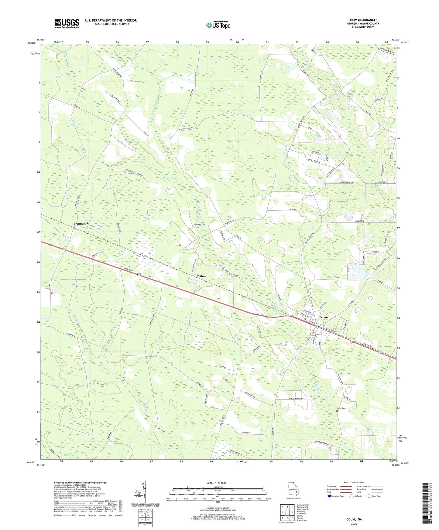
2024 topographic map quadrangle Odum in the state of Georgia. Scale: 1:24000. Based on the newly updated USGS 7.5' US Topo map series, this map is in the following counties: Wayne. The map contains contour data, water features, and other items you are used to seeing on USGS maps, but also has updated roads and other features. This is the next generation of topographic maps. Printed on high-quality waterproof paper with UV fade-resistant inks.
Quads adjacent to this one:
West: Surrency
Northwest: Altamaha SW
North: Altamaha SE
Northeast: Glennville SW
East: Jesup NW
Southeast: Jesup West
South: Ritch
This map covers the same area as the classic USGS quad with code o31082f1.
Contains the following named places: Aspinwall Cemetery, Brentwood, Carter Grove Church, Church of God, City of Odum, Corinth Church, Joiner Cemetery, Keene Bay Branch, Lake Lanell, Lake Lanell Dam, Neva School, Odum, Odum Baptist Church, Odum Division, Odum Elementary School, Odum Post Office, Odum Volunteer Fire Department, Piney Grove, Piney Grove Church, Piney Grove School, Tetlow, Wayne County Correctional Fire Department, Wayne State Prison, ZIP Code: 31555