MyTopo
K'Ville Georgia US Topo Map
Couldn't load pickup availability
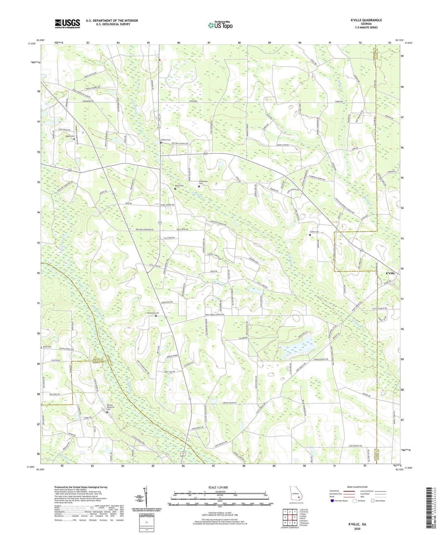
2024 topographic map quadrangle K'Ville in the state of Georgia. Scale: 1:24000. Based on the newly updated USGS 7.5' US Topo map series, this map is in the following counties: Appling, Wayne, Pierce, Bacon. The map contains contour data, water features, and other items you are used to seeing on USGS maps, but also has updated roads and other features. This is the next generation of topographic maps. Printed on high-quality waterproof paper with UV fade-resistant inks.
Quads adjacent to this one:
West: Coffee
Northwest: Alma NE
North: Surrency
Northeast: Odum
East: Ritch
Southeast: Screven
South: Patterson
Southwest: Mershon
This map covers the same area as the classic USGS quad with code o31082e2.
Contains the following named places: Antioch Church, Appling County Fire Department 4th District Station, Appling County Fire Department County Line Station, Big Creek Primitive Baptist Church, Christian Springs Church, Dixon Cemetery, Ephesus Church, Griffis Cemetery, Jesus Cemetery, Jesus Church, K'Ville, Long Branch Community Center, Martha Memorial Cemetery, Martha Memorial Church, Milikin Cemetery, Milikin United Methodist Church, Moody Ford, Morris Chapel, Patterson Cemetery, Paulk Cemetery, Pine Ridge Church, Piney Grove Free Will Baptist Church, Piney Grove School, School Number 4, Sweetwater Creek, Williamson Cemetery, Zion Church, Zion Church of God, ZIP Code: 31518