MyTopo
Lowery Georgia US Topo Map
Couldn't load pickup availability
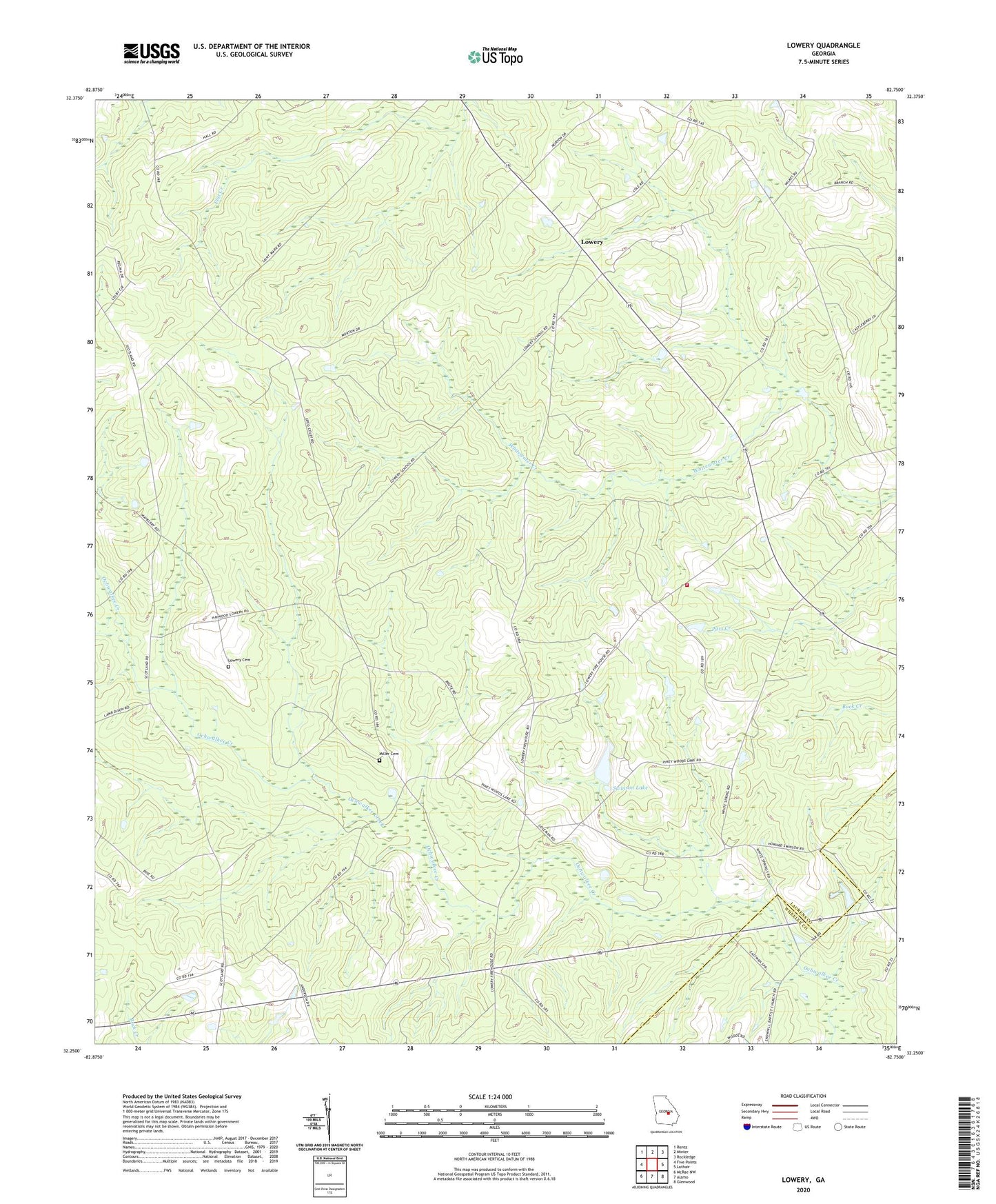
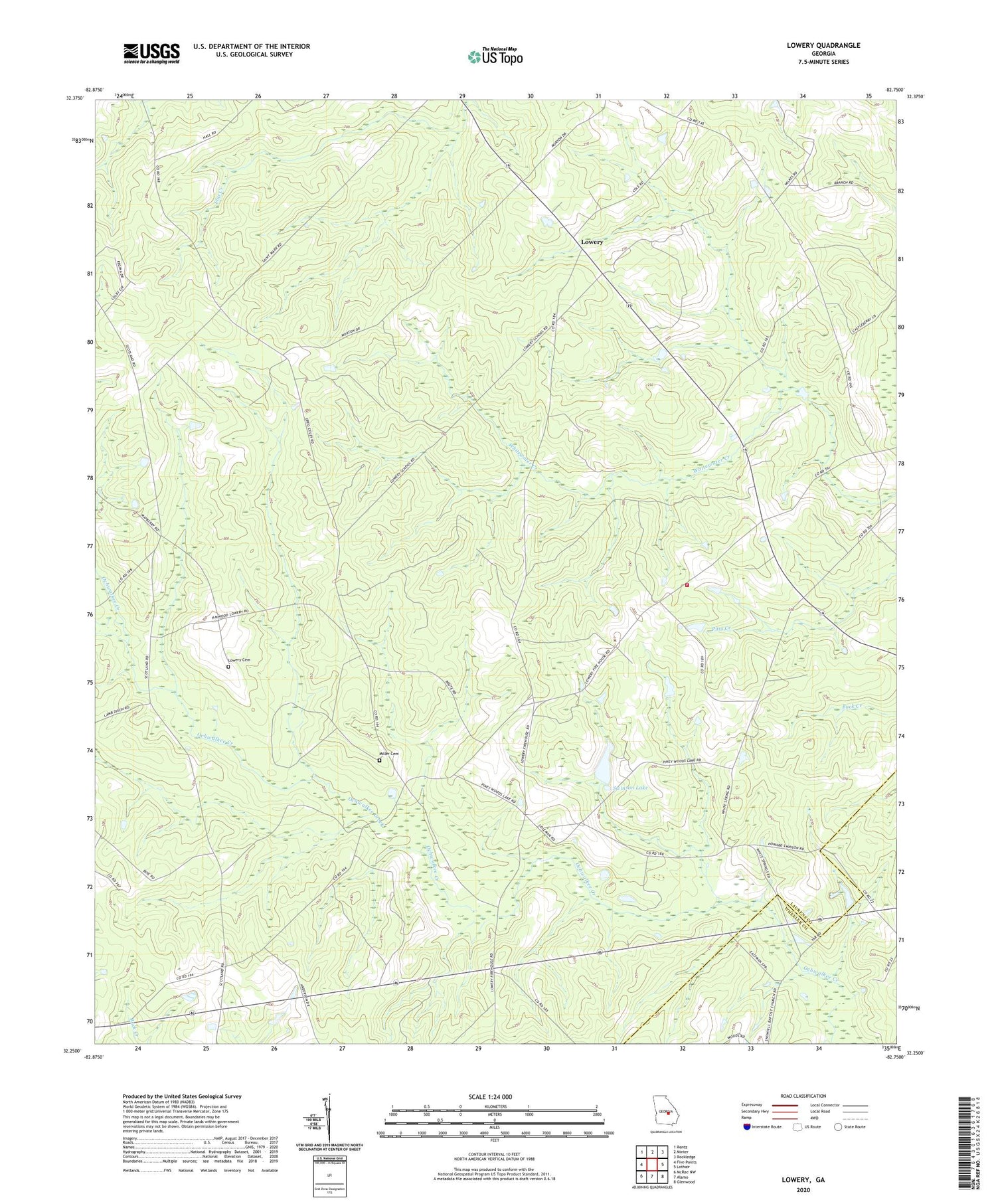
2024 topographic map quadrangle Lowery in the state of Georgia. Scale: 1:24000. Based on the newly updated USGS 7.5' US Topo map series, this map is in the following counties: Laurens, Wheeler. The map contains contour data, water features, and other items you are used to seeing on USGS maps, but also has updated roads and other features. This is the next generation of topographic maps. Printed on high-quality waterproof paper with UV fade-resistant inks.
Quads adjacent to this one:
West: Five Points
Northwest: Rentz
North: Minter
Northeast: Rockledge
East: Lothair
Southeast: Glenwood
South: Alamo
Southwest: McRae NW
This map covers the same area as the classic USGS quad with code o32082c7.
Contains the following named places: Cedar Grove Division, Gerard Gin, Harrigan School, Hatoff, Hatoff Church, Laurens County Fire Department Station 16, Lowery, Lowery Cemetery, Lowery Church, Lowry Church, Lowry School, McRae Church, Miller Cemetery, Ochwalkee Creek, Pearlie Church, Race School, Saint Marks Church, Swinson Lake, Swinson Lake Dam, Walkee, White Spring School, White Springs Church, Whitewater Church, Windham Greenhouses