MyTopo
Patten Georgia US Topo Map
Couldn't load pickup availability
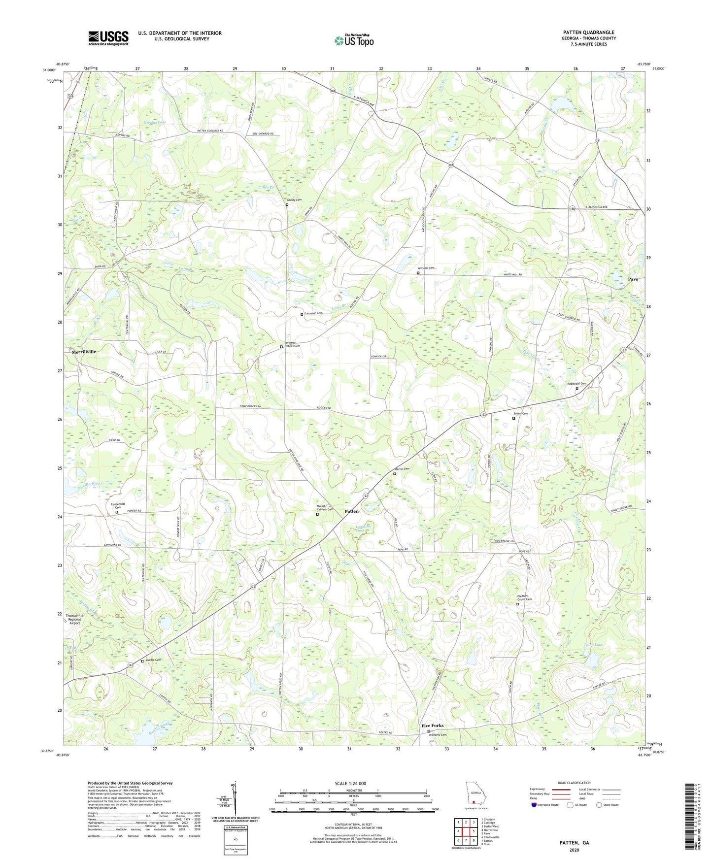
2024 topographic map quadrangle Patten in the state of Georgia. Scale: 1:24000. Based on the newly updated USGS 7.5' US Topo map series, this map is in the following counties: Thomas. The map contains contour data, water features, and other items you are used to seeing on USGS maps, but also has updated roads and other features. This is the next generation of topographic maps. Printed on high-quality waterproof paper with UV fade-resistant inks.
Quads adjacent to this one:
West: Merrillville
Northwest: Chastain
North: Coolidge
Northeast: Berlin West
East: Pavo
Southeast: Dixie
South: Boston
Southwest: Thomasville
This map covers the same area as the classic USGS quad with code o30083h7.
Contains the following named places: Airline School, Antioch Baptist Church, Antioch Cemetery, Aucilla Cemetery, Aucilla Church, Bell Mission Church, Cat Creek, Cedar Hill Church, Centennial Cemetery, Centennial Church, Centennial School, Christs Sanctified Holy Church, Five Forks, Gandy Cemetery, Kennedy Chapel, Kennedy Chapel Cemetery, Lancaster Pond, Lasseter Cemetery, Long Branch, Lost Creek, Martin Cemetery, McDonald Cemetery, Mount Calvary Cemetery, Mount Calvary Church, Murphys Pond, Patten, Patten Church, Pavo-Barwick Division, Pleasant Grove Cemetery, Pleasant Grove Church, Salem Baptist Church, Salem Cemetery, Sweetfield Church, Tyler Lake, Tyler Lake Dam, Williams Cemetery