MyTopo
Pavo Georgia US Topo Map
Couldn't load pickup availability
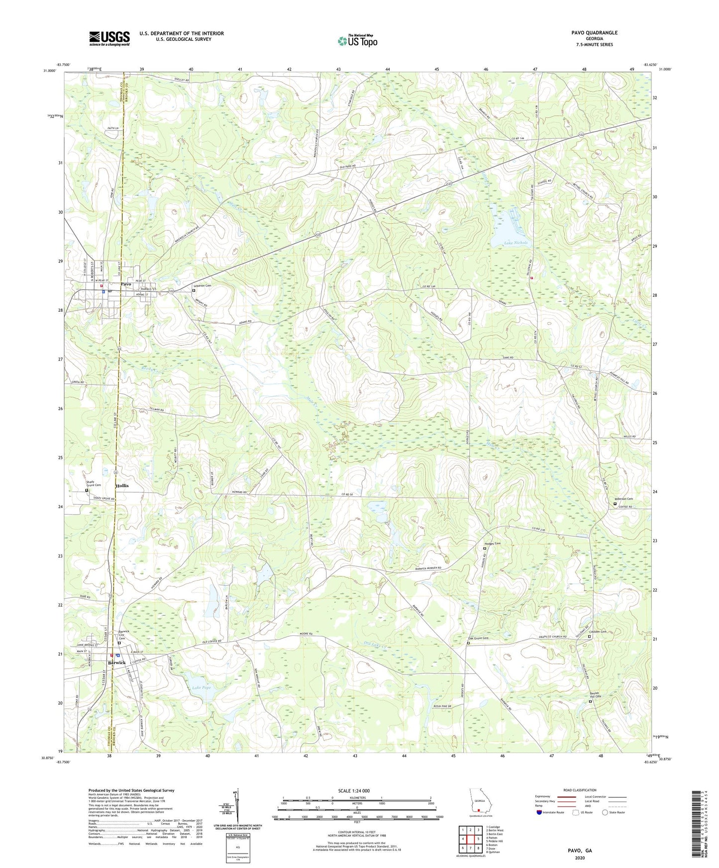
2024 topographic map quadrangle Pavo in the state of Georgia. Scale: 1:24000. Based on the newly updated USGS 7.5' US Topo map series, this map is in the following counties: Brooks, Thomas. The map contains contour data, water features, and other items you are used to seeing on USGS maps, but also has updated roads and other features. This is the next generation of topographic maps. Printed on high-quality waterproof paper with UV fade-resistant inks.
Quads adjacent to this one:
West: Patten
Northwest: Coolidge
North: Berlin West
Northeast: Berlin East
East: Pebble Hill
Southeast: Quitman
South: Dixie
Southwest: Boston
This map covers the same area as the classic USGS quad with code o30083h6.
Contains the following named places: Barwick, Barwick City Cemetery, Barwick Elementary School, Barwick Police Department, Barwick Post Office, Barwick Volunteer Fire Department Station 3, Barwick-Pavo Division, Beulah Hill Cemetery, Bryan Lake, Bryan Lake Dam, Caulden Cemetery, City of Barwick, City of Pavo, Drew School, Excelsior School, Harmony Church, Hodges Cemetery, Hollis, Lake Nichols, Lake Nichols Dam Number I, Lake Nichols Dam Number One, Lake Pope, Lake Pope Dam, Lebanon Cemetery, Mount Zion Church, New Grove Church, Oak Grove Cemetery, Oak Grove Church, Okapilco Church, Pavo, Pavo Elementary School, Pavo Police Station, Pavo Post Office, Pavo Volunteer Fire Department Station 2, Pope Millpond, Popes Mill, Reedy Creek, Riverbend Plantation Lake, Riverbend Plantation Lake Dam, Robinson Cemetery, Sand Hill, Sand Hill Volunteer Fire Department, Sandhill School, Shady Grove Cemetery, Shady Grove Church, Shelly, Sunberry Church, Tallokas School, Union Church, ZIP Codes: 31720, 31778