MyTopo
Berlin West Georgia US Topo Map
Couldn't load pickup availability
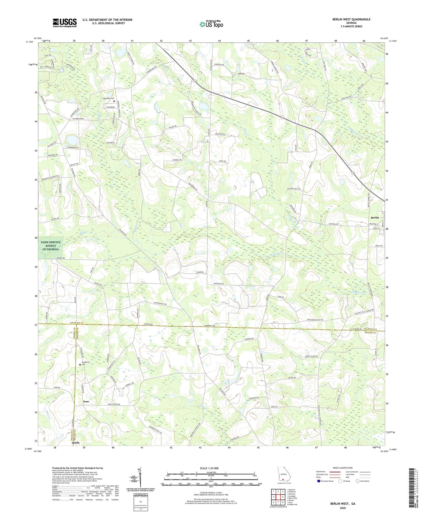
2024 topographic map quadrangle Berlin West in the state of Georgia. Scale: 1:24000. Based on the newly updated USGS 7.5' US Topo map series, this map is in the following counties: Colquitt, Brooks, Thomas. The map contains contour data, water features, and other items you are used to seeing on USGS maps, but also has updated roads and other features. This is the next generation of topographic maps. Printed on high-quality waterproof paper with UV fade-resistant inks.
Quads adjacent to this one:
West: Coolidge
Northwest: Moultrie
North: Pineboro
Northeast: Ellenton
East: Berlin East
Southeast: Pebble Hill
South: Pavo
Southwest: Patten
This map covers the same area as the classic USGS quad with code o31083a6.
Contains the following named places: Adlai School, Brice Pond, Culbertson School, Emerald Hill Church, Hog Creek, Hopewell Cemetery, Hopewell Church, Indian Creek Church, Indian Creek Primitive Baptist Church Cemetery, Ione, Ione Church, Library Faith Church, Little Creek, Magnolia Church, Mount Olive Church, New Jerusalem Church, Odom Elementary School, Pineview Church, Pleasant Hill Cemetery, Pleasant Hill Church, Prosperity Cemetery, Prosperity Church, Sardis Church, Shelly School, Sunbelt Strip, Weldon, Wesley Chapel, ZIP Code: 31788