MyTopo
Metter SE Georgia US Topo Map
Couldn't load pickup availability
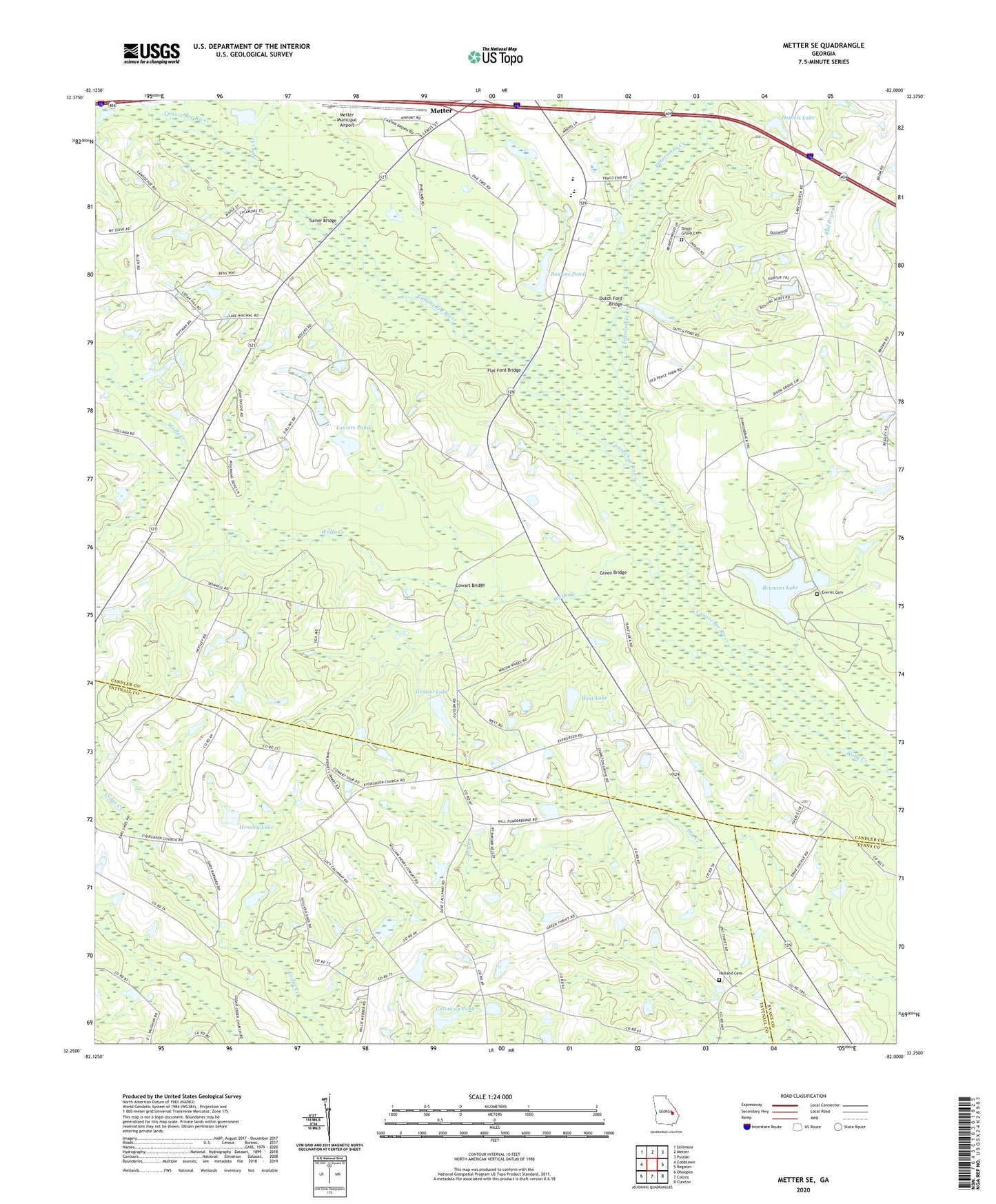
2024 topographic map quadrangle Metter SE in the state of Georgia. Scale: 1:24000. Based on the newly updated USGS 7.5' US Topo map series, this map is in the following counties: Candler, Tattnall, Evans. The map contains contour data, water features, and other items you are used to seeing on USGS maps, but also has updated roads and other features. This is the next generation of topographic maps. Printed on high-quality waterproof paper with UV fade-resistant inks.
Quads adjacent to this one:
West: Cobbtown
Northwest: Stillmore
North: Metter
Northeast: Pulaski
East: Register
Southeast: Claxton
South: Collins
Southwest: Ohoopee
This map covers the same area as the classic USGS quad with code o32082c1.
Contains the following named places: Bethesda School, Bowens Pond, Brannen Lake, Brannen Lake Dam, Callaway Pond, Callaway Pond Dam, Central School, Charlton Grove Church, Cowart Bridge, Daniels Lake, Daniels Lake Dam, Dixon Grove Cemetery, Dixon Grove Church, Dutch Ford Bridge, Evergreen Church, Everitt Cemetery, Fifteenmile Creek, Flat Ford Bridge, Glisson Lake, Glisson Lake Dam, Green Bridge, Hensley Lake, Hensley Lake Dam, Holland Cemetery, Laniers Pond, Laniers Pond Dam, Metter Municipal Airport, Primitive Grove Church, Sams Creek, Steep Hill Church, Turner Bridge, West Lake, West Lake Dam, Wolfe Creek