MyTopo
Shoulderbone Georgia US Topo Map
Couldn't load pickup availability
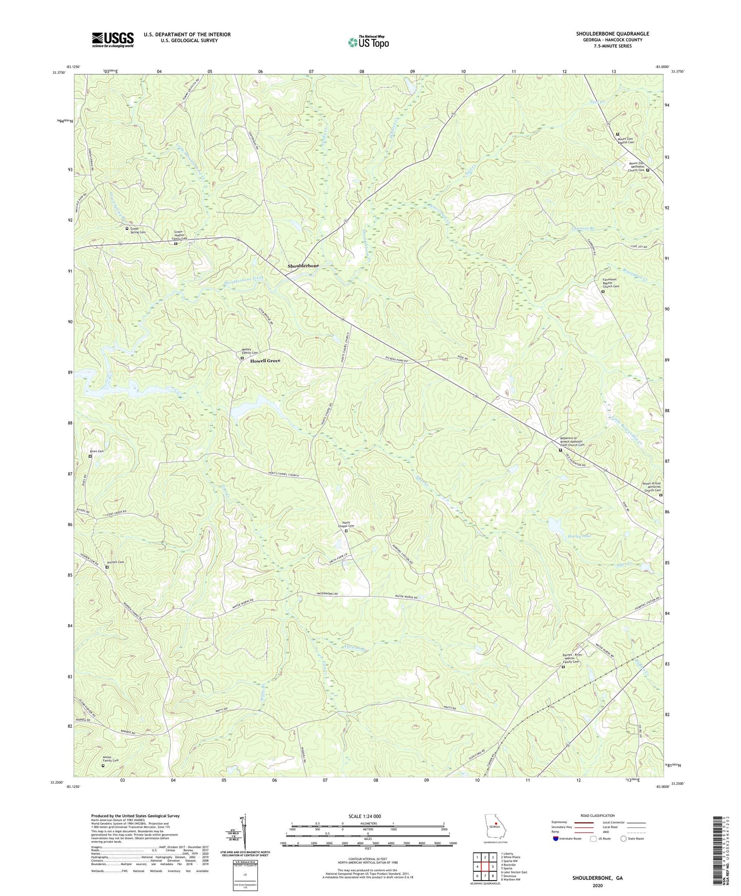
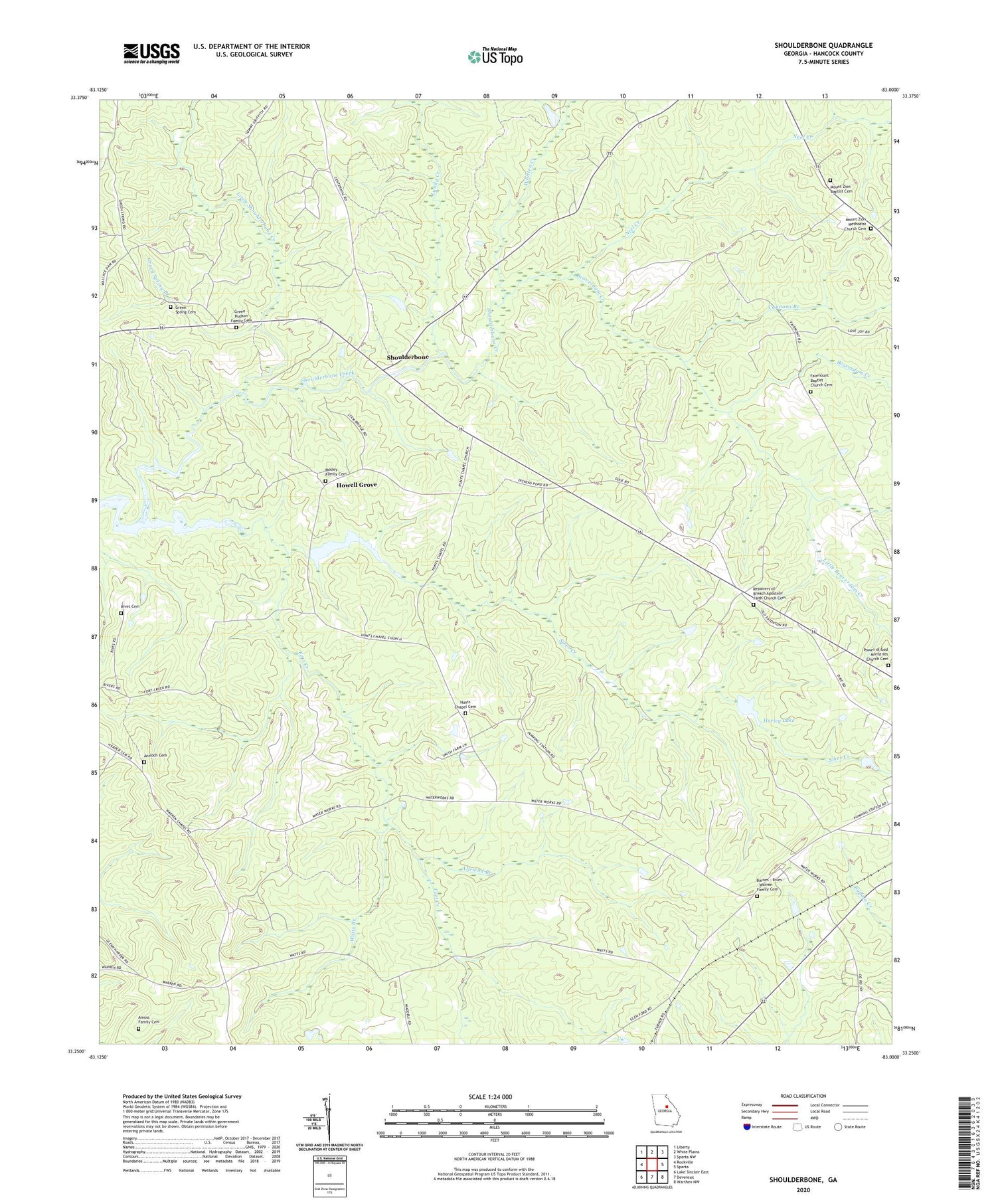
2024 topographic map quadrangle Shoulderbone in the state of Georgia. Scale: 1:24000. Based on the newly updated USGS 7.5' US Topo map series, this map is in the following counties: Hancock. The map contains contour data, water features, and other items you are used to seeing on USGS maps, but also has updated roads and other features. This is the next generation of topographic maps. Printed on high-quality waterproof paper with UV fade-resistant inks.
Quads adjacent to this one:
West: Rockville
Northwest: Liberty
North: White Plains
Northeast: Sparta NW
East: Sparta
Southeast: Warthen NW
South: Devereux
Southwest: Lake Sinclair East
This map covers the same area as the classic USGS quad with code o33083c1.
Contains the following named places: Alfriend Branch, Amoss Family Cemetery, Antioch Cemetery, Antioch Church, Barnes - Rives - Warren Family Cemetery, Beaverdam Creek, Cannons Branch, Dickens Lake, Dickens Lake Dam, Fairmount Baptist Church Cemetery, Fairmount Church, Fort Creek, Glenford, Green - Hudson Family Cemetery, Green Spring Branch, Green Spring Cemetery, Green Spring Church, Hancock County, Harley Lake, Harley Lake Dam, Howell Grove, Hunts Chapel, Hunts Chapel Cemetery, Kingdom Hall Church, Little Beaverdam Creek, Little Shoulderbone Creek, Lundy Creek, Mitchell Chapel, Mosley Family Cemetery, Mount Zion, Mount Zion Baptist Cemetery, Mount Zion Church, Mount Zion Methodist Church Cemetery, Neel Creek, Powell Grove Church, Power of God Ministries Church Cemetery, Repairers of Breach Apostolic Faith Church Cemetery, Rives Cemetery, Shoulderbone, Shoulderbone Creek, Sikes Creek, Warren Chapel, Watts Branch, WHAN-FM (Sparta), Whitten Creek, William Jonathan Northern Monument, ZIP Code: 31087