
MyTopo
Snipesville Georgia US Topo Map
Couldn't load pickup availability
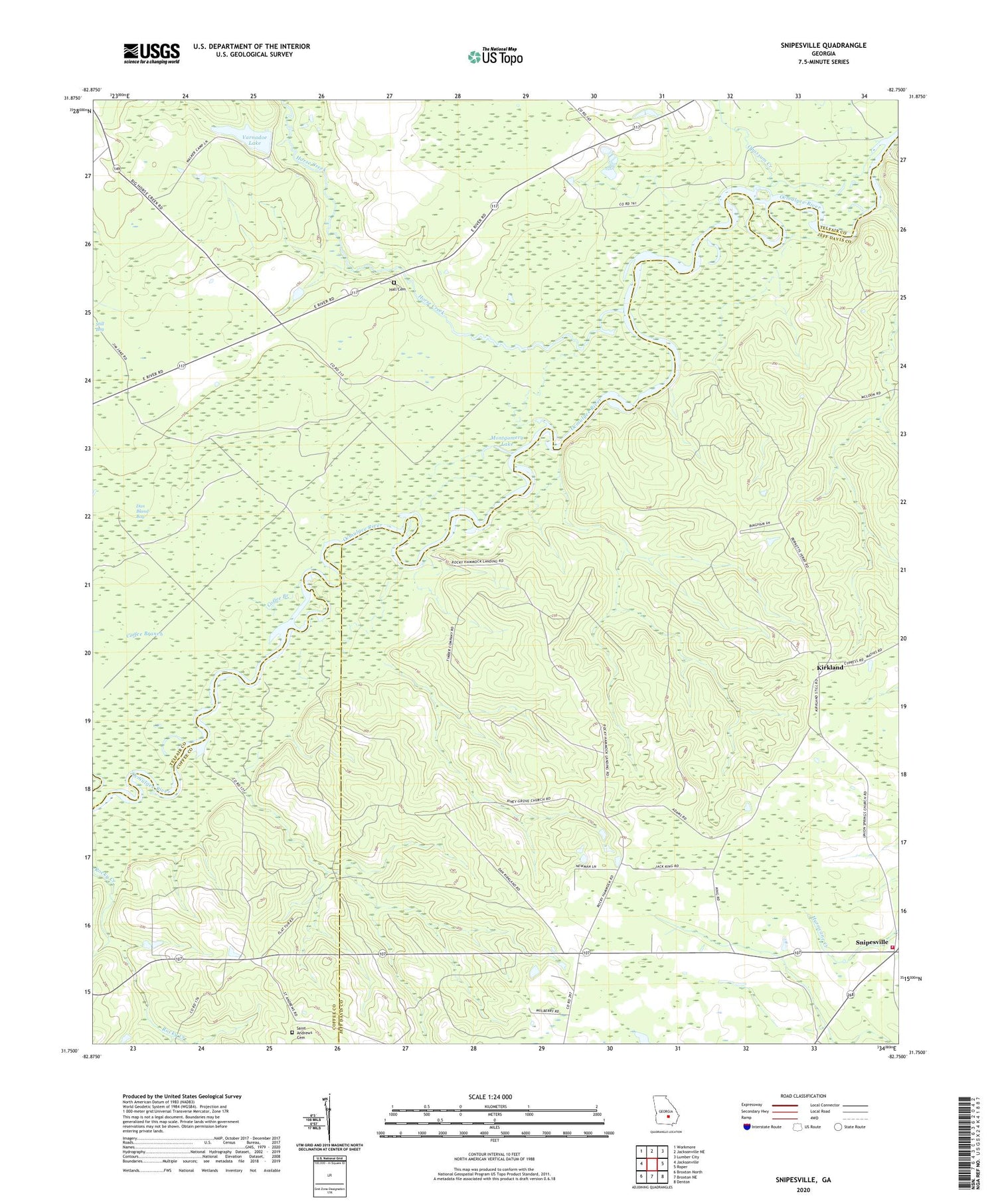
2024 topographic map quadrangle Snipesville in the state of Georgia. Scale: 1:24000. Based on the newly updated USGS 7.5' US Topo map series, this map is in the following counties: Jeff Davis, Telfair, Coffee. The map contains contour data, water features, and other items you are used to seeing on USGS maps, but also has updated roads and other features. This is the next generation of topographic maps. Printed on high-quality waterproof paper with UV fade-resistant inks.
Quads adjacent to this one:
West: Jacksonville
Northwest: Workmore
North: Jacksonville NE
Northeast: Lumber City
East: Roper
Southeast: Denton
South: Broxton NE
Southwest: Broxton North
This map covers the same area as the classic USGS quad with code o31082g7.
Contains the following named places: Ashleys Ferry, Barrel Head Church, Barrel Head School, Bingham, Burket Ferry Landing, Burketts Ferry, Coffee Branch, Dan Bland Bay, Flat Tub Landing, Haddock Landing, Haddocks Landing, Hall Cemetery, Horse Creek, Jeff Davis County Fire Department Station 5 Snipesville, Kirkland, Montgomery Lake, Mount Galilee Church, Oak Hill Church, Opossum Creek, Paceville, Piney Grove Church, Rocky Hammock Landing, Saint Andrews Cemetery, Snipes School, Snipesville, Snipesville Church, Union Springs Church, Varnadoe Lake, Varnadoe Lake Dam


