MyTopo
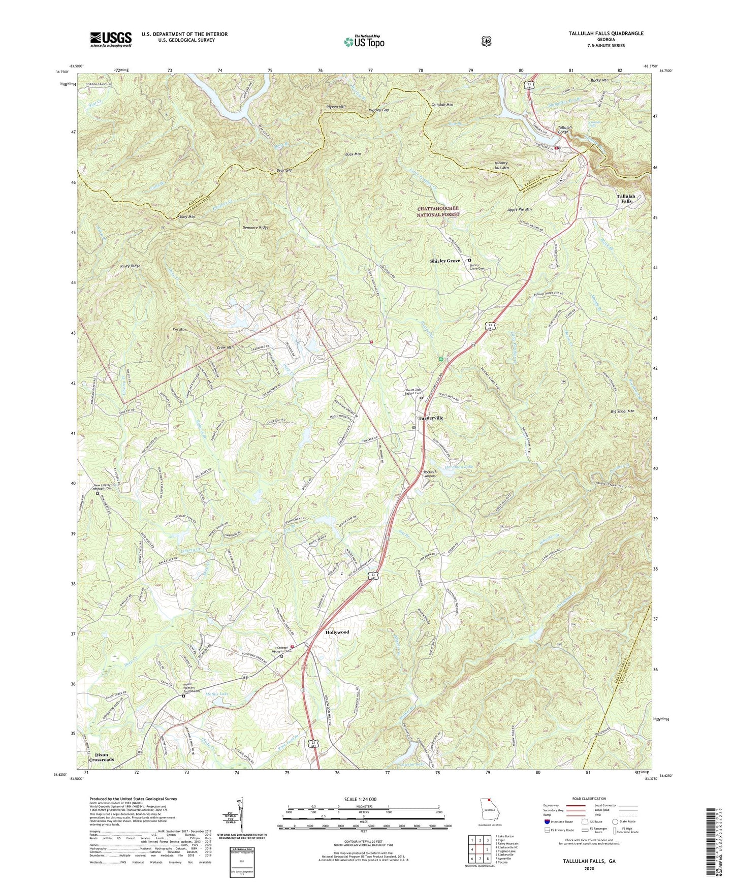
Tallulah Falls Georgia US Topo Map
Couldn't load pickup availability
Also explore the Tallulah Falls Forest Service Topo of this same quad for updated USFS data
2024 topographic map quadrangle Tallulah Falls in the state of Georgia. Scale: 1:24000. Based on the newly updated USGS 7.5' US Topo map series, this map is in the following counties: Habersham, Rabun, Stephens. The map contains contour data, water features, and other items you are used to seeing on USGS maps, but also has updated roads and other features. This is the next generation of topographic maps. Printed on high-quality waterproof paper with UV fade-resistant inks.
Quads adjacent to this one:
West: Clarkesville NE
Northwest: Lake Burton
North: Tiger
Northeast: Rainy Mountain
Southeast: Toccoa
South: Ayersville
Southwest: Clarkesville
This map covers the same area as the classic USGS quad with code o34083f4.
Contains the following named places: Anandale, Apple Pie Mountain, Bad Branch, Bear Branch, Bear Gap, Bible Church, Big Shoal Mountain, Buck Mountain, Camp Chattooga, Camp Yonach, Cascade Falls, Cross Roads School, Crow Mountain, Deep Creek, Demoore Ridge, Dixon Crossroads, Ebenezer Church, Ebenezer Methodist Cemetery, Fry Branch, Fry Mountain, Glade Creek, Habersham County Emergency Medical Services North, Habersham County Fire Department Station 9, Hardman Dam, Hardman Lake, Hickory Nut Mountain, Hollywood, Hollywood Baptist Church, Horse Creek, Lawson Lake, Lawson Lake Dam, Lawson Lake Dam Two, Liberty Creek, Little Panther Creek, Mathis Lake, Mathis Lake Dam, Mount Pleasant Baptist Cemetery, Mount Pleasant Church, Mount Zion Baptist Cemetery, Mount Zion Baptist Church, New Liberty Church, New Liberty Methodist Cemetery, Panther Creek Campground, Panther Creek Picnic Area, Pigeon Mountain, Piney Ridge, Reservoir 29, Reservoir 34, Reservoir 36, Roberts Branch, Rockin R Airport, Shirley Grove, Shirley Grove Baptist Church, Shirley Grove Cemetery, Slaughter Pen Branch, Soquee River Structure 29 Dam, Soquee River Structure 34 Dam, Soquee River Structure 36 Dam, Stony Mountain, Tallulah Falls, Tallulah Falls Baptist Church, Tallulah Falls Boarding School, Tallulah Falls Fire Department, Tallulah Falls Lake, Tallulah Falls Police Department, Tallulah Falls Post Office, Tallulah Lodge, Tallulah Mountain, Tallulah Park, Terrora Park Campground, Toccoa Pumping Station, Todd Dam, Todd Lake, Town of Tallulah Falls, Turnerville, Turnerville Church of God, Turnerville Division, Turnerville Post Office, Walker Branch, Walkers Mill, Waters Lake, Waters Lake Dam, Wheeler Branch, Woodville Elementary School, Worley Gap, WZLI-FM (Toccoa), ZIP Code: 30573