MyTopo
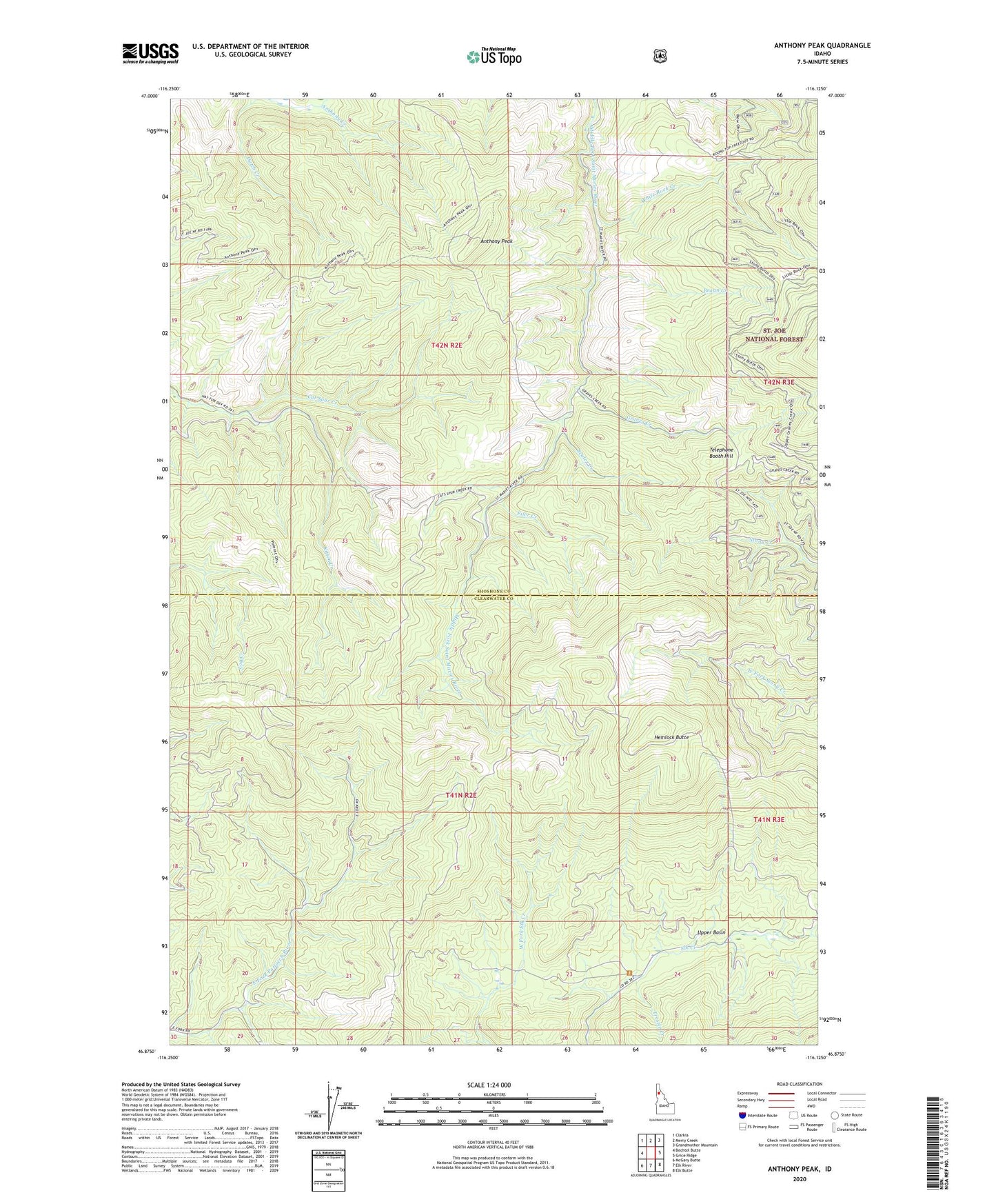
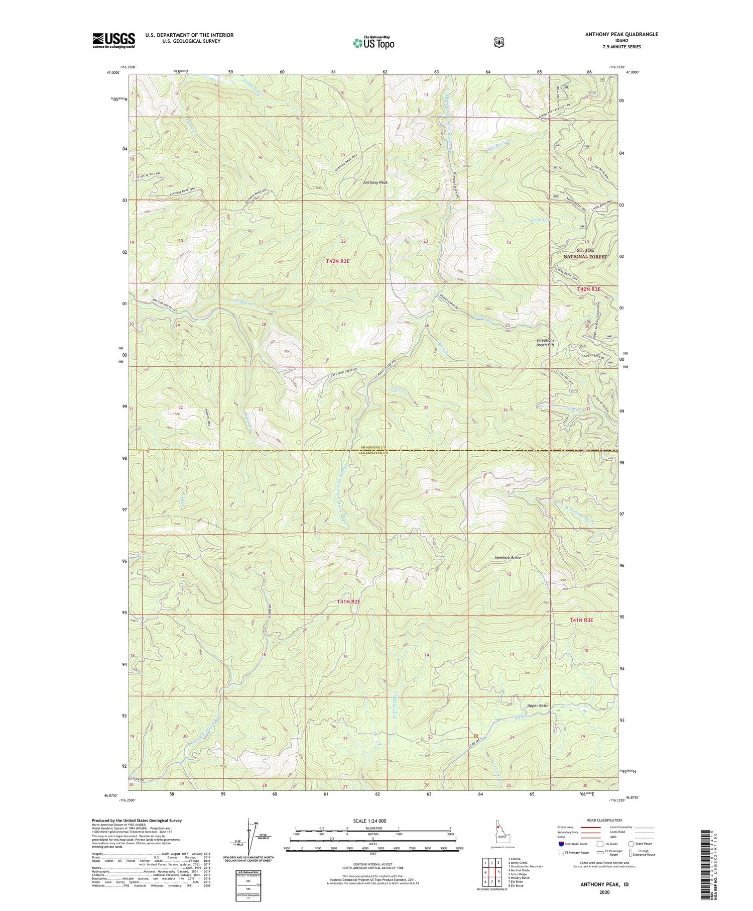
Anthony Peak Idaho US Topo Map
Couldn't load pickup availability
Also explore the Anthony Peak Forest Service Topo of this same quad for updated USFS data
2024 topographic map quadrangle Anthony Peak in the state of Idaho. Scale: 1:24000. Based on the newly updated USGS 7.5' US Topo map series, this map is in the following counties: Shoshone, Clearwater. The map contains contour data, water features, and other items you are used to seeing on USGS maps, but also has updated roads and other features. This is the next generation of topographic maps. Printed on high-quality waterproof paper with UV fade-resistant inks.
Quads adjacent to this one:
West: Bechtel Butte
Northwest: Clarkia
North: Merry Creek
Northeast: Grandmother Mountain
East: Grice Ridge
Southeast: Elk Butte
South: Elk River
Southwest: McGary Butte
This map covers the same area as the classic USGS quad with code o46116h2.
Contains the following named places: Anthony Creek, Anthony Peak, Braun Creek, Filer Creek, Graves Creek, Hemlock Butte, Kitten Creek, Scaler Creek, Telephone Booth Hill, Trestle Creek, Upper Basin, White Rock Creek