
MyTopo
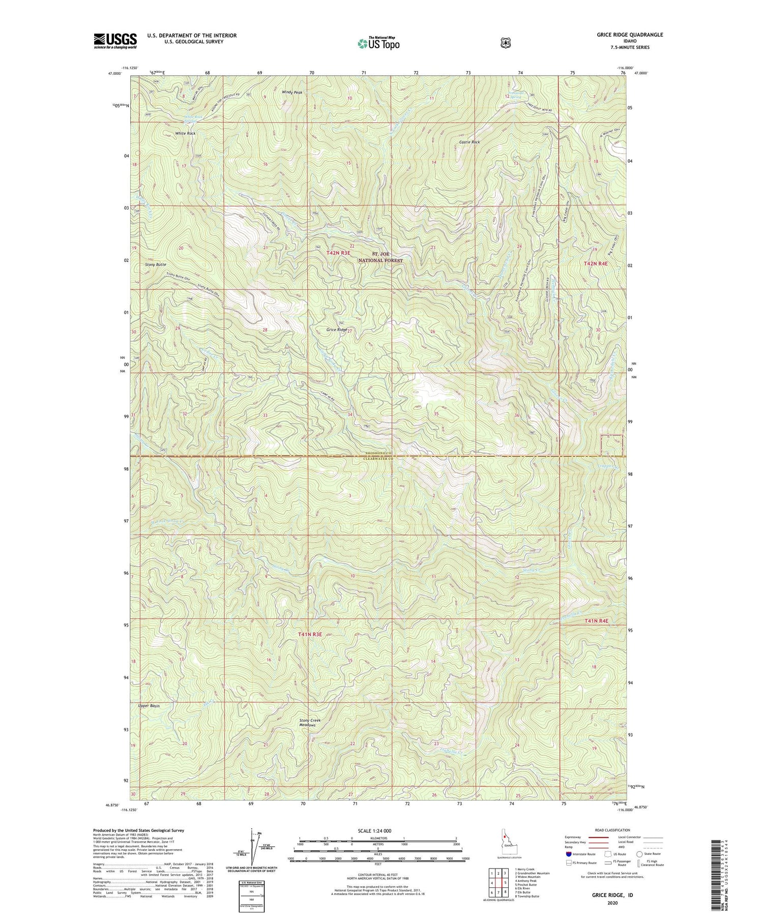
Grice Ridge Idaho US Topo Map
Couldn't load pickup availability
Also explore the Grice Ridge Forest Service Topo of this same quad for updated USFS data
2024 topographic map quadrangle Grice Ridge in the state of Idaho. Scale: 1:24000. Based on the newly updated USGS 7.5' US Topo map series, this map is in the following counties: Shoshone, Clearwater. The map contains contour data, water features, and other items you are used to seeing on USGS maps, but also has updated roads and other features. This is the next generation of topographic maps. Printed on high-quality waterproof paper with UV fade-resistant inks.
Quads adjacent to this one:
West: Anthony Peak
Northwest: Merry Creek
North: Grandmother Mountain
Northeast: Widow Mountain
East: Pinchot Butte
Southeast: Township Butte
South: Elk Butte
Southwest: Elk River
This map covers the same area as the classic USGS quad with code o46116h1.
Contains the following named places: Camp Forty, Camp Forty Creek, Castle Rock, Cedar Creek, Freezeout Camp, Freezeout Lookout Tower, Freezeout Spring, Glover Creek, Grice Ridge, Hemlock Creek, Homestead Creek, Isabella Creek, Kuykedahl Creek, North Fork Glover Creek, Stony Butte, Stony Creek Meadows, Trapper Creek, West Fork Stony Creek, White Rock, White Rock Springs, Windy Peak


