
MyTopo
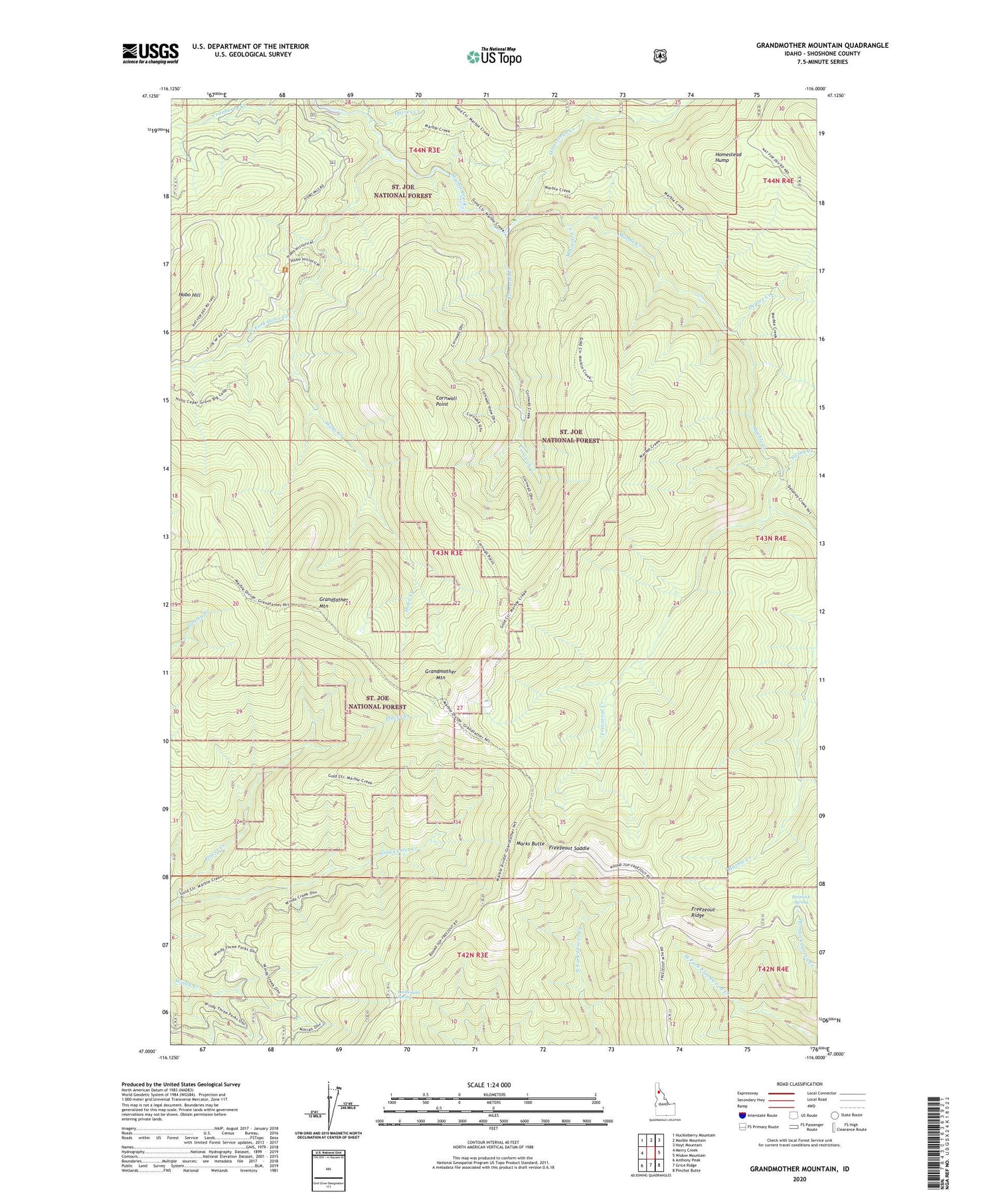
Grandmother Mountain Idaho US Topo Map
Couldn't load pickup availability
Also explore the Grandmother Mountain Forest Service Topo of this same quad for updated USFS data
2024 topographic map quadrangle Grandmother Mountain in the state of Idaho. Scale: 1:24000. Based on the newly updated USGS 7.5' US Topo map series, this map is in the following counties: Shoshone. The map contains contour data, water features, and other items you are used to seeing on USGS maps, but also has updated roads and other features. This is the next generation of topographic maps. Printed on high-quality waterproof paper with UV fade-resistant inks.
Quads adjacent to this one:
West: Merry Creek
Northwest: Huckleberry Mountain
North: Marble Mountain
Northeast: Hoyt Mountain
East: Widow Mountain
Southeast: Pinchot Butte
South: Grice Ridge
Southwest: Anthony Peak
This map covers the same area as the classic USGS quad with code o47116a1.
Contains the following named places: Cedar Grove, Cornwall Creek, Cornwall Point, Davies Creek, Duplex Creek, Freezeout Creek, Freezeout Ridge, Freezeout Saddle, Grandfather Mountain, Grandmother Mountain, Hemlock Spring, Hobo Botanical Area, Hobo Creek, Hobo Creek Splash Dam, Hobo Hill, Homestead Creek, Homestead Hump, Lockensuit Spring, Marks Butte, McGuire Creek, Placer Creek, Swing Creek, West Fork Hobo Creek


