MyTopo
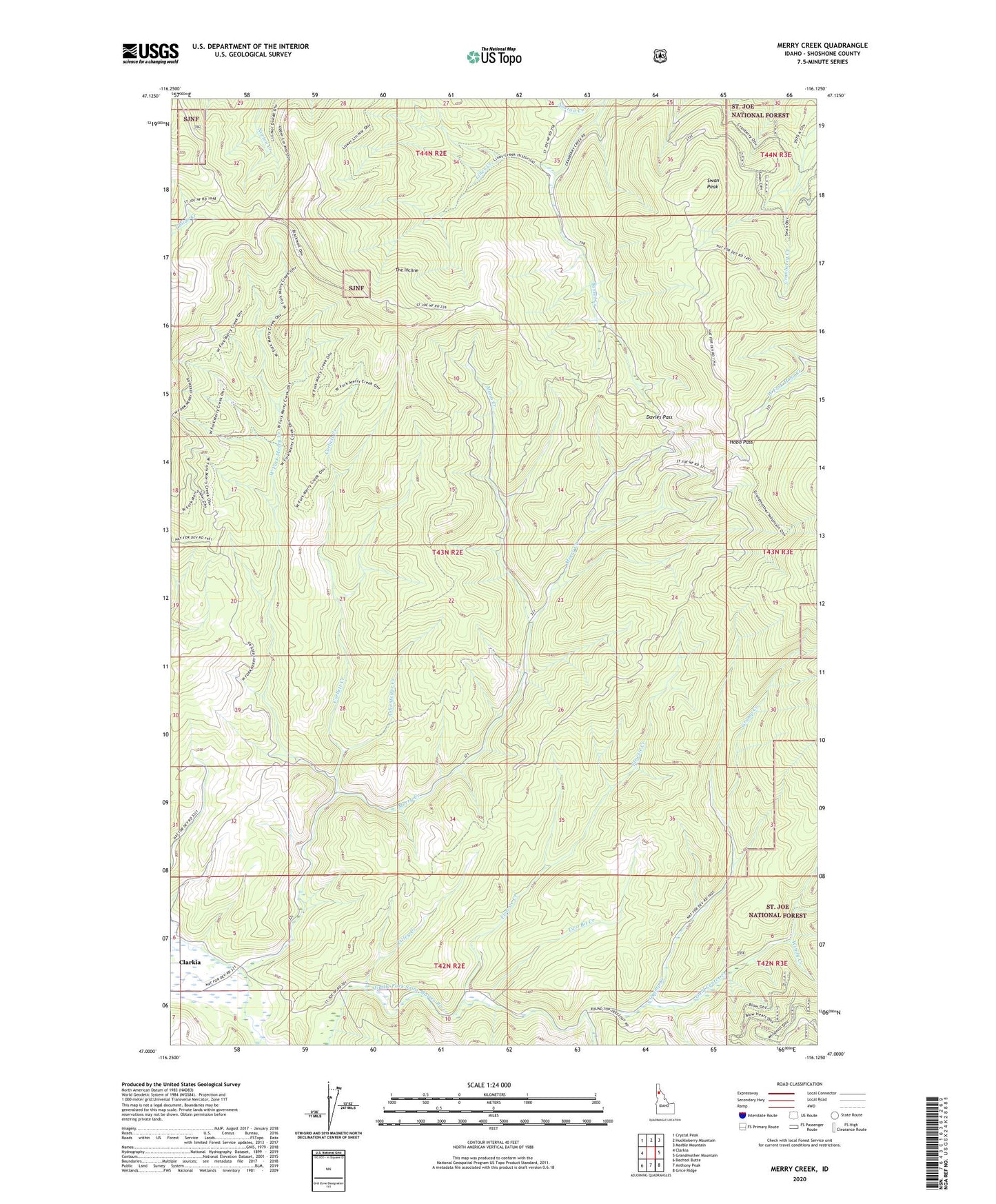
Merry Creek Idaho US Topo Map
Couldn't load pickup availability
Also explore the Merry Creek Forest Service Topo of this same quad for updated USFS data
2024 topographic map quadrangle Merry Creek in the state of Idaho. Scale: 1:24000. Based on the newly updated USGS 7.5' US Topo map series, this map is in the following counties: Shoshone. The map contains contour data, water features, and other items you are used to seeing on USGS maps, but also has updated roads and other features. This is the next generation of topographic maps. Printed on high-quality waterproof paper with UV fade-resistant inks.
Quads adjacent to this one:
West: Clarkia
Northwest: Crystal Peak
North: Huckleberry Mountain
Northeast: Marble Mountain
East: Grandmother Mountain
Southeast: Grice Ridge
South: Anthony Peak
Southwest: Bechtel Butte
This map covers the same area as the classic USGS quad with code o47116a2.
Contains the following named places: Ashenfelter Creek, Corbett Creek, Davies Pass, Dutch Creek, Flewsie Creek, Gold Center Creek, Gramp Creek, Hobo Cedar Grove, Hobo Pass, Lines Creek, Mann Creek, Merry Creek, Merry Creek Access Area, Norton Creek, Swan Peak, The Incline, Titley Creek, Two Bit Creek, West Fork Merry Creek, Windy Creek, ZIP Code: 83812