
MyTopo
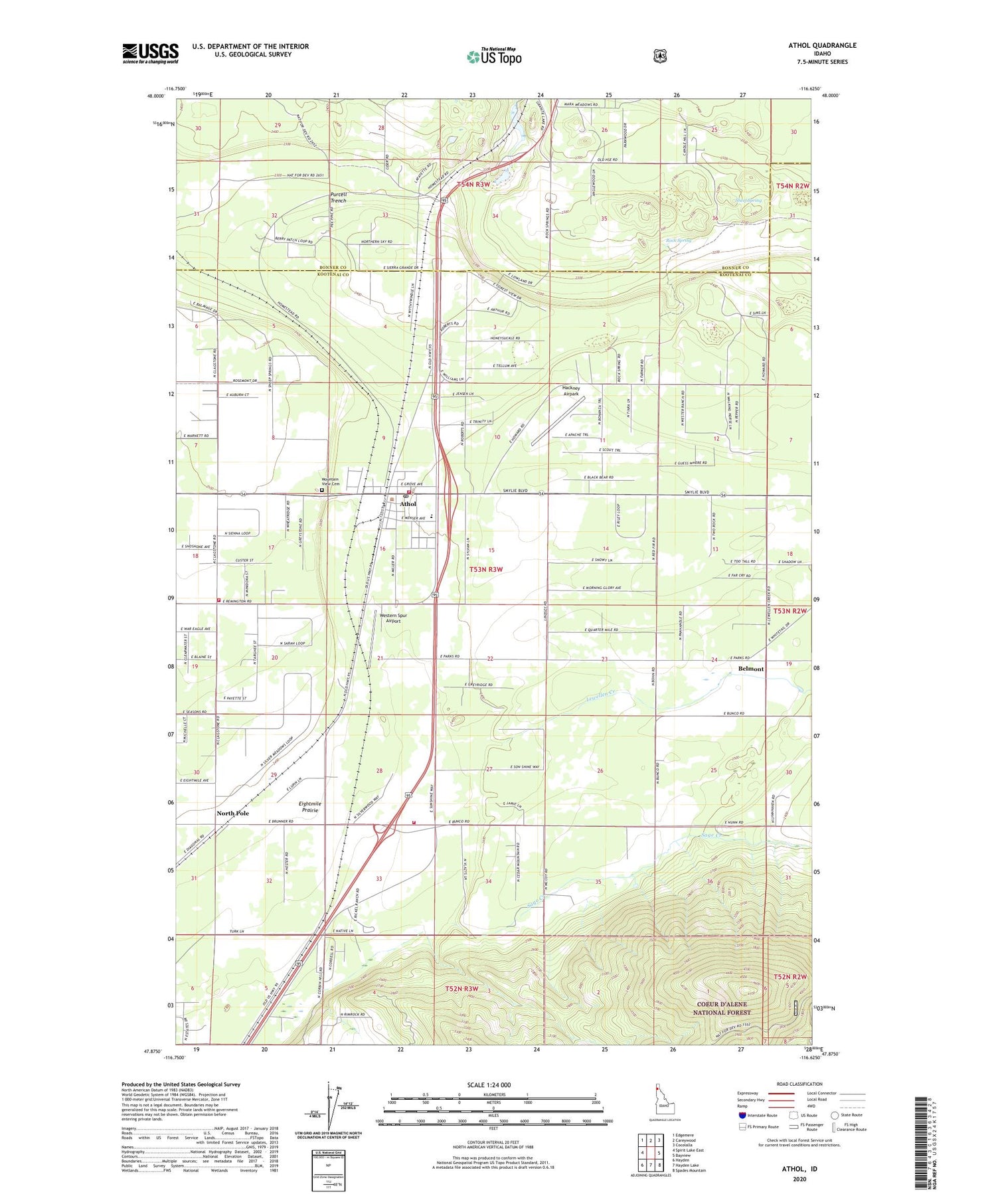
Athol Idaho US Topo Map
Couldn't load pickup availability
Also explore the Athol Forest Service Topo of this same quad for updated USFS data
2024 topographic map quadrangle Athol in the state of Idaho. Scale: 1:24000. Based on the newly updated USGS 7.5' US Topo map series, this map is in the following counties: Kootenai, Bonner. The map contains contour data, water features, and other items you are used to seeing on USGS maps, but also has updated roads and other features. This is the next generation of topographic maps. Printed on high-quality waterproof paper with UV fade-resistant inks.
Quads adjacent to this one:
West: Spirit Lake East
Northwest: Edgemere
North: Careywood
Northeast: Cocolalla
East: Bayview
Southeast: Spades Mountain
South: Hayden Lake
Southwest: Hayden
This map covers the same area as the classic USGS quad with code o47116h6.
Contains the following named places: Athol, Athol Elementary School, Athol Post Office, Belmont, Cedar Mountain, Cedar Mountain School, Cedar Mountain Sky Ranch, City of Athol, Corbin Junction, Eightmile Prairie, Granite Airport, Hackney Airpark, Henley Airstrip, Hoodoo Rest Area, Lewellen Creek, Mountain View Cemetery, North Pole, Rock Spring, Sage Creek, Sheef Spring, Silverwood Airport, Spirit Lake-Athol Division, Timberlake Fire Protection District Station 1, Timberlake Fire Protection District Station 2, Timberlake Fire Protection District Station 3, Western Spur Airport, Wright, ZIP Code: 83801


