MyTopo
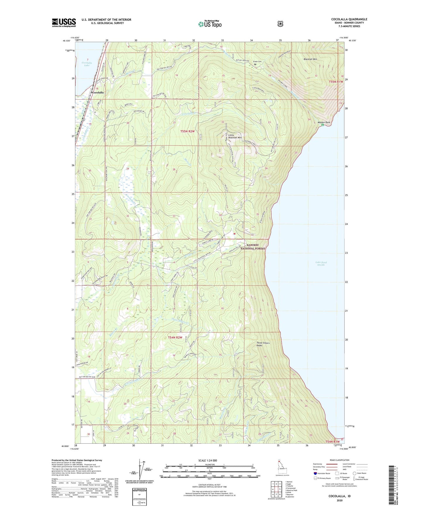
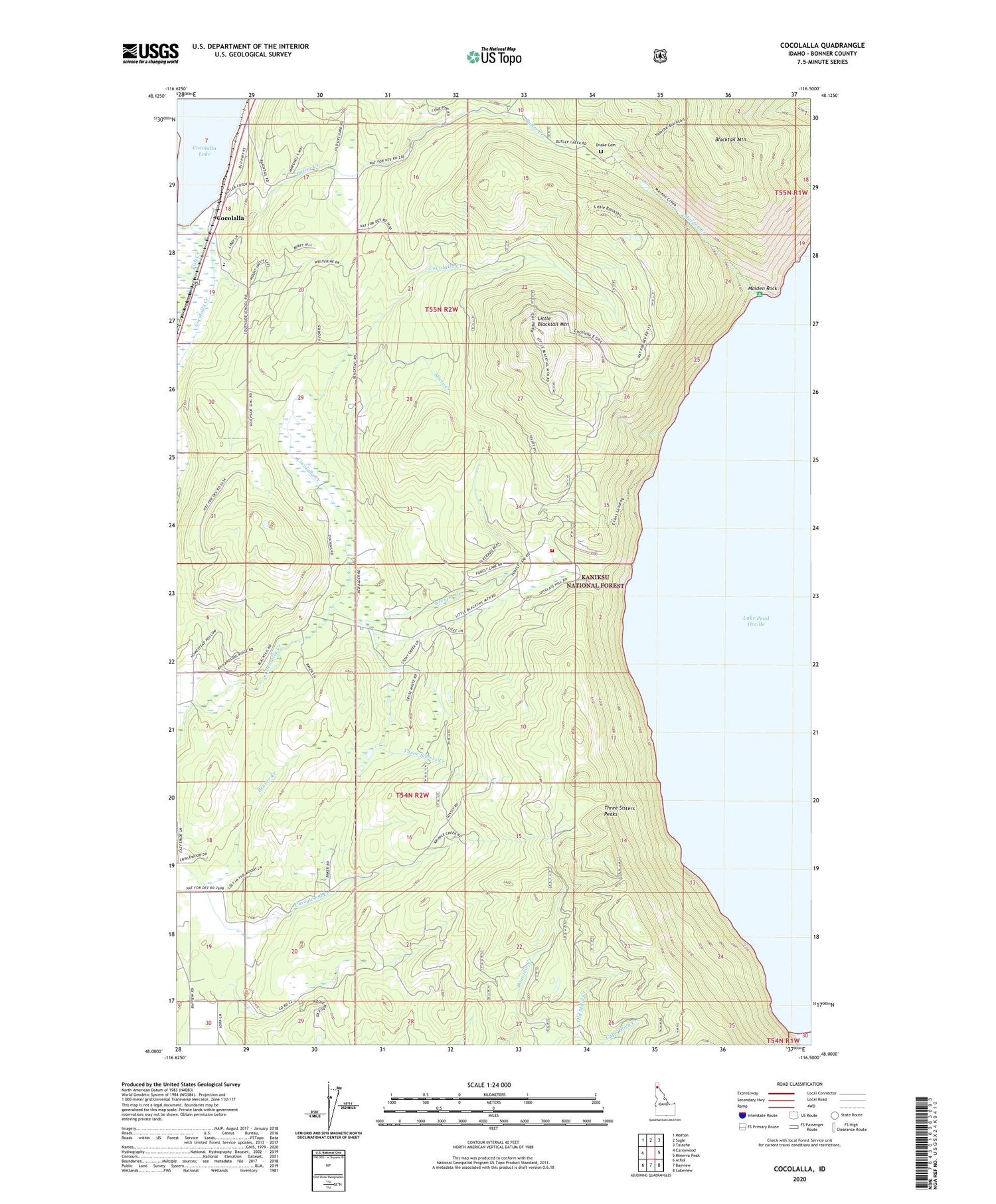
Cocolalla Idaho US Topo Map
Couldn't load pickup availability
Also explore the Cocolalla Forest Service Topo of this same quad for updated USFS data
2024 topographic map quadrangle Cocolalla in the state of Idaho. Scale: 1:24000. Based on the newly updated USGS 7.5' US Topo map series, this map is in the following counties: Bonner. The map contains contour data, water features, and other items you are used to seeing on USGS maps, but also has updated roads and other features. This is the next generation of topographic maps. Printed on high-quality waterproof paper with UV fade-resistant inks.
Quads adjacent to this one:
West: Careywood
Northwest: Morton
North: Sagle
Northeast: Talache
East: Minerva Peak
Southeast: Lakeview
South: Bayview
Southwest: Athol
This map covers the same area as the classic USGS quad with code o48116a5.
Contains the following named places: Beaver Creek, Blacktail Mountain, Butler Creek, Cape Horn Creek, Cocolalla, Drake Cemetery, Evans Landing, Evans Landing Picnic Area, Fish Creek, Kreiger Creek, Little Blacktail Mountain, Maiden Creek, Maiden Rock, Maiden Rock Picnic Area, Micro Creek, Southside Elementary School, Three Sisters Creek, Three Sisters Peaks, Timberlake Fire Protection District Station 6, ZIP Code: 83809