MyTopo
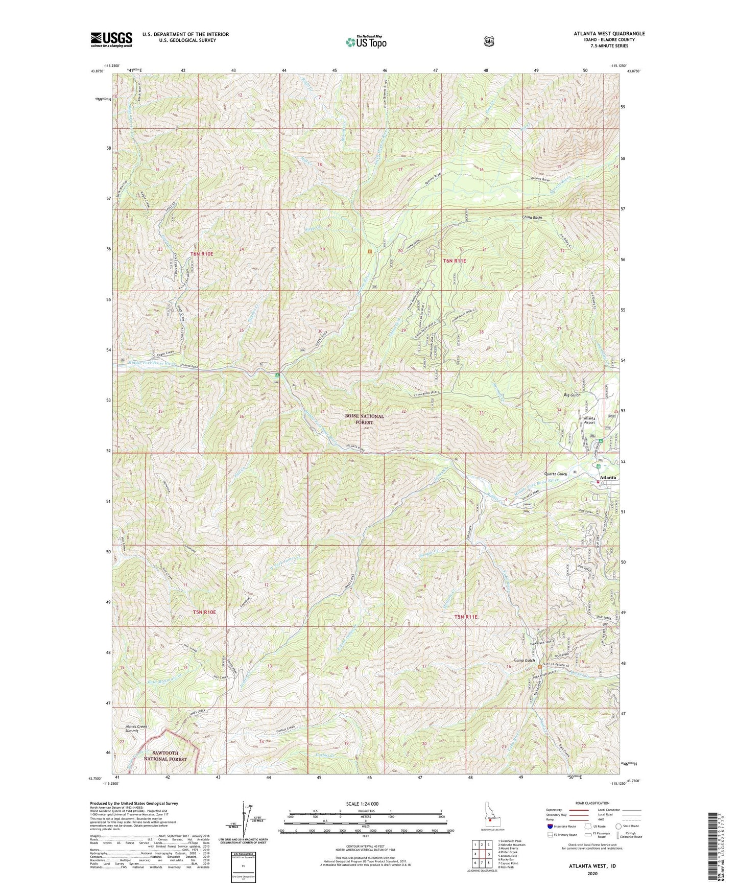
Atlanta West Idaho US Topo Map
Couldn't load pickup availability
Also explore the Atlanta West Forest Service Topo of this same quad for updated USFS data
2023 topographic map quadrangle Atlanta West in the state of Idaho. Scale: 1:24000. Based on the newly updated USGS 7.5' US Topo map series, this map is in the following counties: Elmore. The map contains contour data, water features, and other items you are used to seeing on USGS maps, but also has updated roads and other features. This is the next generation of topographic maps. Printed on high-quality waterproof paper with UV fade-resistant inks.
Quads adjacent to this one:
West: Phifer Creek
Northwest: Swanholm Peak
North: Nahneke Mountain
Northeast: Mount Everly
East: Atlanta East
Southeast: Ross Peak
South: Cayuse Point
Southwest: Rocky Bar
This map covers the same area as the classic USGS quad with code o43115g2.
Contains the following named places: Alturas City, Atlanta, Atlanta Airport, Atlanta Guard Station, Atlanta Power Station, Atlanta Rural Fire Protection District, Basque Creek, Big Gulch, Black Warrior Creek Trail, Browns Creek, Camp Gulch, China Basin, China Fork, Decker Creek, Eagle Creek, East Fork James Creek, Fall Creek, James Creek, James Creek Summit, Kid Creek, King Creek, Little Queens River, McGuire Creek, Mill Creek, Montezuma Creek, Quartz Gulch, Queens River, Queens River Campground, Rabbit Creek, Right Creek, Riverside Campground, Sawmill Creek, Snyder Creek, Steep Creek, Trail Creek, West Fork James Creek, Yuba City, Yuba River