MyTopo
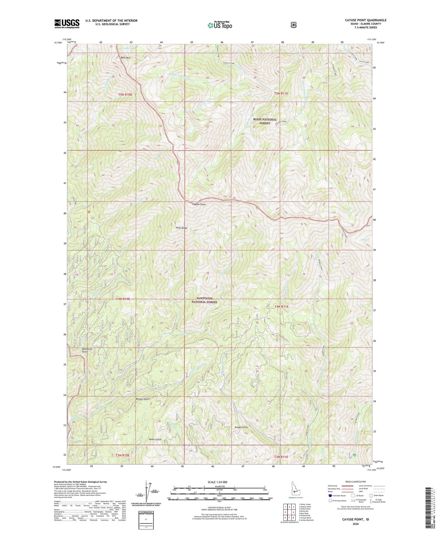
Cayuse Point Idaho US Topo Map
Couldn't load pickup availability
Also explore the Cayuse Point Forest Service Topo of this same quad for updated USFS data
2023 topographic map quadrangle Cayuse Point in the state of Idaho. Scale: 1:24000. Based on the newly updated USGS 7.5' US Topo map series, this map is in the following counties: Elmore. The map contains contour data, water features, and other items you are used to seeing on USGS maps, but also has updated roads and other features. This is the next generation of topographic maps. Printed on high-quality waterproof paper with UV fade-resistant inks.
Quads adjacent to this one:
West: Rocky Bar
Northwest: Phifer Creek
North: Atlanta West
Northeast: Atlanta East
East: Ross Peak
Southeast: Jumbo Mountain
South: Grouse Butte
Southwest: Featherville
This map covers the same area as the classic USGS quad with code o43115f2.
Contains the following named places: Alta Creek, Bald Mountain, Bonaparte Mine, Cayuse Creek, Cayuse Point, Corbus Creek, Corbus Lake, Democrat Gulch, East Fork Yuba River, Little Cayuse Creek, Marsh Creek Mine, Middle Fork Corbus Creek, Pony Ridge, Snake Creek, South Fork Corbus Creek, Three Forks, West Fork Shake Creek, Yuba River Trail