MyTopo
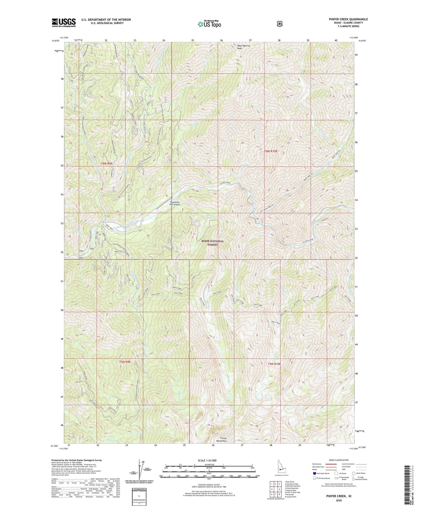
Phifer Creek Idaho US Topo Map
Couldn't load pickup availability
Also explore the Phifer Creek Forest Service Topo of this same quad for updated USFS data
2023 topographic map quadrangle Phifer Creek in the state of Idaho. Scale: 1:24000. Based on the newly updated USGS 7.5' US Topo map series, this map is in the following counties: Elmore. The map contains contour data, water features, and other items you are used to seeing on USGS maps, but also has updated roads and other features. This is the next generation of topographic maps. Printed on high-quality waterproof paper with UV fade-resistant inks.
Quads adjacent to this one:
West: Grand Mountain
Northwest: Bear River
North: Swanholm Peak
Northeast: Nahneke Mountain
East: Atlanta West
Southeast: Cayuse Point
South: Rocky Bar
Southwest: Little Trinity Lake
This map covers the same area as the classic USGS quad with code o43115g3.
Contains the following named places: Bald Mountain Creek, Bear Creek, Black Warrior Creek, Dutch Creek, Dutch Creek Forest Service Station, Dutch Creek Guard Station, East Fork Swanholm Creek, Fly Creek, Hot Creek, Hot Springs Creek Trail, Lake Creek, Phifer Creek, Smith Creek, Steel Creek, Steppe Creek, Swanholm Creek, Weatherby USFS Airport, West Warrior Creek