MyTopo
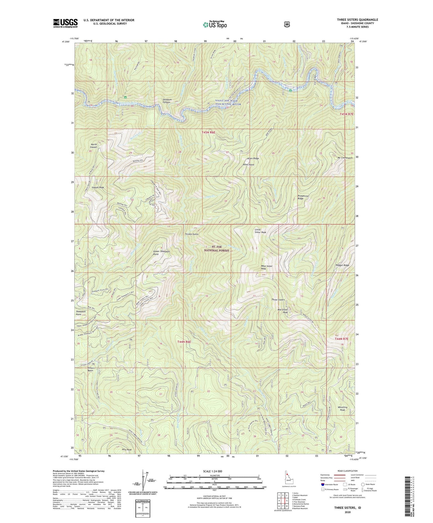
Three Sisters Idaho US Topo Map
Couldn't load pickup availability
Also explore the Three Sisters Forest Service Topo of this same quad for updated USFS data
2024 topographic map quadrangle Three Sisters in the state of Idaho. Scale: 1:24000. Based on the newly updated USGS 7.5' US Topo map series, this map is in the following counties: Shoshone. The map contains contour data, water features, and other items you are used to seeing on USGS maps, but also has updated roads and other features. This is the next generation of topographic maps. Printed on high-quality waterproof paper with UV fade-resistant inks.
Quads adjacent to this one:
West: Fishhook Creek
Northwest: Avery
North: Shefoot Mountain
Northeast: Adair
East: Thor Mountain
Southeast: Bathtub Mountain
South: Montana Peak
Southwest: Monumental Buttes
This map covers the same area as the classic USGS quad with code o47115b6.
Contains the following named places: Allen Creek, Allen Point, Allen Ridge, Alpine Creek, Bear Skull Creek, Bird Creek, Bootleg Creek, Coyote Creek, Dunce Creek, East Sister Peak, Elevator Creek, Forest Cabin, Gypo Creek, Hilo Creek, Hilo Peak, Little Sister Peak, Lower Shoepack Point, Middle Sister Peak, Mount Chenoweth, North Siwash, Nugget Ridge, Packsaddle Campground, Packsaddle Creek, Pinnacle Ridge, Prospector Ridge, Shoepack Creek, Shoepack Point, Sisters Basin, Sisters Creek, Siwash Creek, Siwash Peak, Skookum Canyon, Skookum Creek, Three Sisters, Tourist Creek, Trickle Gulch, Turner Creek, Turner Flat Campground, West Sister Peak, Whistling Peak