MyTopo
Fishhook Creek Idaho US Topo Map
Couldn't load pickup availability
Also explore the Fishhook Creek Forest Service Topo of this same quad for updated USFS data
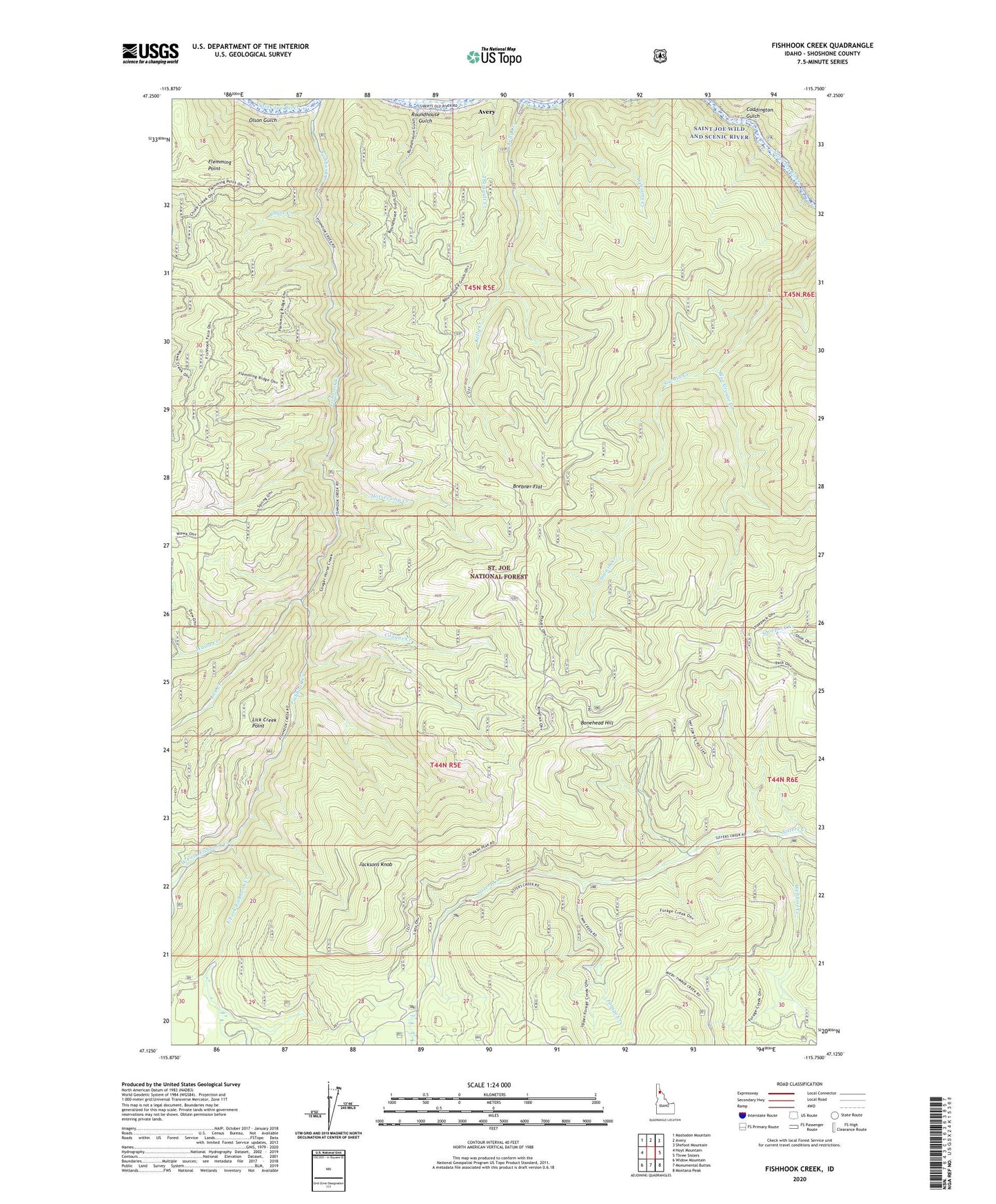
2024 topographic map quadrangle Fishhook Creek in the state of Idaho. Scale: 1:24000. Based on the newly updated USGS 7.5' US Topo map series, this map is in the following counties: Shoshone. The map contains contour data, water features, and other items you are used to seeing on USGS maps, but also has updated roads and other features. This is the next generation of topographic maps. Printed on high-quality waterproof paper with UV fade-resistant inks.
Quads adjacent to this one:
West: Hoyt Mountain
Northwest: Mastodon Mountain
North: Avery
Northeast: Shefoot Mountain
East: Three Sisters
Southeast: Montana Peak
South: Monumental Buttes
Southwest: Widow Mountain
This map covers the same area as the classic USGS quad with code o47115b7.
Contains the following named places: Avery-Clarkia Division, Blue Grouse Creek, Bonehead Hill, Brebner Flat, Chute Creek, Coddington Creek, Coddington Gulch, Cougar Creek, East Fork Fishhook Creek, Fishhook Creek, Flemming Point, Forage Creek, Horsecamp Creek, Jacksons Knob, Kelley Creek, Lick Creek, Lick Creek Point, Olson Gulch, Outlaw Creek, Roundhouse Gulch, Wawa Creek, Webfoot Creek, West Fork Fishhook Creek, Williams Creek