MyTopo
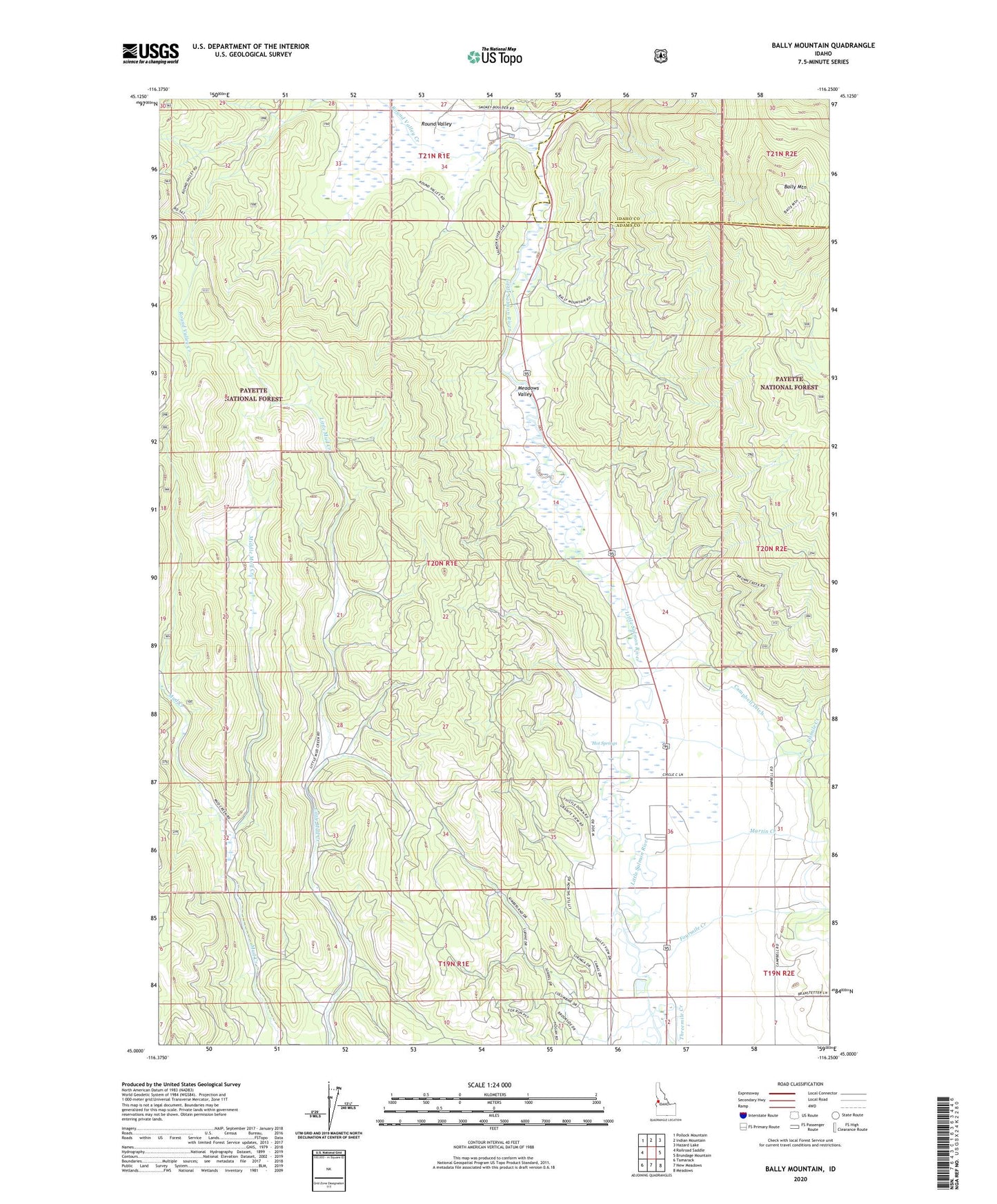
Bally Mountain Idaho US Topo Map
Couldn't load pickup availability
Also explore the Bally Mountain Forest Service Topo of this same quad for updated USFS data
2024 topographic map quadrangle Bally Mountain in the state of Idaho. Scale: 1:24000. Based on the newly updated USGS 7.5' US Topo map series, this map is in the following counties: Adams, Idaho. The map contains contour data, water features, and other items you are used to seeing on USGS maps, but also has updated roads and other features. This is the next generation of topographic maps. Printed on high-quality waterproof paper with UV fade-resistant inks.
Quads adjacent to this one:
West: Railroad Saddle
Northwest: Pollock Mountain
North: Indian Mountain
Northeast: Hazard Lake
East: Brundage Mountain
Southeast: Meadows
South: New Meadows
Southwest: Tamarack
This map covers the same area as the classic USGS quad with code o45116a3.
Contains the following named places: Bally Mountain, Circle C Ranch, Fourmile Creek, Hot Springs, Martin Creek, Meadows Valley, Middle Mud Creek, New Meadows Division, Round Valley, Round Valley Creek, Sixmile Creek, Threemile Creek, ZIP Code: 83654