MyTopo
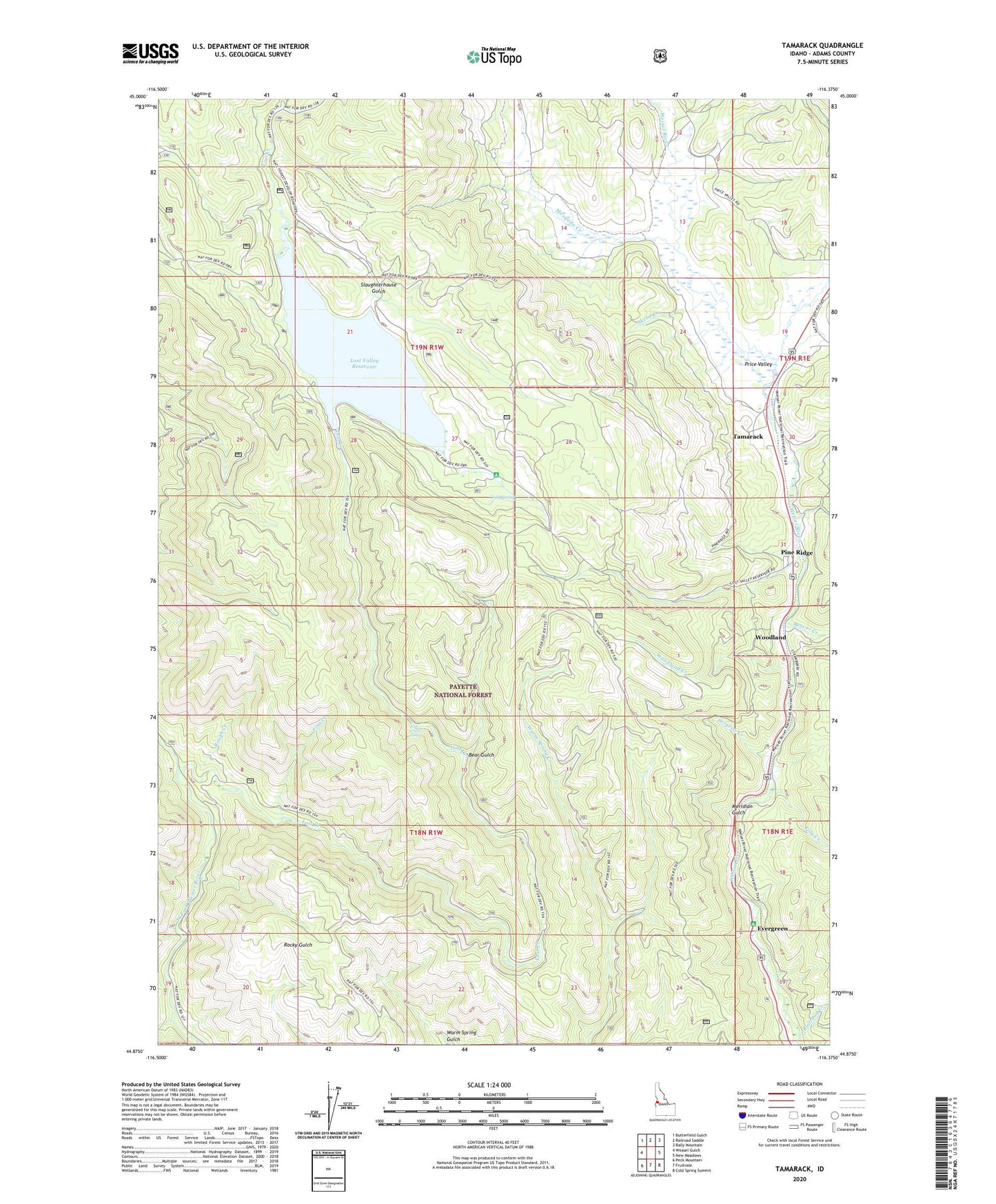
Tamarack Idaho US Topo Map
Couldn't load pickup availability
Also explore the Tamarack Forest Service Topo of this same quad for updated USFS data
2024 topographic map quadrangle Tamarack in the state of Idaho. Scale: 1:24000. Based on the newly updated USGS 7.5' US Topo map series, this map is in the following counties: Adams. The map contains contour data, water features, and other items you are used to seeing on USGS maps, but also has updated roads and other features. This is the next generation of topographic maps. Printed on high-quality waterproof paper with UV fade-resistant inks.
Quads adjacent to this one:
West: Weasel Gulch
Northwest: Butterfield Gulch
North: Railroad Saddle
Northeast: Bally Mountain
East: New Meadows
Southeast: Cold Spring Summit
South: Fruitvale
Southwest: Peck Mountain
This map covers the same area as the classic USGS quad with code o44116h4.
Contains the following named places: Adams County, Bear Gulch, Beaver Creek, Cold Spring, Cold Springs Campground, East Fork Lost Creek, Evergreen, Evergreen Campground, Filly Creek, Finn Creek, IXL Mine, Lost Creek, Lost Creek Falls, Lost Valley Dam, Lost Valley Reservoir, Meridian Gulch, Mosquito Creek, Pine Ridge, Price Valley, Railroad Creek, Rough Creek, Skern Creek, Slaughter Gulch Campground, Slaughterhouse Gulch, Surprise Creek, Tamarack, Woodland, Woodland Creek